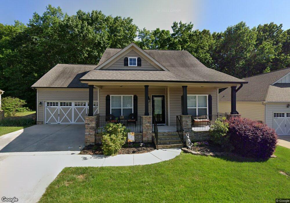
145 Battery Dr Unit 17 Locust, NC 28097
Estimated Value: $319,000 - $393,000
3
Beds
2
Baths
1,530
Sq Ft
$232/Sq Ft
Est. Value
About This Home
This home is located at 145 Battery Dr Unit 17, Locust, NC 28097 and is currently estimated at $355,405, approximately $232 per square foot. 145 Battery Dr Unit 17 is a home located in Stanly County with nearby schools including Locust Elementary School, West Stanly Middle School, and West Stanly High School.
Ownership History
Date
Name
Owned For
Owner Type
Purchase Details
Closed on
Jun 8, 2016
Sold by
Zeigler Thomas F and Zeigler Sherri M
Bought by
Hildreth Shirley
Current Estimated Value
Purchase Details
Closed on
Jan 1, 2011
Bought by
Zeigler Thomas F
Purchase Details
Closed on
Sep 22, 2010
Sold by
Hucks Clay E and Hucks Jennifer S
Bought by
Zeigler Thomas F and Zeigler Sherri M
Home Financials for this Owner
Home Financials are based on the most recent Mortgage that was taken out on this home.
Original Mortgage
$187,300
Interest Rate
4.25%
Mortgage Type
FHA
Create a Home Valuation Report for This Property
The Home Valuation Report is an in-depth analysis detailing your home's value as well as a comparison with similar homes in the area
Home Values in the Area
Average Home Value in this Area
Purchase History
| Date | Buyer | Sale Price | Title Company |
|---|---|---|---|
| Hildreth Shirley | $173,000 | Attorney | |
| Zeigler Thomas F | -- | -- | |
| Zeigler Thomas F | $190,000 | None Available |
Source: Public Records
Mortgage History
| Date | Status | Borrower | Loan Amount |
|---|---|---|---|
| Previous Owner | Zeigler Thomas F | $187,300 |
Source: Public Records
Tax History
| Year | Tax Paid | Tax Assessment Tax Assessment Total Assessment is a certain percentage of the fair market value that is determined by local assessors to be the total taxable value of land and additions on the property. | Land | Improvement |
|---|---|---|---|---|
| 2025 | $2,713 | $294,850 | $60,000 | $234,850 |
| 2024 | $54 | $228,328 | $55,000 | $173,328 |
| 2023 | $44 | $228,328 | $55,000 | $173,328 |
| 2022 | $1,353 | $228,328 | $55,000 | $173,328 |
| 2021 | $1,342 | $228,328 | $55,000 | $173,328 |
| 2020 | $2,110 | $178,000 | $30,000 | $148,000 |
| 2019 | $2,131 | $178,000 | $30,000 | $148,000 |
| 2018 | $42 | $178,000 | $30,000 | $148,000 |
| 2017 | $2,011 | $178,000 | $30,000 | $148,000 |
| 2016 | $1,948 | $172,351 | $28,000 | $144,351 |
| 2015 | $2,061 | $172,351 | $28,000 | $144,351 |
| 2014 | $1,871 | $172,351 | $28,000 | $144,351 |
Source: Public Records
Map
Nearby Homes
- 117 Battery Dr
- 166 Battery Dr
- 230 Battery Dr
- 117 Danita Dr
- 219 Kerri Dawn Ln
- 319 N Central Ave
- 288 Harrison Ln
- 417 Kiser Ln
- 213 Delancy St
- 206 Delancy St
- 213 Vanderbilt Blvd
- 913 Meadow Creek Church Rd
- 716 Saddlebred Ln
- 347 Carolina Hemlock Dr
- 421 Carolina Hemlock Dr
- 206 Montclair Dr
- 107 Oakgrove St
- Lot 1 Meadow Creek Church Rd Unit 1
- 402 Church St
- 106 Marlwood Dr
- 145 Battery Dr
- 149 Battery Dr
- 141 Battery Dr
- 141 Battery Dr Unit lot 16
- 155 Battery Dr
- 146 Battery Dr
- 135 Battery Dr
- 152 Battery Dr
- 138 Battery Dr
- 159 Battery Dr
- 156 Battery Dr
- 131 Battery Dr
- 134 Battery Dr
- 131 Meeting St
- 132 Battery Dr
- 125 Meeting St Unit 101
- 162 Battery Dr
- 167 Battery Dr
- 220 Battery Dr
- 128 Battery Dr
Your Personal Tour Guide
Ask me questions while you tour the home.