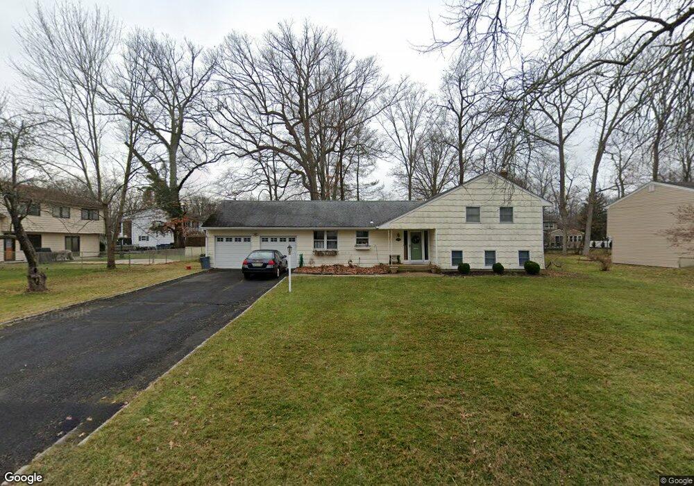
145 Briarwood Dr W Berkeley Heights, NJ 07922
Estimated Value: $794,377 - $955,000
--
Bed
--
Bath
2,168
Sq Ft
$411/Sq Ft
Est. Value
About This Home
This home is located at 145 Briarwood Dr W, Berkeley Heights, NJ 07922 and is currently estimated at $890,594, approximately $410 per square foot. 145 Briarwood Dr W is a home located in Union County with nearby schools including Columbia Middle School, Governor Livingston High School, and The Academy of Our Lady of Peace.
Ownership History
Date
Name
Owned For
Owner Type
Purchase Details
Closed on
Feb 21, 2018
Sold by
Burns Richard S and Burns Marie
Bought by
Burns Marie and Burns Richard S
Current Estimated Value
Purchase Details
Closed on
Jul 6, 1999
Sold by
Collard Ross T and Collard Joan Rosen
Bought by
Burns Richard S and Burns Marie
Home Financials for this Owner
Home Financials are based on the most recent Mortgage that was taken out on this home.
Original Mortgage
$177,500
Outstanding Balance
$49,641
Interest Rate
7.54%
Mortgage Type
Purchase Money Mortgage
Estimated Equity
$840,953
Purchase Details
Closed on
Dec 16, 1994
Sold by
Collard Ross T and Collard Joan Rosen
Bought by
Collard Ross T and Collard Joan Rosen
Create a Home Valuation Report for This Property
The Home Valuation Report is an in-depth analysis detailing your home's value as well as a comparison with similar homes in the area
Home Values in the Area
Average Home Value in this Area
Purchase History
| Date | Buyer | Sale Price | Title Company |
|---|---|---|---|
| Burns Marie | -- | None Available | |
| Burns Richard S | $327,500 | -- | |
| Collard Ross T | -- | -- |
Source: Public Records
Mortgage History
| Date | Status | Borrower | Loan Amount |
|---|---|---|---|
| Open | Burns Richard S | $177,500 |
Source: Public Records
Tax History Compared to Growth
Tax History
| Year | Tax Paid | Tax Assessment Tax Assessment Total Assessment is a certain percentage of the fair market value that is determined by local assessors to be the total taxable value of land and additions on the property. | Land | Improvement |
|---|---|---|---|---|
| 2025 | $12,004 | $280,000 | $144,600 | $135,400 |
| 2024 | $11,830 | $280,000 | $144,600 | $135,400 |
| 2023 | $11,830 | $280,000 | $144,600 | $135,400 |
| 2022 | $11,757 | $280,000 | $144,600 | $135,400 |
| 2021 | $11,693 | $280,000 | $144,600 | $135,400 |
| 2020 | $11,754 | $280,000 | $144,600 | $135,400 |
| 2019 | $11,696 | $280,000 | $144,600 | $135,400 |
| 2018 | $11,452 | $280,000 | $144,600 | $135,400 |
| 2017 | $11,312 | $280,000 | $144,600 | $135,400 |
| 2016 | $11,113 | $280,000 | $144,600 | $135,400 |
| 2015 | $11,052 | $280,000 | $144,600 | $135,400 |
| 2014 | $10,763 | $280,000 | $144,600 | $135,400 |
Source: Public Records
Map
Nearby Homes
- 30 Robbins Ave
- 126 Snyder Ave
- 12 Park Edge
- 33 Bristol Ct
- 93 Park Edge Unit 3H
- 43 Kuntz Ave
- 63 Snyder Ave
- 41 Meadowview Ln
- 61 Kuntz Ave
- 46 Snyder Ave
- 28 Peacock Ln Unit 28
- 34 Meadowview Ln
- 27 Angela Way Unit 727
- 19 Guenevere Way Ondo
- 45 Wilson Dr
- 132 Fairview Ave
- 3 Cottage Ct Unit 3
- 235 Plainfield Ave
- 25 Oechsner Ct
- 11 Earl Place
- 137 Briarwood Dr W
- 3 Greenbriar Dr
- 58 Hastings Rd
- 15 Greenbriar Dr
- 48 Hastings Rd
- 146 Briarwood Dr W
- 129 Briarwood Dr W
- 181 Briarwood Dr E
- 138 Briarwood Dr W
- 42 Hastings Rd
- 4 Greenbriar Dr
- 130 Briarwood Dr W
- 121 Briarwood Dr W
- 173 Briarwood Dr E
- 14 Greenbriar Dr
- 190 Briarwood Dr E
- 29 Greenbriar Dr
- 51 Hastings Rd
- 182 Briarwood Dr E
- 39 Hastings Rd