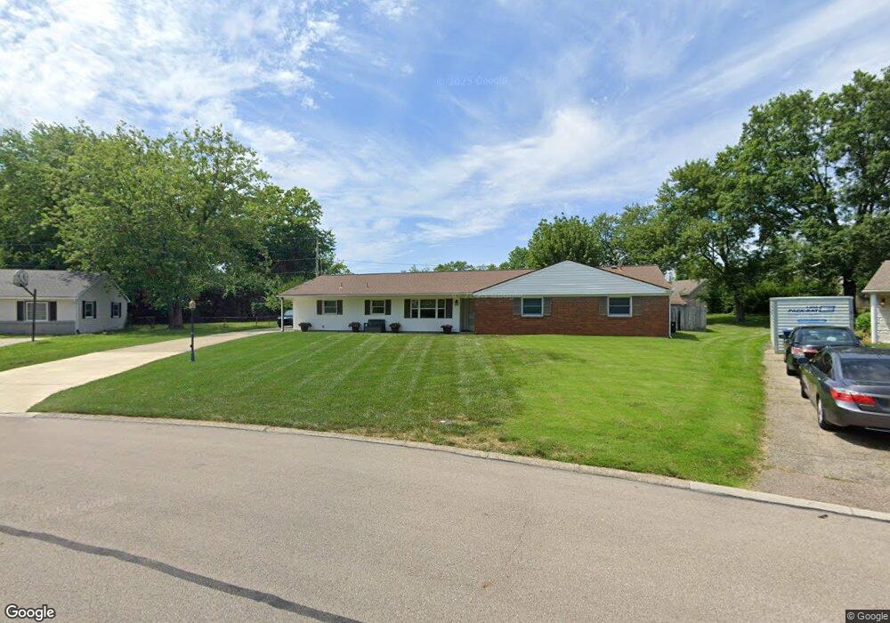
145 Broadripple Rd Dayton, OH 45458
Estimated Value: $313,000 - $361,630
4
Beds
2
Baths
2,549
Sq Ft
$130/Sq Ft
Est. Value
About This Home
This home is located at 145 Broadripple Rd, Dayton, OH 45458 and is currently estimated at $332,158, approximately $130 per square foot. 145 Broadripple Rd is a home located in Montgomery County with nearby schools including Primary Village South, Cline Elementary, and Tower Heights Middle School.
Ownership History
Date
Name
Owned For
Owner Type
Purchase Details
Closed on
Oct 23, 2002
Sold by
Huber Michael D
Bought by
Huber Michael Dean and Huber Joan K Qvick
Current Estimated Value
Home Financials for this Owner
Home Financials are based on the most recent Mortgage that was taken out on this home.
Original Mortgage
$113,600
Interest Rate
6.18%
Purchase Details
Closed on
Feb 21, 1994
Sold by
Huber Kathy L
Bought by
Huber Michael D
Create a Home Valuation Report for This Property
The Home Valuation Report is an in-depth analysis detailing your home's value as well as a comparison with similar homes in the area
Purchase History
| Date | Buyer | Sale Price | Title Company |
|---|---|---|---|
| Huber Michael Dean | -- | -- | |
| Huber Michael D | -- | -- |
Source: Public Records
Mortgage History
| Date | Status | Borrower | Loan Amount |
|---|---|---|---|
| Closed | Huber Michael Dean | $113,600 |
Source: Public Records
Tax History
| Year | Tax Paid | Tax Assessment Tax Assessment Total Assessment is a certain percentage of the fair market value that is determined by local assessors to be the total taxable value of land and additions on the property. | Land | Improvement |
|---|---|---|---|---|
| 2025 | $6,950 | $109,450 | $14,390 | $95,060 |
| 2024 | $6,356 | $109,450 | $14,390 | $95,060 |
| 2023 | $6,356 | $109,450 | $14,390 | $95,060 |
| 2022 | $5,854 | $79,940 | $10,500 | $69,440 |
| 2021 | $5,869 | $79,940 | $10,500 | $69,440 |
| 2020 | $5,861 | $79,940 | $10,500 | $69,440 |
| 2019 | $4,858 | $59,100 | $10,500 | $48,600 |
| 2018 | $4,306 | $59,100 | $10,500 | $48,600 |
| 2017 | $4,257 | $59,100 | $10,500 | $48,600 |
| 2016 | $4,266 | $55,930 | $10,500 | $45,430 |
| 2015 | $4,222 | $55,930 | $10,500 | $45,430 |
| 2014 | $4,222 | $55,930 | $10,500 | $45,430 |
| 2012 | -- | $55,500 | $11,550 | $43,950 |
Source: Public Records
Map
Nearby Homes
- 104 Martha Ave
- 51 Winchester (#E) Place
- 100 Weller Ave
- 225 S Main St
- 174 Waterford Dr
- 65 Dale Ridge Dr
- 55 Gulfwood Ct
- 30 Lynn Rae Cir
- 108 Mallard Glen Dr Unit 3
- 190 Lyons Dr
- 358 Sentinel Oak Dr
- 262 Laurel Oak Dr
- 7767 Brams Hill Dr Unit 7767
- 7810 Port Cir Unit 7810
- 404 Waterfront Place Unit 4404
- 9363 Rochelle Ln
- 8772 Washington Colony Dr Unit 12
- 7036 Far Hills Ave
- 9139 Indian Springs Ct
- 8738 Washington Colony Dr Unit 832
- 135 Broadripple Rd
- 155 Broadripple Rd
- 38 Martha Ave
- 50 Martha Ave
- 125 Broadripple Rd
- 165 Broadripple Rd
- 134 Broadripple Rd
- 54 Martha Ave
- 62 Martha Ave
- 164 Broadripple Rd
- 115 Broadripple Rd
- 175 Broadripple Rd
- 118 S Main St
- 174 Broadripple Rd
- 72 Martha Ave
- 104 Broadripple Rd
- 33 Martha Ave
- 105 Broadripple Rd
- 185 Broadripple Rd
- 80 Martha Ave
Your Personal Tour Guide
Ask me questions while you tour the home.