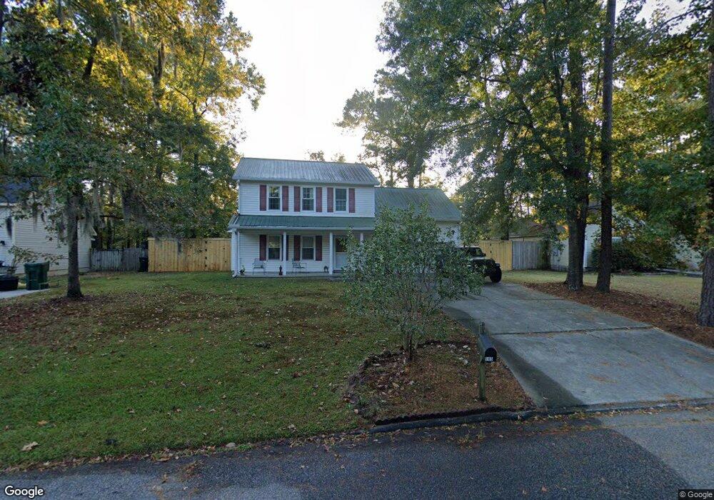
145 Carol Dr Goose Creek, SC 29445
Estimated Value: $271,000 - $356,031
4
Beds
4
Baths
1,680
Sq Ft
$191/Sq Ft
Est. Value
About This Home
This home is located at 145 Carol Dr, Goose Creek, SC 29445 and is currently estimated at $320,758, approximately $190 per square foot. 145 Carol Dr is a home located in Berkeley County with nearby schools including Boulder Bluff Elementary School, Westview Middle School, and Goose Creek High School.
Ownership History
Date
Name
Owned For
Owner Type
Purchase Details
Closed on
Apr 12, 2010
Sold by
Ashabraner Daryl L
Bought by
Berg Mathew W
Current Estimated Value
Home Financials for this Owner
Home Financials are based on the most recent Mortgage that was taken out on this home.
Original Mortgage
$143,810
Outstanding Balance
$98,124
Interest Rate
5.5%
Mortgage Type
FHA
Estimated Equity
$222,634
Purchase Details
Closed on
Nov 10, 2004
Sold by
Altman Joel A and Altman Francyne M
Bought by
Ashabraner Daryl L
Purchase Details
Closed on
Dec 16, 2002
Sold by
Altman Joel A
Bought by
Altman Joel A and Altman Francyne M
Purchase Details
Closed on
May 16, 2001
Sold by
The Altman Group Llc
Bought by
Altman Joel A
Purchase Details
Closed on
Nov 27, 2000
Sold by
Sherman Harold I As Trustee and Lynn Mitchell
Bought by
The Altman Group Llc
Create a Home Valuation Report for This Property
The Home Valuation Report is an in-depth analysis detailing your home's value as well as a comparison with similar homes in the area
Home Values in the Area
Average Home Value in this Area
Purchase History
| Date | Buyer | Sale Price | Title Company |
|---|---|---|---|
| Berg Mathew W | $151,500 | -- | |
| Ashabraner Daryl L | $144,000 | -- | |
| Altman Joel A | -- | -- | |
| Altman Joel A | $125,000 | -- | |
| The Altman Group Llc | $13,400 | -- |
Source: Public Records
Mortgage History
| Date | Status | Borrower | Loan Amount |
|---|---|---|---|
| Open | Berg Mathew W | $143,810 |
Source: Public Records
Tax History Compared to Growth
Tax History
| Year | Tax Paid | Tax Assessment Tax Assessment Total Assessment is a certain percentage of the fair market value that is determined by local assessors to be the total taxable value of land and additions on the property. | Land | Improvement |
|---|---|---|---|---|
| 2025 | $1,143 | $198,145 | $33,651 | $164,494 |
| 2024 | $1,119 | $7,926 | $1,346 | $6,580 |
| 2023 | $1,119 | $7,926 | $1,346 | $6,580 |
| 2022 | $1,097 | $6,892 | $1,200 | $5,692 |
| 2021 | $1,181 | $6,890 | $1,200 | $5,692 |
| 2020 | $1,129 | $6,892 | $1,200 | $5,692 |
| 2019 | $1,079 | $6,892 | $1,200 | $5,692 |
| 2018 | $1,045 | $6,476 | $1,200 | $5,276 |
| 2017 | $1,037 | $6,476 | $1,200 | $5,276 |
| 2016 | $1,045 | $6,480 | $1,200 | $5,280 |
| 2015 | $984 | $6,480 | $1,200 | $5,280 |
| 2014 | $928 | $6,480 | $1,200 | $5,280 |
| 2013 | -- | $6,480 | $1,200 | $5,280 |
Source: Public Records
Map
Nearby Homes
- 136 Blossom St
- 116 Blossom St
- 102 Amberside Dr
- 229 Lindy Creek Rd
- 103 Kathryn Dr
- 104 Cairnwell Pass
- 208 Mary Scott Dr
- 235 Mary Scott Dr
- 216 Lindy Creek Rd
- 244 Jean Wells Dr
- Lot 3 Thurgood Dr
- 128 Foxborough Rd
- 318 Jean Wells Dr
- 110 Red Cypress Dr
- 215 Woodland Lakes Rd
- 334 Water Oak Dr
- 105 Cane Break Ln
- 267 Border Rd
- 102 Brush Blvd
- 111 Bassett Ct