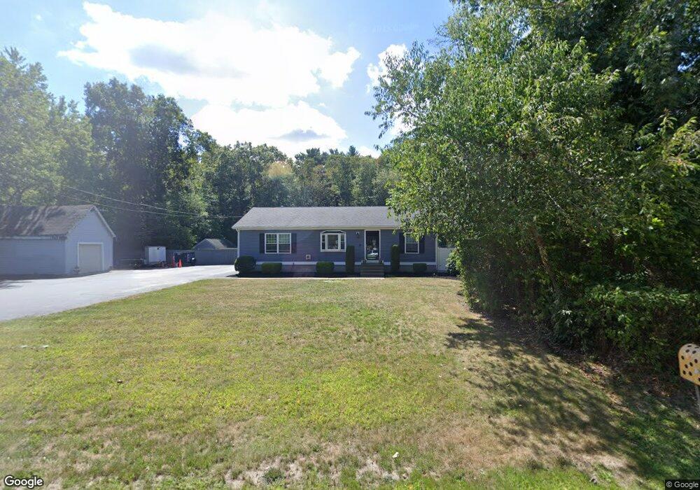
145 Chace Rd East Freetown, MA 02717
Estimated Value: $362,000 - $586,000
3
Beds
2
Baths
1,196
Sq Ft
$416/Sq Ft
Est. Value
About This Home
This home is located at 145 Chace Rd, East Freetown, MA 02717 and is currently estimated at $497,990, approximately $416 per square foot. 145 Chace Rd is a home located in Bristol County with nearby schools including Freetown Elementary School, George R Austin Intermediate School, and Freetown-Lakeville Middle School.
Ownership History
Date
Name
Owned For
Owner Type
Purchase Details
Closed on
Nov 1, 2010
Sold by
Langiano Derek C and Ferreira Heather
Bought by
Langiano Derek C
Current Estimated Value
Home Financials for this Owner
Home Financials are based on the most recent Mortgage that was taken out on this home.
Original Mortgage
$190,000
Outstanding Balance
$126,124
Interest Rate
4.39%
Mortgage Type
Purchase Money Mortgage
Estimated Equity
$371,866
Purchase Details
Closed on
May 27, 1998
Sold by
Pittsley Dale R and Pittsley Laurene A
Bought by
Langiano Derek C and Ferreira Heather
Create a Home Valuation Report for This Property
The Home Valuation Report is an in-depth analysis detailing your home's value as well as a comparison with similar homes in the area
Home Values in the Area
Average Home Value in this Area
Purchase History
| Date | Buyer | Sale Price | Title Company |
|---|---|---|---|
| Langiano Derek C | $100,000 | -- | |
| Langiano Derek C | $118,000 | -- |
Source: Public Records
Mortgage History
| Date | Status | Borrower | Loan Amount |
|---|---|---|---|
| Open | Langiano Derek C | $190,000 | |
| Previous Owner | Langiano Derek C | $165,000 | |
| Previous Owner | Langiano Derek C | $135,000 | |
| Previous Owner | Langiano Derek C | $112,500 |
Source: Public Records
Tax History Compared to Growth
Tax History
| Year | Tax Paid | Tax Assessment Tax Assessment Total Assessment is a certain percentage of the fair market value that is determined by local assessors to be the total taxable value of land and additions on the property. | Land | Improvement |
|---|---|---|---|---|
| 2025 | $4,577 | $461,900 | $162,100 | $299,800 |
| 2024 | $4,583 | $439,400 | $152,900 | $286,500 |
| 2023 | $4,452 | $415,700 | $137,700 | $278,000 |
| 2022 | $4,256 | $352,900 | $116,700 | $236,200 |
| 2021 | $4,130 | $325,200 | $106,100 | $219,100 |
| 2020 | $4,053 | $311,300 | $102,100 | $209,200 |
| 2019 | $3,840 | $292,000 | $97,200 | $194,800 |
| 2018 | $3,586 | $269,400 | $97,200 | $172,200 |
| 2017 | $3,442 | $258,400 | $97,200 | $161,200 |
| 2016 | $3,284 | $250,900 | $94,400 | $156,500 |
| 2015 | $3,130 | $242,600 | $94,400 | $148,200 |
| 2014 | $2,938 | $233,000 | $92,400 | $140,600 |
Source: Public Records
Map
Nearby Homes
- 144 Chace Rd
- 0 Costa Dr
- 195 Slab Bridge Rd
- 24 Bells Brook Rd
- 150 Quanapoag Rd
- 599 Quanapoag Rd
- Lot 2/3 Quanapoag Rd
- 9 Paul Ave
- 1475 Braley Rd Unit 17
- 4597 Acushnet Ave
- 7 Great Cedar Crossing
- 13 Luscomb Ln
- 16 Swallow St
- 5 Freetown St
- 1069 Cherokee St
- 319 Northwest St
- 20 Slab Bridge Rd
- 111 High St
- 15 Morrison Way
- 6 Weetamoe Dr