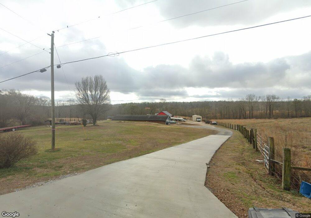
145 Club Rd Buchanan, GA 30113
Estimated Value: $249,000 - $350,000
2
Beds
1
Bath
1,760
Sq Ft
$178/Sq Ft
Est. Value
About This Home
This home is located at 145 Club Rd, Buchanan, GA 30113 and is currently estimated at $312,979, approximately $177 per square foot. 145 Club Rd is a home located in Haralson County with nearby schools including Haralson County High School.
Ownership History
Date
Name
Owned For
Owner Type
Purchase Details
Closed on
Jul 31, 2017
Sold by
Robinson Sammy R
Bought by
Eaves Robert E
Current Estimated Value
Home Financials for this Owner
Home Financials are based on the most recent Mortgage that was taken out on this home.
Original Mortgage
$55,000
Outstanding Balance
$45,794
Interest Rate
3.88%
Mortgage Type
New Conventional
Estimated Equity
$267,185
Purchase Details
Closed on
Sep 9, 2014
Sold by
Robinson Sammy R
Bought by
Harrison Karl
Purchase Details
Closed on
Mar 21, 2008
Sold by
Shepherd Peggy Robinson
Bought by
Robinson Sammy Ray
Purchase Details
Closed on
Dec 21, 1998
Sold by
Robinson Sammy R and Robinson Carol
Bought by
Robinson Sammy R and Robinson Carol
Purchase Details
Closed on
Jul 17, 1998
Sold by
Robinson James B
Bought by
Robinson Sammy R and Robinson Carol
Create a Home Valuation Report for This Property
The Home Valuation Report is an in-depth analysis detailing your home's value as well as a comparison with similar homes in the area
Home Values in the Area
Average Home Value in this Area
Purchase History
| Date | Buyer | Sale Price | Title Company |
|---|---|---|---|
| Eaves Robert E | $78,000 | -- | |
| Harrison Karl | $21,710 | -- | |
| Robinson Sammy Ray | -- | -- | |
| Robinson Sammy R | -- | -- | |
| Robinson Sammy R | $18,300 | -- |
Source: Public Records
Mortgage History
| Date | Status | Borrower | Loan Amount |
|---|---|---|---|
| Open | Eaves Robert E | $55,000 |
Source: Public Records
Tax History Compared to Growth
Tax History
| Year | Tax Paid | Tax Assessment Tax Assessment Total Assessment is a certain percentage of the fair market value that is determined by local assessors to be the total taxable value of land and additions on the property. | Land | Improvement |
|---|---|---|---|---|
| 2024 | $2,345 | $90,461 | $5,155 | $85,306 |
| 2023 | $2,617 | $97,619 | $4,285 | $93,334 |
| 2022 | $2,131 | $79,463 | $4,285 | $75,178 |
| 2021 | $2,118 | $75,836 | $4,108 | $71,728 |
| 2020 | $2,147 | $76,520 | $4,108 | $72,412 |
| 2019 | $2,152 | $73,845 | $4,108 | $69,737 |
| 2018 | $922 | $73,845 | $4,108 | $69,737 |
| 2017 | $1,936 | $61,538 | $4,108 | $57,430 |
| 2016 | $1,646 | $55,715 | $3,966 | $51,749 |
| 2015 | $1,636 | $55,358 | $3,966 | $51,393 |
| 2014 | $2,018 | $68,864 | $16,237 | $52,627 |
Source: Public Records
Map
Nearby Homes
- 901 Tallapoosa East Church Rd
- 170 Willow Leaf Dr
- 40 Red Oak Cir
- 443 Tallapoosa East Church Rd
- 327 Jeffers Rd
- 262 Corinth-Five Points Rd
- 280 Corinth-Five Points Rd
- 5246 Georgia 120
- 0000 Corinth-Five Points Rd
- 62 Joe Rowell Rd
- 134 Roy Dean Rd
- 1601 Bethlehem Church Rd
- 207 van Wert St
- 315 Carrollton St
- 471 McBrayer Rd
- 904 Corinth Five Points Rd
- 046.08 Roy Dean Rd
- 0 Roy Dean Rd Unit 24150079
- 0 Roy Dean Rd Unit 10564383
- 201 Club Rd
- 166 Club Rd
- 130 Club Rd
- 206 Club Rd
- 140 Club Rd
- 70 Club Rd
- 43 Club Rd
- 767 High Point Rd
- 731 High Point Rd
- 32 Club Rd
- 665 High Point Rd
- 763 High Point Rd
- 00001 Club Rd
- 695 High Point Rd
- 365 Club Rd
- 0 High Point Rd Unit 6071 8235261
- 0 High Point Rd Unit 7537857
- 0 High Point Rd Unit 3198621
- 0 High Point Rd Unit 7254006
- 0 High Point Rd Unit 7316613
