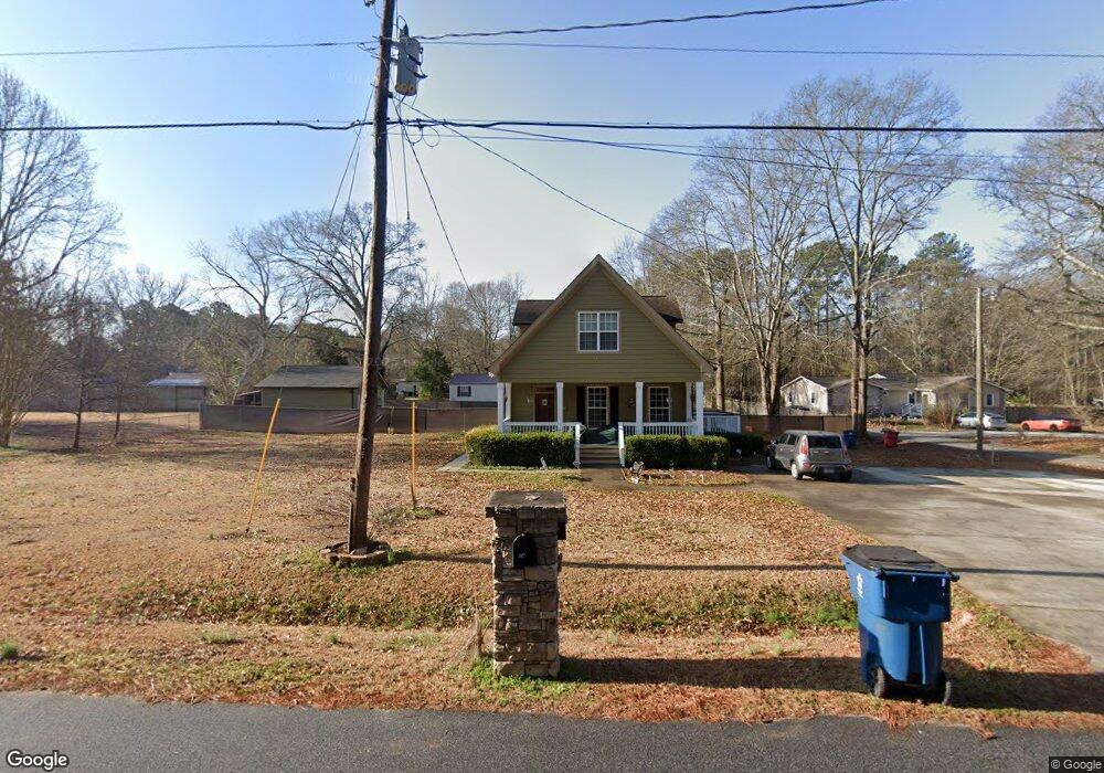
145 Dwight Rd Athens, GA 30605
Estimated Value: $275,000 - $325,000
Studio
1
Bath
1,820
Sq Ft
$169/Sq Ft
Est. Value
About This Home
This home is located at 145 Dwight Rd, Athens, GA 30605 and is currently estimated at $307,531, approximately $168 per square foot. 145 Dwight Rd is a home located in Clarke County with nearby schools including Howard B. Stroud Elementary School, Coile Middle School, and Cedar Shoals High School.
Ownership History
Date
Name
Owned For
Owner Type
Purchase Details
Closed on
Aug 26, 2010
Sold by
Colbert Brantley D
Bought by
Colbert Brantley D
Current Estimated Value
Home Financials for this Owner
Home Financials are based on the most recent Mortgage that was taken out on this home.
Original Mortgage
$86,800
Outstanding Balance
$57,333
Interest Rate
4.6%
Mortgage Type
New Conventional
Estimated Equity
$250,198
Create a Home Valuation Report for This Property
The Home Valuation Report is an in-depth analysis detailing your home's value as well as a comparison with similar homes in the area
Purchase History
| Date | Buyer | Sale Price | Title Company |
|---|---|---|---|
| Colbert Brantley D | -- | -- | |
| Colbert Brantley D | -- | -- |
Source: Public Records
Mortgage History
| Date | Status | Borrower | Loan Amount |
|---|---|---|---|
| Open | Colbert Brantley D | $86,800 |
Source: Public Records
Tax History
| Year | Tax Paid | Tax Assessment Tax Assessment Total Assessment is a certain percentage of the fair market value that is determined by local assessors to be the total taxable value of land and additions on the property. | Land | Improvement |
|---|---|---|---|---|
| 2025 | $3,565 | $114,810 | $12,000 | $102,810 |
| 2024 | $3,565 | $111,019 | $12,000 | $99,019 |
| 2023 | $3,469 | $99,085 | $10,400 | $88,685 |
| 2022 | $2,862 | $89,714 | $10,400 | $79,314 |
| 2021 | $1,844 | $64,721 | $8,000 | $56,721 |
| 2020 | $1,702 | $60,505 | $8,000 | $52,505 |
| 2019 | $1,554 | $55,784 | $7,600 | $48,184 |
| 2018 | $1,371 | $50,375 | $7,600 | $42,775 |
| 2017 | $1,351 | $49,801 | $7,600 | $42,201 |
| 2016 | $1,275 | $47,562 | $7,600 | $39,962 |
| 2015 | $1,290 | $47,943 | $7,600 | $40,343 |
| 2014 | $1,306 | $48,323 | $7,600 | $40,723 |
Source: Public Records
Map
Nearby Homes
- 1390 Murrell Rd
- 157 Glendale Heights
- 664 Hancock Industrial Way
- 181 Summerplace Dr
- 310 Airport Rd
- 165 Sycamore Ln
- 165/175/195 Sycamore Ln
- 1144 Cherokee Rd
- 1725 Cherokee Rd
- 105 Overlook Dr
- 315 Woodridge Cir
- 145 Beaverdam Rd
- 171 Candy Cir
- 160 Morningview Cir
- 2025 Oakley Trail
- 440 Martin Cir
- 2005 Hollis St
- 105 Carney Lake Rd
- 300 Martin Cir
- 1975 Hollis St
- 155 Dwight Rd
- 1525 Spring Valley Rd
- 115 Dwight Rd
- 1495 Spring Valley Rd
- 140 Dwight Rd
- 1491 Spring Valley Rd
- 160 Dwight Rd
- 150 Dwight Rd
- 154 Dwight Rd
- 1529 Spring Valley Rd
- 165 Dwight Rd
- 158 Dwight Rd
- 1489 Spring Valley Rd
- 150 Binion Rd
- 147 Binion Rd
- 164 Dwight Rd
- 2691 Winterville Rd
- 1532 Spring Valley Rd
- 1650 Spring Valley Rd
- 145 Binion Rd
Your Personal Tour Guide
Ask me questions while you tour the home.