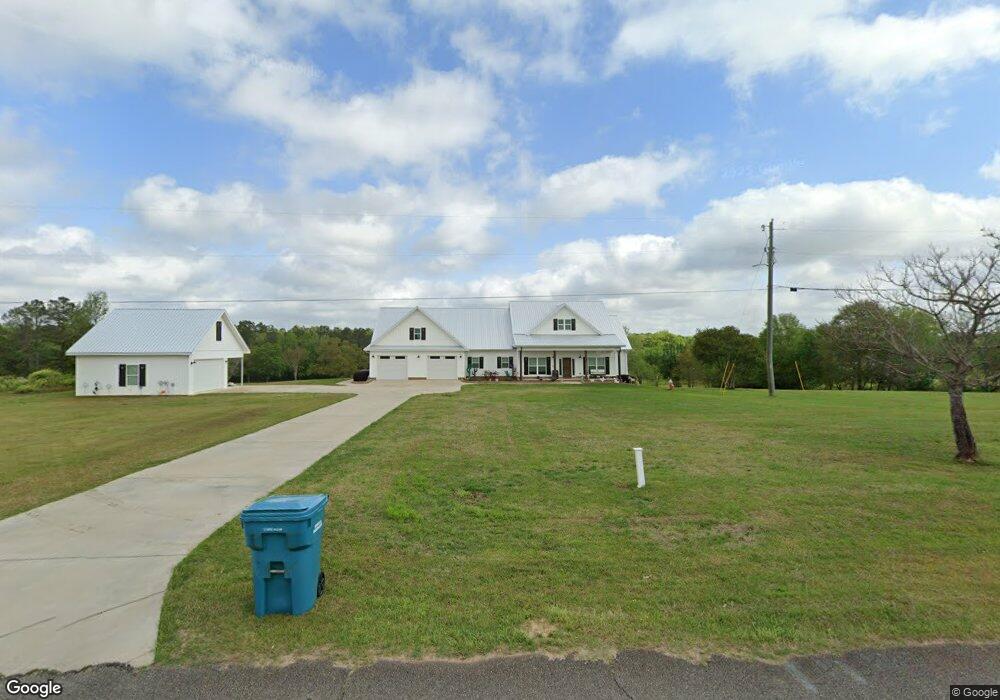
145 Farr Rd Kathleen, GA 31047
Estimated Value: $402,000 - $447,796
3
Beds
2
Baths
2,489
Sq Ft
$171/Sq Ft
Est. Value
About This Home
This home is located at 145 Farr Rd, Kathleen, GA 31047 and is currently estimated at $426,599, approximately $171 per square foot. 145 Farr Rd is a home with nearby schools including Matthew Arthur Elementary School, Perry Middle School, and Veterans High School.
Ownership History
Date
Name
Owned For
Owner Type
Purchase Details
Closed on
Nov 2, 2007
Sold by
Woods Betty Sue Estate
Bought by
Woods Ronnie N
Current Estimated Value
Purchase Details
Closed on
Sep 15, 1993
Sold by
Williams George L and Mae Delle
Bought by
Woods Ronnie N and Betty Sue*
Purchase Details
Closed on
Feb 16, 1984
Sold by
Limestone Creek Dairy Inc
Bought by
Williams George L and Mae Delle
Purchase Details
Closed on
Jul 30, 1980
Sold by
Rush Robert E Etal
Bought by
Limestone Creek Dairy Inc
Create a Home Valuation Report for This Property
The Home Valuation Report is an in-depth analysis detailing your home's value as well as a comparison with similar homes in the area
Home Values in the Area
Average Home Value in this Area
Purchase History
| Date | Buyer | Sale Price | Title Company |
|---|---|---|---|
| Woods Ronnie N | -- | -- | |
| Woods Ronnie N | $20,000 | -- | |
| Williams George L | -- | -- | |
| Limestone Creek Dairy Inc | -- | -- |
Source: Public Records
Tax History Compared to Growth
Tax History
| Year | Tax Paid | Tax Assessment Tax Assessment Total Assessment is a certain percentage of the fair market value that is determined by local assessors to be the total taxable value of land and additions on the property. | Land | Improvement |
|---|---|---|---|---|
| 2024 | $3,354 | $142,200 | $22,320 | $119,880 |
| 2023 | $3,010 | $126,520 | $27,840 | $98,680 |
| 2022 | $1,294 | $53,520 | $27,840 | $25,680 |
| 2021 | $593 | $24,400 | $23,120 | $1,280 |
| 2020 | $348 | $14,240 | $12,960 | $1,280 |
| 2019 | $530 | $5,140 | $0 | $5,140 |
| 2018 | $530 | $5,140 | $0 | $5,140 |
| 2017 | $530 | $5,140 | $0 | $5,140 |
| 2016 | $532 | $5,140 | $0 | $5,140 |
| 2015 | $532 | $21,712 | $12,960 | $8,752 |
| 2014 | -- | $21,712 | $12,960 | $8,752 |
| 2013 | -- | $21,840 | $12,960 | $8,880 |
Source: Public Records
Map
Nearby Homes
- 106 Planter's Ridge Trail
- 238 Old Hollow Way
- 531 Bristleleaf Path
- 529 Bristleleaf Path
- 315 Willowbrook Ln
- 521 Bristleleaf Path
- 205 Emberwood Way
- 525 Bristleleaf Path
- 202 Emberwood Way
- 523 Bristleleaf Path
- 533 Bristleleaf Path
- 109 Black Birch Ln
- 101 Black Birch Ln
- 321 Willowbrook Ln
- 102 Black Birch Ln
- 313 Willowbrook Ln
- 319 Willowbrook Run
- 323 Willowbrook Ln
- 105 Black Birch Ln
- 214 Old Hollow Way
- 190 Farr Rd
- 0 Farr Rd Unit B2 8267123
- 0 Farr Rd Unit 10601011
- 0 Farr Rd Unit 255930
- 0 Farr Rd Unit 234387
- 0 Farr Rd Unit 2999896
- 0 Farr Rd Unit 7441447
- 0 Farr Rd Unit 7285158
- 0 Farr Rd Unit 175385
- 117 Farr Rd
- 129 Farr Rd
- 135 Farr Rd
- 141 Farr Rd
- 152 Farr Rd
- 156 Farr Rd
- 142 Farr Rd
- 101 Wilderness Trail
- 137 Lonesome Doe Cir
- 100 Wilderness Trail
- 120 Lonesome Doe Cir