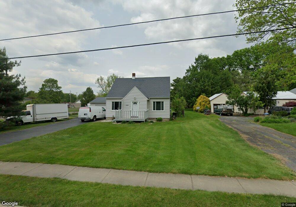
145 Fowler St Cortland, OH 44410
Estimated Value: $164,000 - $191,000
3
Beds
2
Baths
1,597
Sq Ft
$111/Sq Ft
Est. Value
About This Home
This home is located at 145 Fowler St, Cortland, OH 44410 and is currently estimated at $176,759, approximately $110 per square foot. 145 Fowler St is a home located in Trumbull County with nearby schools including Lakeview Elementary School, Lakeview Middle School, and Lakeview High School.
Ownership History
Date
Name
Owned For
Owner Type
Purchase Details
Closed on
Sep 10, 2003
Sold by
Chase Manhattan Bank
Bought by
Whitman Kay E
Current Estimated Value
Home Financials for this Owner
Home Financials are based on the most recent Mortgage that was taken out on this home.
Original Mortgage
$48,000
Outstanding Balance
$22,175
Interest Rate
6.18%
Mortgage Type
New Conventional
Estimated Equity
$154,584
Purchase Details
Closed on
Mar 27, 2003
Sold by
Mullins Robert L
Bought by
Chase Manhattan Bank Usa
Purchase Details
Closed on
Dec 16, 1994
Sold by
Sbano Nicholas P
Bought by
Mullins Robert L and Mullins Sheryl L
Home Financials for this Owner
Home Financials are based on the most recent Mortgage that was taken out on this home.
Original Mortgage
$74,150
Interest Rate
9%
Mortgage Type
VA
Purchase Details
Closed on
Jan 1, 1990
Bought by
Nicholas P Sbano
Create a Home Valuation Report for This Property
The Home Valuation Report is an in-depth analysis detailing your home's value as well as a comparison with similar homes in the area
Home Values in the Area
Average Home Value in this Area
Purchase History
| Date | Buyer | Sale Price | Title Company |
|---|---|---|---|
| Whitman Kay E | $60,000 | Resource Title Agency Inc | |
| Chase Manhattan Bank Usa | $65,000 | -- | |
| Mullins Robert L | $72,000 | -- | |
| Nicholas P Sbano | -- | -- |
Source: Public Records
Mortgage History
| Date | Status | Borrower | Loan Amount |
|---|---|---|---|
| Open | Chase Manhattan Bank Usa | $48,000 | |
| Previous Owner | Mullins Robert L | $74,150 |
Source: Public Records
Tax History
| Year | Tax Paid | Tax Assessment Tax Assessment Total Assessment is a certain percentage of the fair market value that is determined by local assessors to be the total taxable value of land and additions on the property. | Land | Improvement |
|---|---|---|---|---|
| 2024 | $2,189 | $50,580 | $7,490 | $43,090 |
| 2023 | $2,143 | $50,580 | $7,490 | $43,090 |
| 2022 | $1,388 | $30,870 | $7,490 | $23,380 |
| 2021 | $1,393 | $30,870 | $7,490 | $23,380 |
| 2020 | $1,954 | $30,870 | $7,490 | $23,380 |
| 2019 | $1,826 | $28,180 | $7,490 | $20,690 |
| 2018 | $1,834 | $28,180 | $7,490 | $20,690 |
| 2017 | $1,832 | $28,180 | $7,490 | $20,690 |
| 2016 | $1,705 | $25,340 | $7,490 | $17,850 |
| 2015 | $1,698 | $25,340 | $7,490 | $17,850 |
| 2014 | $1,493 | $25,340 | $7,490 | $17,850 |
| 2013 | $1,520 | $25,340 | $7,490 | $17,850 |
Source: Public Records
Map
Nearby Homes
- 105 Ruth Ave
- 248 Robbies Run
- 319 Russell Ave
- 105 Fairview Ave
- 303 Russell Ave
- 2 Harneds Landing
- 465 S Colonial Dr
- 705 Lakeview Dr Unit 705
- 700 Lakeview Dr Unit 700
- 0 N High St
- 155 Heritage Ln
- 324 Greenbriar Dr
- 359 Denman Ave
- 220 Wae Trail
- 3098 Fowler St
- 232 Bayview Dr Unit 232
- 284 Old Oak Dr
- 202 Tournament Trail Unit 202
- 404 Cherry Hill Ln
- 0 St Andrews Unit 5113795
Your Personal Tour Guide
Ask me questions while you tour the home.