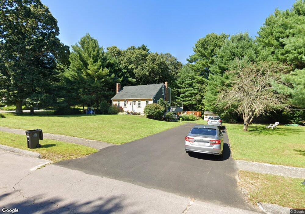
145 King James Way Wrentham, MA 02093
Estimated Value: $638,000 - $716,000
3
Beds
2
Baths
2,012
Sq Ft
$329/Sq Ft
Est. Value
About This Home
This home is located at 145 King James Way, Wrentham, MA 02093 and is currently estimated at $662,228, approximately $329 per square foot. 145 King James Way is a home located in Norfolk County with nearby schools including Delaney Elementary School, Charles E Roderick, and Foxborough Regional Charter School.
Ownership History
Date
Name
Owned For
Owner Type
Purchase Details
Closed on
Aug 27, 2010
Sold by
Egan Edward T and Egan Melanie A
Bought by
Debaggis Jeffrey R and Debaggis Andrea L
Current Estimated Value
Home Financials for this Owner
Home Financials are based on the most recent Mortgage that was taken out on this home.
Original Mortgage
$272,800
Outstanding Balance
$181,323
Interest Rate
4.57%
Mortgage Type
Purchase Money Mortgage
Estimated Equity
$480,905
Purchase Details
Closed on
Jul 19, 2002
Sold by
Carr Bruce D and Carr Jane S
Bought by
Egan Edward T and Egan Melanie A
Home Financials for this Owner
Home Financials are based on the most recent Mortgage that was taken out on this home.
Original Mortgage
$220,000
Interest Rate
6.73%
Mortgage Type
Purchase Money Mortgage
Create a Home Valuation Report for This Property
The Home Valuation Report is an in-depth analysis detailing your home's value as well as a comparison with similar homes in the area
Home Values in the Area
Average Home Value in this Area
Purchase History
| Date | Buyer | Sale Price | Title Company |
|---|---|---|---|
| Debaggis Jeffrey R | $341,000 | -- | |
| Egan Edward T | $325,000 | -- | |
| Egan Edward T | $325,000 | -- |
Source: Public Records
Mortgage History
| Date | Status | Borrower | Loan Amount |
|---|---|---|---|
| Open | Debaggis Jeffrey R | $272,800 | |
| Previous Owner | Egan Edward T | $220,000 |
Source: Public Records
Tax History Compared to Growth
Tax History
| Year | Tax Paid | Tax Assessment Tax Assessment Total Assessment is a certain percentage of the fair market value that is determined by local assessors to be the total taxable value of land and additions on the property. | Land | Improvement |
|---|---|---|---|---|
| 2025 | $6,507 | $561,400 | $304,400 | $257,000 |
| 2024 | $6,274 | $522,800 | $304,400 | $218,400 |
| 2023 | $5,982 | $474,000 | $276,800 | $197,200 |
| 2022 | $5,777 | $422,600 | $258,300 | $164,300 |
| 2021 | $5,376 | $382,100 | $225,700 | $156,400 |
| 2020 | $5,349 | $375,400 | $200,900 | $174,500 |
| 2019 | $5,178 | $366,700 | $200,900 | $165,800 |
| 2018 | $5,122 | $359,700 | $201,100 | $158,600 |
| 2017 | $4,836 | $339,400 | $197,300 | $142,100 |
| 2016 | $4,727 | $331,000 | $191,500 | $139,500 |
| 2015 | $4,618 | $308,300 | $184,200 | $124,100 |
| 2014 | $4,319 | $282,100 | $162,500 | $119,600 |
Source: Public Records
Map
Nearby Homes
- 1 Lorraine Metcalf Dr
- 270 Dedham St
- 362 East St
- 155 Clark Rd Unit 155
- 65 Pond St
- 10 Nature View Dr
- 15 Nature View Dr
- 25 Foxboro Rd
- 131 Washington St Unit 42
- 10 W Birch Rd
- 120 Hawes St
- 0 W Birch Rd
- 483 Thurston St
- 246 Forest Grove Ave
- 131 Creek St Unit 7
- 11 Earle Stewart Ln
- 500 Franklin St
- 7 Hill St Unit 10
- 71 Pond St
- 11 Goodwin Dr
- 135 King James Way
- 85 Alderbrook Ct
- 140 King James Way
- 70 Alderbrook Ct
- 125 King James Way
- 90 King James Way
- 80 Alderbrook Ct
- 65 Alderbrook Ct
- 60 Alderbrook Ct
- 120 Lorraine Metcalf Dr
- 115 King James Way
- 145 Lorraine Metcalf Dr
- 50 Alderbrook Ct
- 55 Alderbrook Ct
- 80 King James Way
- 135 Lorraine Metcalf Dr
- 40 Alderbrook Ct
- 110 Lorraine Metcalf Dr
- 125 Lorraine Metcalf Dr
- 105 King James Way