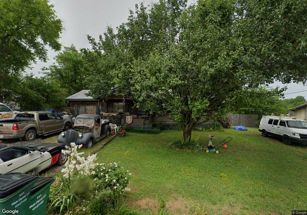
145 Lillian Dr Rossville, GA 30741
Westside NeighborhoodEstimated Value: $165,071 - $220,000
--
Bed
2
Baths
1,224
Sq Ft
$159/Sq Ft
Est. Value
About This Home
This home is located at 145 Lillian Dr, Rossville, GA 30741 and is currently estimated at $195,018, approximately $159 per square foot. 145 Lillian Dr is a home located in Catoosa County with nearby schools including West Side Elementary School, Lakeview Middle School, and Lakeview-Fort Oglethorpe High School.
Ownership History
Date
Name
Owned For
Owner Type
Purchase Details
Closed on
Jun 27, 2006
Sold by
Seattle Corp
Bought by
Burroughs Larry E
Current Estimated Value
Home Financials for this Owner
Home Financials are based on the most recent Mortgage that was taken out on this home.
Original Mortgage
$21,058
Outstanding Balance
$12,453
Interest Rate
6.58%
Mortgage Type
New Conventional
Estimated Equity
$182,565
Purchase Details
Closed on
Feb 7, 2006
Sold by
Burroughs Joyce
Bought by
Seattle Corp
Create a Home Valuation Report for This Property
The Home Valuation Report is an in-depth analysis detailing your home's value as well as a comparison with similar homes in the area
Home Values in the Area
Average Home Value in this Area
Purchase History
| Date | Buyer | Sale Price | Title Company |
|---|---|---|---|
| Burroughs Larry E | $23,600 | -- | |
| Seattle Corp | -- | -- |
Source: Public Records
Mortgage History
| Date | Status | Borrower | Loan Amount |
|---|---|---|---|
| Open | Burroughs Larry E | $21,058 |
Source: Public Records
Tax History Compared to Growth
Tax History
| Year | Tax Paid | Tax Assessment Tax Assessment Total Assessment is a certain percentage of the fair market value that is determined by local assessors to be the total taxable value of land and additions on the property. | Land | Improvement |
|---|---|---|---|---|
| 2024 | $730 | $37,659 | $6,533 | $31,126 |
| 2023 | $618 | $29,608 | $6,533 | $23,075 |
| 2022 | $505 | $24,551 | $6,533 | $18,018 |
| 2021 | $472 | $24,551 | $6,533 | $18,018 |
| 2020 | $482 | $20,826 | $5,600 | $15,226 |
| 2019 | $440 | $20,826 | $5,600 | $15,226 |
| 2018 | $491 | $19,892 | $4,666 | $15,226 |
| 2017 | $443 | $19,923 | $4,666 | $15,257 |
| 2016 | $429 | $18,507 | $4,666 | $13,841 |
| 2015 | -- | $18,507 | $4,666 | $13,841 |
| 2014 | -- | $18,507 | $4,666 | $13,841 |
| 2013 | -- | $18,507 | $4,666 | $13,840 |
Source: Public Records
Map
Nearby Homes
- 137 Winchester Dr
- 98 Winchester Dr
- 72 Lillian Dr
- 5 Winchester Dr
- 385 Winchester Dr
- 398 Winchester Dr
- 302 Huntley Meadows Dr
- 527 Winchester Dr
- 530 Winchester Dr
- 518 Winchester Dr
- Peyton Plan at The Fields at Huntley Meadows
- Quail Run Plan at The Fields at Huntley Meadows
- Hawthorne Plan at The Fields at Huntley Meadows
- Silverton Plan at The Fields at Huntley Meadows
- Aspen Plan at The Fields at Huntley Meadows
- Hudson Plan at The Fields at Huntley Meadows
- Ocoee Plan at The Fields at Huntley Meadows
- Peachtree Plan at The Fields at Huntley Meadows
- 458 Winchester Dr
- 792 S MacK Smith Rd
- 129 Lillian Dr
- 163 Lillian Dr
- 144 Lillian Dr
- 124 Lillian Dr
- 162 Lillian Dr
- 111 Lillian Dr
- 183 Lillian Dr
- 140 Ann Dr
- 140 Ann Dr Unit 60
- 108 Lillian Dr
- 182 Lillian Dr
- 282 Winchester Dr
- 282 Winchester Dr Unit 25
- 266 Winchester Dr
- 266 Winchester Dr Unit 24
- 294 Winchester Dr
- 294 Winchester Dr Unit 26
- 201 Lillian Dr
- 87 Lillian Dr
- 254 Winchester Dr