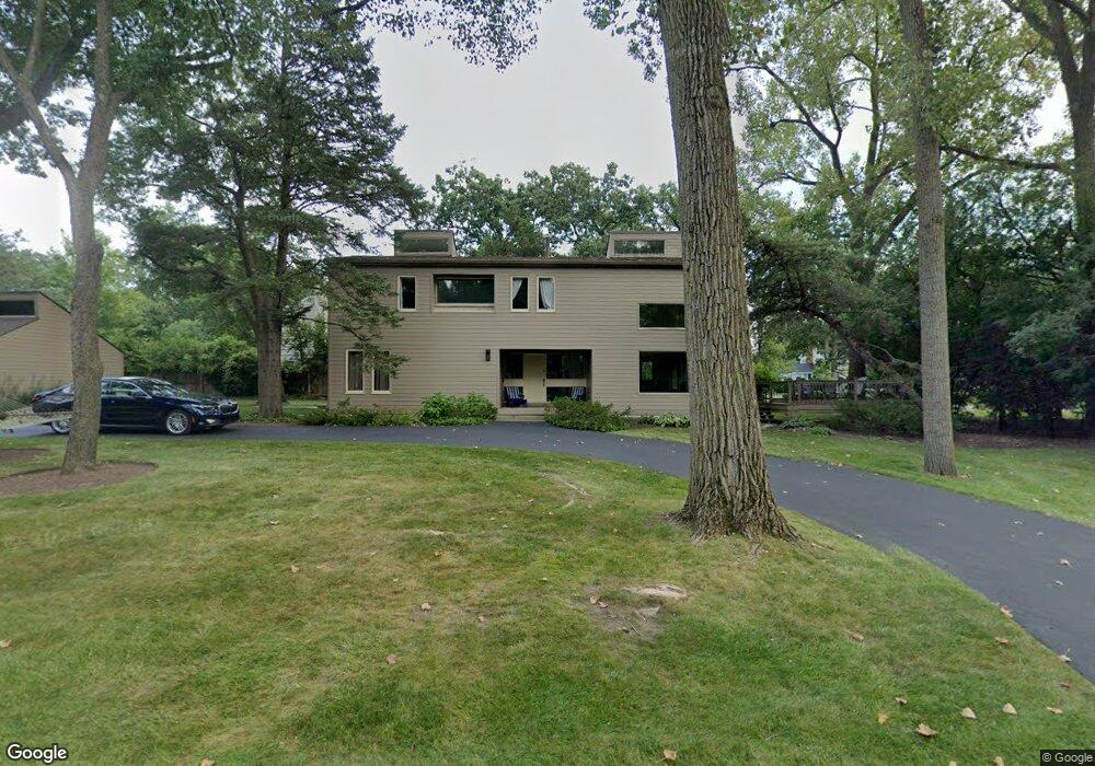
145 Linden Ave Lake Forest, IL 60045
Estimated Value: $946,056 - $1,036,000
4
Beds
3
Baths
2,800
Sq Ft
$360/Sq Ft
Est. Value
About This Home
This home is located at 145 Linden Ave, Lake Forest, IL 60045 and is currently estimated at $1,007,264, approximately $359 per square foot. 145 Linden Ave is a home located in Lake County with nearby schools including Cherokee Elementary School, Deer Path Middle School East, and Lake Forest High School.
Ownership History
Date
Name
Owned For
Owner Type
Purchase Details
Closed on
Jun 24, 2008
Sold by
Alfe Robert and Alfe Jane K
Bought by
Pelinski John W and Pelinski Shermin L
Current Estimated Value
Home Financials for this Owner
Home Financials are based on the most recent Mortgage that was taken out on this home.
Original Mortgage
$417,000
Outstanding Balance
$271,796
Interest Rate
6.36%
Mortgage Type
Unknown
Estimated Equity
$735,468
Create a Home Valuation Report for This Property
The Home Valuation Report is an in-depth analysis detailing your home's value as well as a comparison with similar homes in the area
Home Values in the Area
Average Home Value in this Area
Purchase History
| Date | Buyer | Sale Price | Title Company |
|---|---|---|---|
| Pelinski John W | $630,000 | St |
Source: Public Records
Mortgage History
| Date | Status | Borrower | Loan Amount |
|---|---|---|---|
| Open | Pelinski John W | $417,000 |
Source: Public Records
Tax History Compared to Growth
Tax History
| Year | Tax Paid | Tax Assessment Tax Assessment Total Assessment is a certain percentage of the fair market value that is determined by local assessors to be the total taxable value of land and additions on the property. | Land | Improvement |
|---|---|---|---|---|
| 2024 | $14,503 | $249,692 | $88,968 | $160,724 |
| 2023 | $12,823 | $239,628 | $85,382 | $154,246 |
| 2022 | $12,823 | $219,400 | $80,430 | $138,970 |
| 2021 | $12,117 | $211,531 | $77,545 | $133,986 |
| 2020 | $11,804 | $211,976 | $77,708 | $134,268 |
| 2019 | $11,410 | $211,616 | $77,576 | $134,040 |
| 2018 | $6,400 | $234,695 | $82,224 | $152,471 |
| 2017 | $11,830 | $233,947 | $81,962 | $151,985 |
| 2016 | $11,464 | $225,101 | $78,863 | $146,238 |
| 2015 | $11,283 | $211,501 | $74,098 | $137,403 |
| 2014 | $10,987 | $208,552 | $74,628 | $133,924 |
| 2012 | $10,615 | $206,713 | $73,970 | $132,743 |
Source: Public Records
Map
Nearby Homes
- 104 E Louis Ave
- 710 Buena Rd
- 1124 Fairview Ave
- 1010 S Green Bay Rd
- 1150 Highland Ave
- 124 W Old Elm Rd
- 3464 Old Mill Rd
- 1014 S Ridge Rd
- 3390 Old Mill Rd
- 930 S Ridge Rd
- 1022 Estes Ave
- 687 W Old Elm Rd
- 701 Morningside Dr
- 510 Buena Rd
- 736 Morningside Dr
- 1156 Mount Vernon Ave
- 3175 Applewood Ct
- 1627 S Ridge Rd
- 390 S Basswood Rd
- 555 W Everett Rd