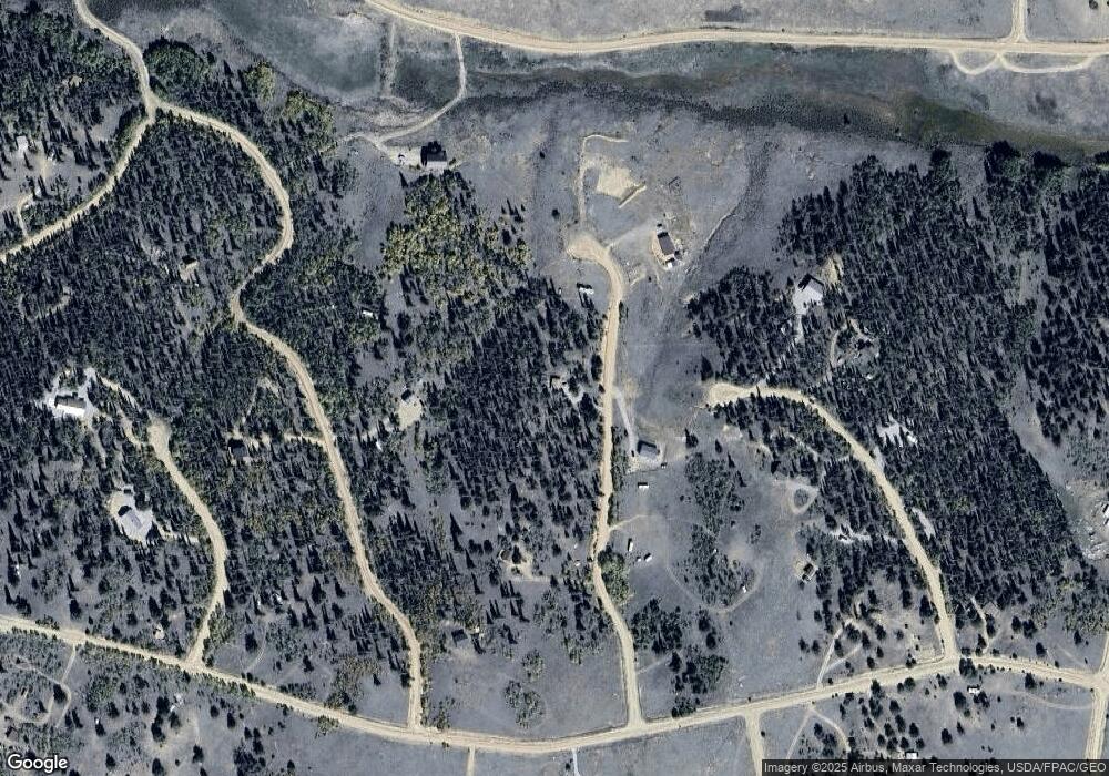
145 Long Rifle Run Como, CO 80432
Estimated Value: $304,206 - $356,000
1
Bed
1
Bath
480
Sq Ft
$681/Sq Ft
Est. Value
About This Home
This home is located at 145 Long Rifle Run, Como, CO 80432 and is currently estimated at $326,802, approximately $680 per square foot. 145 Long Rifle Run is a home located in Park County with nearby schools including Edith Teter Elementary School, Cienega Elementary School, and South Park Middle School.
Ownership History
Date
Name
Owned For
Owner Type
Purchase Details
Closed on
Sep 24, 2018
Sold by
Hish Lonnie and Hish Eua Denise
Bought by
Bauer Burton Jr Jerry R and Bauer Burton Tammy
Current Estimated Value
Home Financials for this Owner
Home Financials are based on the most recent Mortgage that was taken out on this home.
Original Mortgage
$143,920
Outstanding Balance
$125,248
Interest Rate
4.5%
Mortgage Type
New Conventional
Estimated Equity
$201,554
Purchase Details
Closed on
May 26, 2017
Sold by
Hedgcoxe Sean and Janik Stephanie
Bought by
Hish Lonnie and Hish Eula Denise
Home Financials for this Owner
Home Financials are based on the most recent Mortgage that was taken out on this home.
Original Mortgage
$122,400
Interest Rate
3.97%
Mortgage Type
New Conventional
Create a Home Valuation Report for This Property
The Home Valuation Report is an in-depth analysis detailing your home's value as well as a comparison with similar homes in the area
Home Values in the Area
Average Home Value in this Area
Purchase History
| Date | Buyer | Sale Price | Title Company |
|---|---|---|---|
| Bauer Burton Jr Jerry R | $179,900 | Fidelity National Title | |
| Hish Lonnie | $153,000 | Fidelity National Title |
Source: Public Records
Mortgage History
| Date | Status | Borrower | Loan Amount |
|---|---|---|---|
| Open | Bauer Burton Jr Jerry R | $143,920 | |
| Previous Owner | Hish Lonnie | $122,400 |
Source: Public Records
Tax History Compared to Growth
Tax History
| Year | Tax Paid | Tax Assessment Tax Assessment Total Assessment is a certain percentage of the fair market value that is determined by local assessors to be the total taxable value of land and additions on the property. | Land | Improvement |
|---|---|---|---|---|
| 2024 | $931 | $16,350 | $3,260 | $13,090 |
| 2023 | $931 | $16,350 | $3,260 | $13,090 |
| 2022 | $801 | $12,311 | $2,217 | $10,094 |
| 2021 | $809 | $12,660 | $2,280 | $10,380 |
| 2020 | $710 | $10,820 | $1,480 | $9,340 |
| 2019 | $690 | $10,820 | $1,480 | $9,340 |
| 2018 | $501 | $10,820 | $1,480 | $9,340 |
| 2017 | $431 | $7,700 | $1,120 | $6,580 |
| 2016 | $442 | $7,790 | $940 | $6,850 |
| 2015 | $451 | $7,790 | $940 | $6,850 |
| 2014 | $374 | $0 | $0 | $0 |
Source: Public Records
Map
Nearby Homes
- 16 Buckshot Trail
- 1404 Buffalo Ridge Rd
- 9 Hump Path
- 209 Crooked Rock Path
- 538 Remington Rd
- 4019 Buffalo Ridge Rd
- 381 Remington Rd
- 111 Antelope Way
- 646 Antelope Way
- 368 Antelope Way
- 4588 Remington Rd
- 890 Mcdowell Dr
- 64 Carbine Rd
- 458 Remington Rd
- 3370 Remington Rd
- 6452 Remington Rd
- 0 Winchester Dr Unit 380
- 00 Winchester Dr Unit 382
- 499 Kiowa St
- 123 Jims Way
- 145 Long Rifle Way
- 205 Long Rifle Way
- 142 Long Rifle Way
- 130 Buckshot Trail
- 142 Long Rifle Run
- 81 Long Rifle Way
- 205 Long Rifle Run
- 81 Long Rifle Way
- 142 Long Rifle Way
- 194 Buckshot Trail
- 180 Long Rifle Way
- 157 Tumbler
- 3739 Remington Rd
- 16 Buckshot Way
- 3675 Remington Rd
- 191 Buckshot Trail
- 83 Tumbler
- 3621 Remington Rd
- 148 Tumbler Way
- 959 Buffalo Ridge Rd
