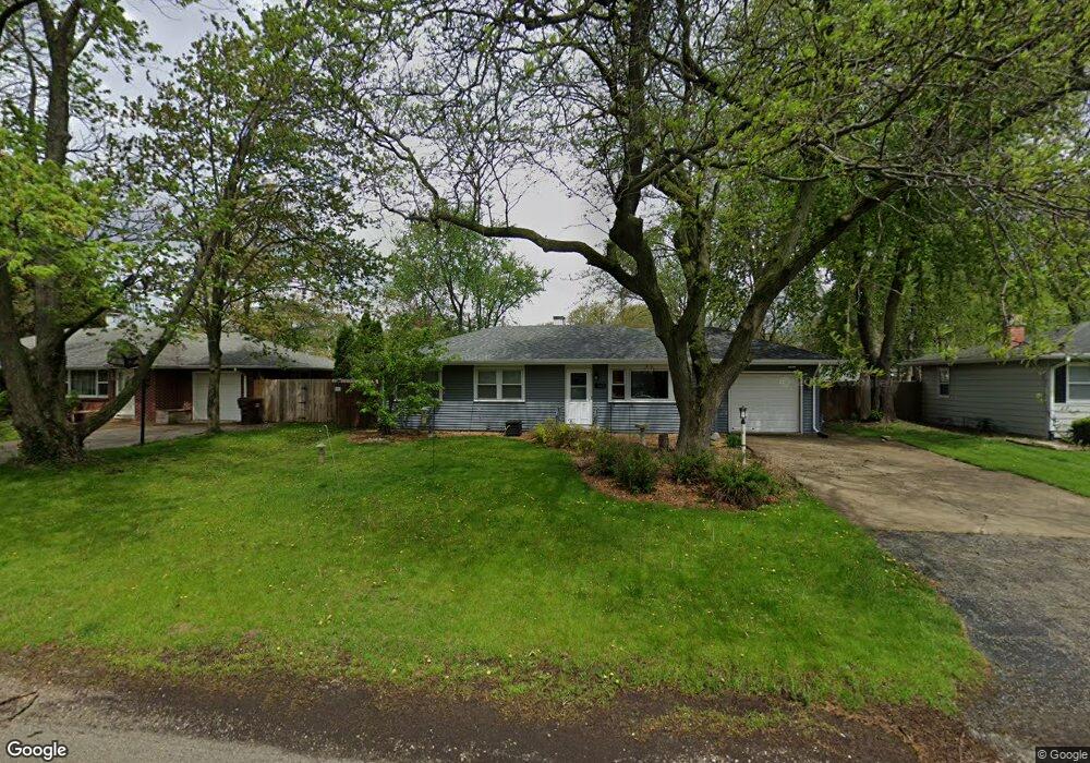
145 Michael Ln New Lenox, IL 60451
Estimated Value: $280,000 - $308,000
3
Beds
1
Bath
1,000
Sq Ft
$291/Sq Ft
Est. Value
About This Home
This home is located at 145 Michael Ln, New Lenox, IL 60451 and is currently estimated at $291,283, approximately $291 per square foot. 145 Michael Ln is a home located in Will County with nearby schools including Oster-Oakview School, Haines Elementary School, and Lincoln Way West.
Ownership History
Date
Name
Owned For
Owner Type
Purchase Details
Closed on
Jun 12, 2012
Sold by
Ace Group Llc Iv
Bought by
Kojro Badziak Jason and Kojro Badziak Jennifer
Current Estimated Value
Home Financials for this Owner
Home Financials are based on the most recent Mortgage that was taken out on this home.
Original Mortgage
$149,246
Outstanding Balance
$103,044
Interest Rate
3.75%
Mortgage Type
FHA
Estimated Equity
$188,239
Purchase Details
Closed on
Apr 1, 2011
Sold by
Bruinius Jennifer L and Chaffee Jennifer L
Bought by
Ace Group Llc
Purchase Details
Closed on
Apr 5, 2007
Sold by
Wieclaw Ferdinand A and Wieclaw Harriet
Bought by
Bruinius Jennifer L
Home Financials for this Owner
Home Financials are based on the most recent Mortgage that was taken out on this home.
Original Mortgage
$195,000
Interest Rate
6.2%
Mortgage Type
Purchase Money Mortgage
Create a Home Valuation Report for This Property
The Home Valuation Report is an in-depth analysis detailing your home's value as well as a comparison with similar homes in the area
Home Values in the Area
Average Home Value in this Area
Purchase History
| Date | Buyer | Sale Price | Title Company |
|---|---|---|---|
| Kojro Badziak Jason | $152,000 | None Available | |
| Ace Group Llc | $92,000 | Citywide Title Corporation | |
| Bruinius Jennifer L | $195,000 | Chicago Title Insurance Co |
Source: Public Records
Mortgage History
| Date | Status | Borrower | Loan Amount |
|---|---|---|---|
| Open | Kojro Badziak Jason | $149,246 | |
| Previous Owner | Bruinius Jennifer L | $195,000 |
Source: Public Records
Tax History Compared to Growth
Tax History
| Year | Tax Paid | Tax Assessment Tax Assessment Total Assessment is a certain percentage of the fair market value that is determined by local assessors to be the total taxable value of land and additions on the property. | Land | Improvement |
|---|---|---|---|---|
| 2024 | $5,418 | $77,251 | $20,237 | $57,014 |
| 2023 | $5,418 | $70,421 | $18,448 | $51,973 |
| 2022 | $4,911 | $64,874 | $16,995 | $47,879 |
| 2021 | $4,649 | $61,012 | $15,983 | $45,029 |
| 2020 | $4,507 | $58,835 | $15,413 | $43,422 |
| 2019 | $4,304 | $57,011 | $14,935 | $42,076 |
| 2018 | $4,195 | $55,046 | $14,420 | $40,626 |
| 2017 | $3,975 | $53,463 | $14,005 | $39,458 |
| 2016 | $3,852 | $52,032 | $13,630 | $38,402 |
| 2015 | $3,719 | $50,394 | $13,201 | $37,193 |
| 2014 | $3,719 | $49,772 | $13,038 | $36,734 |
| 2013 | $3,719 | $50,443 | $13,214 | $37,229 |
Source: Public Records
Map
Nearby Homes
- 1344 N Cedar Rd
- 133 Barbara Ln
- 200 Redwood Ave
- 208 Redwood Ave
- 1231 Town Crest Dr Unit E
- 1999 Silver Cross Blvd
- 217 Aspen Dr
- 12001 W Route 6
- 0 Silver Cross Blvd
- 1301 Silver Cross Blvd
- 807 Picardy Place
- 224 Hauser Ct
- 338 Willow St
- 125 Kimber Dr
- 1261 S Regan Rd
- 1920 Edmonds Ave
- 203 Fir St
- 331 Old Hickory Rd
- 13621 W Maple Rd
- 13741 Elizabeth Ln
- 149 Michael Ln
- 141 Michael Ln
- 138 Terry Ellen Ln
- 134 Terry Ellen Ln
- 153 Michael Ln
- 153 Michael Ln
- 137 Michael Ln
- 146 Michael Ln
- 130 Terry Ellen Ln
- 150 Michael Ln
- 142 Michael Ln
- 157 Michael Ln
- 133 Michael Ln
- 146 Terry Ellen Ln
- 154 Michael Ln
- 138 Michael Ln
- 128 Terry Ellen Ln
- 158 Michael Ln
- 134 Michael Ln
- 161 Michael Ln