Estimated Value: $148,000 - $215,000
Studio
--
Bath
1,341
Sq Ft
$124/Sq Ft
Est. Value
About This Home
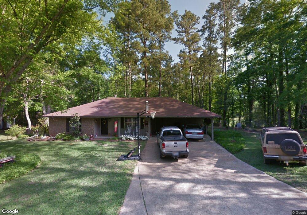
This home is located at 145 Patrick Place, Many, LA 71449 and is currently estimated at $166,910, approximately $124 per square foot. 145 Patrick Place is a home located in Sabine Parish with nearby schools including Many Junior High School and Many High School.
Ownership History
Date
Name
Owned For
Owner Type
Purchase Details
Closed on
Dec 13, 2012
Sold by
Moore James Shawn
Bought by
Wright Rex and Wright Cynthia Ann
Current Estimated Value
Home Financials for this Owner
Home Financials are based on the most recent Mortgage that was taken out on this home.
Original Mortgage
$95,000
Outstanding Balance
$16,781
Interest Rate
2.67%
Mortgage Type
New Conventional
Estimated Equity
$150,129
Purchase Details
Closed on
Jul 1, 2005
Sold by
Federal National Mortgage Association
Bought by
Moore James Shawn
Home Financials for this Owner
Home Financials are based on the most recent Mortgage that was taken out on this home.
Original Mortgage
$56,750
Interest Rate
5.64%
Mortgage Type
New Conventional
Create a Home Valuation Report for This Property
The Home Valuation Report is an in-depth analysis detailing your home's value as well as a comparison with similar homes in the area
Home Values in the Area
Average Home Value in this Area
Purchase History
| Date | Buyer | Sale Price | Title Company |
|---|---|---|---|
| Wright Rex | $100,000 | None Available | |
| Moore James Shawn | $49,900 | None Available |
Source: Public Records
Mortgage History
| Date | Status | Borrower | Loan Amount |
|---|---|---|---|
| Open | Wright Rex | $95,000 | |
| Previous Owner | Moore James Shawn | $56,750 |
Source: Public Records
Tax History
| Year | Tax Paid | Tax Assessment Tax Assessment Total Assessment is a certain percentage of the fair market value that is determined by local assessors to be the total taxable value of land and additions on the property. | Land | Improvement |
|---|---|---|---|---|
| 2024 | $331 | $11,087 | $1,550 | $9,537 |
| 2023 | $152 | $8,878 | $1,075 | $7,803 |
| 2022 | $792 | $8,878 | $1,075 | $7,803 |
| 2021 | $848 | $8,878 | $1,075 | $7,803 |
| 2020 | $917 | $8,878 | $1,075 | $7,803 |
| 2019 | $889 | $8,878 | $1,075 | $7,803 |
| 2018 | $625 | $5,930 | $750 | $5,180 |
| 2017 | $623 | $5,930 | $750 | $5,180 |
| 2016 | $620 | $5,930 | $750 | $5,180 |
| 2015 | $34 | $5,930 | $750 | $5,180 |
| 2014 | $34 | $5,930 | $750 | $5,180 |
Source: Public Records
Map
Nearby Homes
- 910 Ponder St Unit 27
- 825 Shreveport Hwy
- 825 Shreveport Hwy Unit 8 & 9 Blk 14
- 1113 Alieze St
- 765 N Capitol St
- 0 Chasin Fin Dr Unit 6
- 0 Chasin Fin Dr Unit 5
- 0 Chasin Fin Dr Unit 4
- 00 Chasin Fin Dr Unit 2
- 0 **Mobile Home Only** Unit TO BE MOVED!!!!
- 0 Chasin Fin Dr Unit 7
- 00 Chasin Fin Dr Unit 3
- 850 Hill St
- 18692 Louisiana 175 Unit Tract 4
- 295 Highland Ave
- 11460 Texas Hwy
- 000 Texas Hwy
- 0 Texas Hwy Unit 11330283
- 0 Texas Hwy Unit 11438353
- 0 Texas Hwy Unit 11438355
- 1350 Forest Ln
- 1353 Forest Ln
- 1310 Forest Ln
- 1301 Forest Ln
- 1300 Forest Ln
- 115 Meadow Ln
- 1335 Andries St
- 1210 Forest Ln
- 150 Meadow Ln
- 1205 Forest Ln
- 1325 Andries St
- 1206 Forest Ln
- 1330 Andries St
- 435 Miller St
- 1315 Blake St
- 245 Patrick Place
- 1202 Forest Ln
- 1215 Andries St
- 445 Miller St
- 310 Miller St
Your Personal Tour Guide
Ask me questions while you tour the home.