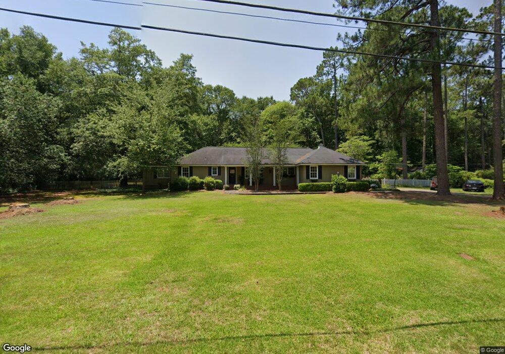
145 Pearson Dr SW Dawson, GA 39842
Estimated Value: $218,000 - $297,000
4
Beds
2
Baths
2,990
Sq Ft
$86/Sq Ft
Est. Value
About This Home
This home is located at 145 Pearson Dr SW, Dawson, GA 39842 and is currently estimated at $258,407, approximately $86 per square foot. 145 Pearson Dr SW is a home located in Terrell County with nearby schools including Cooper-Carver Elementary School, Terrell Middle School, and Terrell High School.
Ownership History
Date
Name
Owned For
Owner Type
Purchase Details
Closed on
Jul 30, 2002
Sold by
Ingram Phillip Thoma
Bought by
Bell Frederick S
Current Estimated Value
Purchase Details
Closed on
Aug 25, 1998
Sold by
Duncan Deanne Holley
Bought by
Ingram Phillip Thoma
Purchase Details
Closed on
Aug 24, 1998
Sold by
Ingram Phil U
Bought by
Duncan Deanne Holley
Create a Home Valuation Report for This Property
The Home Valuation Report is an in-depth analysis detailing your home's value as well as a comparison with similar homes in the area
Home Values in the Area
Average Home Value in this Area
Purchase History
| Date | Buyer | Sale Price | Title Company |
|---|---|---|---|
| Bell Frederick S | $90,100 | -- | |
| Ingram Phillip Thoma | $59,700 | -- | |
| Duncan Deanne Holley | $50,000 | -- |
Source: Public Records
Tax History Compared to Growth
Tax History
| Year | Tax Paid | Tax Assessment Tax Assessment Total Assessment is a certain percentage of the fair market value that is determined by local assessors to be the total taxable value of land and additions on the property. | Land | Improvement |
|---|---|---|---|---|
| 2024 | $3,262 | $77,317 | $5,000 | $72,317 |
| 2023 | $3,263 | $77,317 | $5,000 | $72,317 |
| 2022 | $2,334 | $77,317 | $5,000 | $72,317 |
| 2021 | $2,334 | $77,317 | $5,000 | $72,317 |
| 2020 | $2,334 | $77,317 | $5,000 | $72,317 |
| 2019 | $2,258 | $77,317 | $5,000 | $72,317 |
| 2018 | $2,258 | $77,317 | $5,000 | $72,317 |
| 2017 | $2,945 | $77,317 | $5,000 | $72,317 |
| 2016 | $2,258 | $77,317 | $5,000 | $72,317 |
| 2015 | -- | $77,317 | $5,000 | $72,317 |
| 2014 | -- | $77,317 | $5,000 | $72,317 |
| 2013 | -- | $77,317 | $5,000 | $72,317 |
Source: Public Records
Map
Nearby Homes
- 0 Cox Rd
- 439 Cherry St SE
- 13XX Graves Hwy
- 411 E Lee St
- 707 Johnson St SE
- 229 7th Ave NW
- 361/552 NW Tenth Ave
- 1266 Georgia Ave SE
- 527 Orange St NE
- 513 College St NE
- 0 Elladale Dr SE Unit 18754943
- 1460 Georgia Ave SE
- 1240 Askew Dr NE
- 1258 Askew Dr NE
- 904 Ash St NE
- 828 Cooper Dr NE
- 0 Cooper Dr NE Unit 7597500
- 0 Cooper Dr NE Unit 10543060
- 1239 Askew Dr NE
- 434 Foster Ave
- 121 Pearson Dr SW
- 185 Pearson Dr SW
- 146 Pearson Dr SW
- 971 Herod Rd
- 1111 Herod Rd SE
- 184 Pearson Dr SW
- 1075 Margaret Ave SW
- 133 Orndorff Dr SW
- 921 Herod Rd
- 1044 Herod Rd SE
- 219 Pearson Dr SW
- 1088 Herod Rd SE
- 920 Margaret Ave SW
- 210 Pearson Dr SW
- 1161 Herod Rd SE
- 1755 Georgia 55
- 249 Pearson Dr SW
- 1130 Herod Rd SE
- 1088 Herod Hwy
- 925 Margaret Ave SW