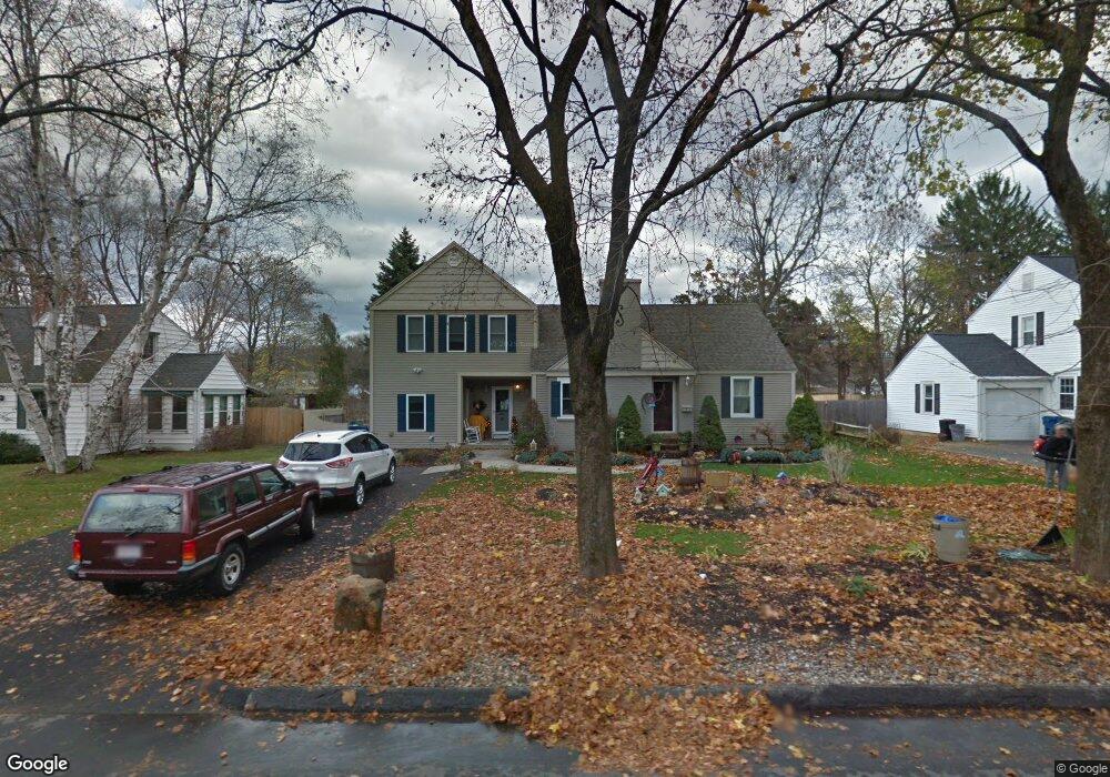
145 Poplar Ave West Springfield, MA 01089
Estimated Value: $373,000 - $537,000
3
Beds
3
Baths
2,739
Sq Ft
$164/Sq Ft
Est. Value
About This Home
This home is located at 145 Poplar Ave, West Springfield, MA 01089 and is currently estimated at $448,886, approximately $163 per square foot. 145 Poplar Ave is a home located in Hampden County with nearby schools including West Springfield High School and St Thomas The Apostle School.
Ownership History
Date
Name
Owned For
Owner Type
Purchase Details
Closed on
Mar 24, 2004
Sold by
Siano William L
Bought by
Siano Joanne L and Siano William L
Current Estimated Value
Home Financials for this Owner
Home Financials are based on the most recent Mortgage that was taken out on this home.
Original Mortgage
$131,250
Outstanding Balance
$61,255
Interest Rate
5.65%
Mortgage Type
Purchase Money Mortgage
Estimated Equity
$387,631
Purchase Details
Closed on
Oct 1, 1997
Sold by
Rackliffe Joyce L
Bought by
Siano William L
Home Financials for this Owner
Home Financials are based on the most recent Mortgage that was taken out on this home.
Original Mortgage
$10,000
Interest Rate
7.31%
Create a Home Valuation Report for This Property
The Home Valuation Report is an in-depth analysis detailing your home's value as well as a comparison with similar homes in the area
Home Values in the Area
Average Home Value in this Area
Purchase History
| Date | Buyer | Sale Price | Title Company |
|---|---|---|---|
| Siano Joanne L | -- | -- | |
| Siano William L | $80,000 | -- |
Source: Public Records
Mortgage History
| Date | Status | Borrower | Loan Amount |
|---|---|---|---|
| Open | Siano Joanne L | $131,250 | |
| Previous Owner | Siano William L | $25,000 | |
| Previous Owner | Siano William L | $10,000 | |
| Previous Owner | Siano William L | $79,775 |
Source: Public Records
Tax History
| Year | Tax Paid | Tax Assessment Tax Assessment Total Assessment is a certain percentage of the fair market value that is determined by local assessors to be the total taxable value of land and additions on the property. | Land | Improvement |
|---|---|---|---|---|
| 2025 | $6,547 | $440,300 | $127,000 | $313,300 |
| 2024 | $6,558 | $442,800 | $127,000 | $315,800 |
| 2023 | $6,135 | $394,800 | $127,000 | $267,800 |
| 2022 | $5,585 | $354,400 | $115,200 | $239,200 |
| 2021 | $5,460 | $323,100 | $107,600 | $215,500 |
| 2020 | $5,415 | $318,700 | $107,600 | $211,100 |
| 2019 | $5,405 | $318,700 | $107,600 | $211,100 |
| 2018 | $5,434 | $318,700 | $107,600 | $211,100 |
| 2017 | $5,434 | $318,700 | $107,600 | $211,100 |
| 2016 | $5,464 | $321,600 | $103,400 | $218,200 |
| 2015 | $5,357 | $315,300 | $101,300 | $214,000 |
| 2014 | $1,302 | $315,300 | $101,300 | $214,000 |
Source: Public Records
Map
Nearby Homes
- 144 Almon Ave
- 1996 Westfield St
- 65 Churchill Rd
- 117 Sibley Ave
- 62 Talcott Ave
- 32 Glenview Dr
- 65 Verdugo St
- 88 Verdugo St
- 240 Morton St
- 61 Clarence St
- lot A North St
- 24 E View Dr
- 112 North St
- 81 Chestnut St
- 128 Hampden St
- 999 N Street Extension
- 32 Maple St
- 20 Ottawa St
- 1086 N Street Extension
- 31 North Blvd
- 137 Poplar Ave
- 153 Poplar Ave
- 159 Poplar Ave
- 129 Poplar Ave
- 150 Meadowbrook Ave
- 142 Meadowbrook Ave
- 156 Meadowbrook Ave
- 154 Poplar Ave
- 136 Poplar Ave
- 167 Poplar Ave
- 146 Poplar Ave
- 164 Meadowbrook Ave
- 134 Meadowbrook Ave
- 160 Poplar Ave
- 115 Poplar Ave
- 170 Meadowbrook Ave
- 126 Meadowbrook Ave
- 124 Poplar Ave
- 175 Poplar Ave
- 180 Meadowbrook Ave
Your Personal Tour Guide
Ask me questions while you tour the home.