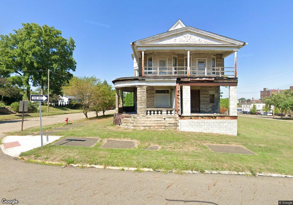
145 S Linden Ave Alliance, OH 44601
Estimated Value: $51,870 - $107,000
4
Beds
3
Baths
2,976
Sq Ft
$25/Sq Ft
Est. Value
About This Home
This home is located at 145 S Linden Ave, Alliance, OH 44601 and is currently estimated at $75,468, approximately $25 per square foot. 145 S Linden Ave is a home with nearby schools including Alliance Intermediate School at Northside, Alliance Elementary School at Rockhill, and Alliance Middle School.
Ownership History
Date
Name
Owned For
Owner Type
Purchase Details
Closed on
Nov 22, 2008
Sold by
Minor Ronald C and Minor Anna M
Bought by
Moonbern Properties Llc
Current Estimated Value
Purchase Details
Closed on
Apr 8, 2002
Sold by
Powell Mary P
Bought by
Minor Ii Ronald C and Minor Anna M
Home Financials for this Owner
Home Financials are based on the most recent Mortgage that was taken out on this home.
Original Mortgage
$24,000
Interest Rate
6.87%
Mortgage Type
Seller Take Back
Create a Home Valuation Report for This Property
The Home Valuation Report is an in-depth analysis detailing your home's value as well as a comparison with similar homes in the area
Home Values in the Area
Average Home Value in this Area
Purchase History
| Date | Buyer | Sale Price | Title Company |
|---|---|---|---|
| Moonbern Properties Llc | $22,300 | None Available | |
| Minor Ii Ronald C | $25,000 | -- |
Source: Public Records
Mortgage History
| Date | Status | Borrower | Loan Amount |
|---|---|---|---|
| Previous Owner | Minor Ii Ronald C | $24,000 |
Source: Public Records
Tax History Compared to Growth
Tax History
| Year | Tax Paid | Tax Assessment Tax Assessment Total Assessment is a certain percentage of the fair market value that is determined by local assessors to be the total taxable value of land and additions on the property. | Land | Improvement |
|---|---|---|---|---|
| 2025 | -- | $12,600 | $4,690 | $7,910 |
| 2024 | -- | $12,600 | $4,690 | $7,910 |
| 2023 | $278 | $6,760 | $2,380 | $4,380 |
| 2022 | $280 | $6,760 | $2,380 | $4,380 |
| 2021 | $281 | $6,760 | $2,380 | $4,380 |
| 2020 | $357 | $8,020 | $2,070 | $5,950 |
| 2019 | $352 | $8,020 | $2,070 | $5,950 |
| 2018 | $354 | $8,020 | $2,070 | $5,950 |
| 2017 | $324 | $7,210 | $1,750 | $5,460 |
| 2016 | $326 | $7,210 | $1,750 | $5,460 |
| 2015 | $329 | $7,210 | $1,750 | $5,460 |
| 2014 | $336 | $7,000 | $1,680 | $5,320 |
| 2013 | $167 | $7,000 | $1,680 | $5,320 |
Source: Public Records
Map
Nearby Homes
- 356 E Broadway St
- 361 E Main St
- V/L S Fredeom Ave
- 432 S Linden Ave
- 142 S Seneca Ave
- 452 E Summit St
- 427 S Union Ave
- 263 Franklin Ave
- 163 W Market St
- 710 N Freedom Ave
- 132 S Haines Ave
- 807 S Union Ave
- 140 W Summit St
- 124 E Wayne St
- 1005 S Freedom Ave
- 1214 Jersey St
- 831 Wade Ave
- 652 N Webb Ave
- 814 Milner St
- 1044 S Liberty Ave
- 338 E Columbia St
- 355 E Columbia St
- 326 E Columbia St
- 425 E Market St
- 419 E Columbia St
- 325 E Columbia St
- 227 S Linden Ave
- 313 E Columbia St
- 226 S Linden Ave
- 214 S Arch Ave
- 232 S Linden Ave
- 404 E Broadway St
- 330 E Broadway St
- 40 S Linden Ave
- 133 S Freedom Ave
- 149 S Freedom Ave
- 205 S Arch Ave
- 221 S Arch Ave
- 355 E Main St
- 353 E Main St