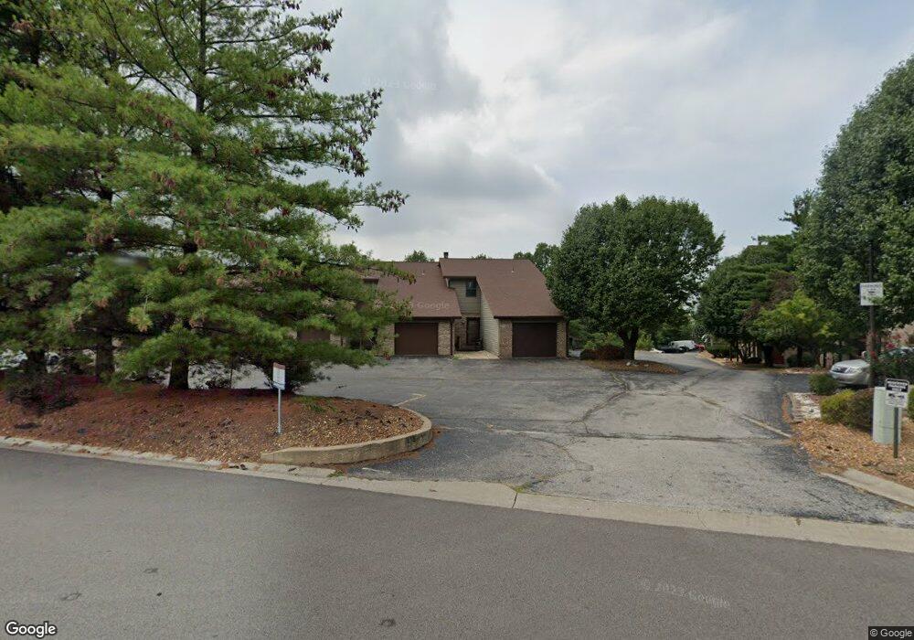
145 Sandridge Dr Unit 17 Collinsville, IL 62234
Estimated Value: $62,000 - $105,066
1
Bed
1
Bath
705
Sq Ft
$103/Sq Ft
Est. Value
About This Home
This home is located at 145 Sandridge Dr Unit 17, Collinsville, IL 62234 and is currently estimated at $72,767, approximately $103 per square foot. 145 Sandridge Dr Unit 17 is a home located in Madison County with nearby schools including Dorris Intermediate School, Twin Echo Elementary School, and Collinsville Middle School.
Ownership History
Date
Name
Owned For
Owner Type
Purchase Details
Closed on
May 13, 2021
Sold by
Crews Carol
Bought by
Daniels Christine
Current Estimated Value
Purchase Details
Closed on
Apr 13, 2018
Sold by
Gitcho Jan and Crews Carol
Bought by
Crews Carol
Purchase Details
Closed on
Nov 26, 2008
Sold by
Gitcho Jan R
Bought by
Gitcho Jan and Crews Carol
Purchase Details
Closed on
Oct 15, 2008
Sold by
Citimortgage Inc
Bought by
Gitcho Jan R
Purchase Details
Closed on
Mar 24, 2008
Sold by
Fanning Roy
Bought by
Citimortgage Inc
Create a Home Valuation Report for This Property
The Home Valuation Report is an in-depth analysis detailing your home's value as well as a comparison with similar homes in the area
Home Values in the Area
Average Home Value in this Area
Purchase History
| Date | Buyer | Sale Price | Title Company |
|---|---|---|---|
| Daniels Christine | $28,000 | Benchmark Title Co | |
| Crews Carol | -- | Madison County Title | |
| Gitcho Jan | -- | Mctc | |
| Gitcho Jan R | $27,000 | Fatic | |
| Citimortgage Inc | -- | Fatic |
Source: Public Records
Tax History Compared to Growth
Tax History
| Year | Tax Paid | Tax Assessment Tax Assessment Total Assessment is a certain percentage of the fair market value that is determined by local assessors to be the total taxable value of land and additions on the property. | Land | Improvement |
|---|---|---|---|---|
| 2024 | $646 | $16,100 | $1,510 | $14,590 |
| 2023 | $646 | $14,340 | $1,370 | $12,970 |
| 2022 | $549 | $13,260 | $1,270 | $11,990 |
| 2021 | $860 | $12,450 | $1,190 | $11,260 |
| 2020 | $829 | $11,880 | $1,140 | $10,740 |
| 2019 | $1,017 | $14,450 | $1,090 | $13,360 |
| 2018 | $994 | $13,690 | $1,040 | $12,650 |
| 2017 | $996 | $13,420 | $1,020 | $12,400 |
| 2016 | $1,049 | $13,420 | $1,020 | $12,400 |
| 2015 | $978 | $13,070 | $990 | $12,080 |
| 2014 | $978 | $13,070 | $990 | $12,080 |
| 2013 | $978 | $13,070 | $990 | $12,080 |
Source: Public Records
Map
Nearby Homes
- 1051 Lafayette Ct Unit A
- 1059 Lafayette Ct Unit A
- 1035 Lafayette Ct Unit B
- 1121 Carraway Ct
- 2007 Belt Line Rd
- 100 Debbie Dr
- 5 Brookwood Dr
- 22 Brookwood Dr
- 123 Elliot St
- 45 Bellevue Dr
- 414 Bunker Hill Dr
- 101 Westminster Dr
- 510 N Combs Ave
- 0 Strong Ave
- 205 Audrey Ave
- 580 N Guernsey St
- 1224 Cedar Ridge Ct
- 0 Elm St
- 123 W Wickliffe Ave
- 221 N Hesperia St Unit 221 A and 221 B
- 141 Sandridge Dr Unit 18
- 139 Sandridge Dr Unit 23
- 137 Sandridge Dr
- 135 Sandridge Dr Unit 24
- 143 Sandridge Dr Unit 22
- 147 Sandridge Dr
- 133 Sandridge Dr
- 137 Sandridge Dr Unit 19
- 181 Sandridge Dr
- 149 Sandridge Dr
- 165 Sandridge Dr Unit 25
- 183 Sandridge Dr
- 175 Sandridge Dr Unit 34
- 173 Sandridge Dr Unit 33
- 171 Sandridge Dr
- 117 Sandridge Dr
- 163 Sandridge Dr Unit 41
- 157 Sandridge Dr Unit 38
- 185 Sandridge Dr