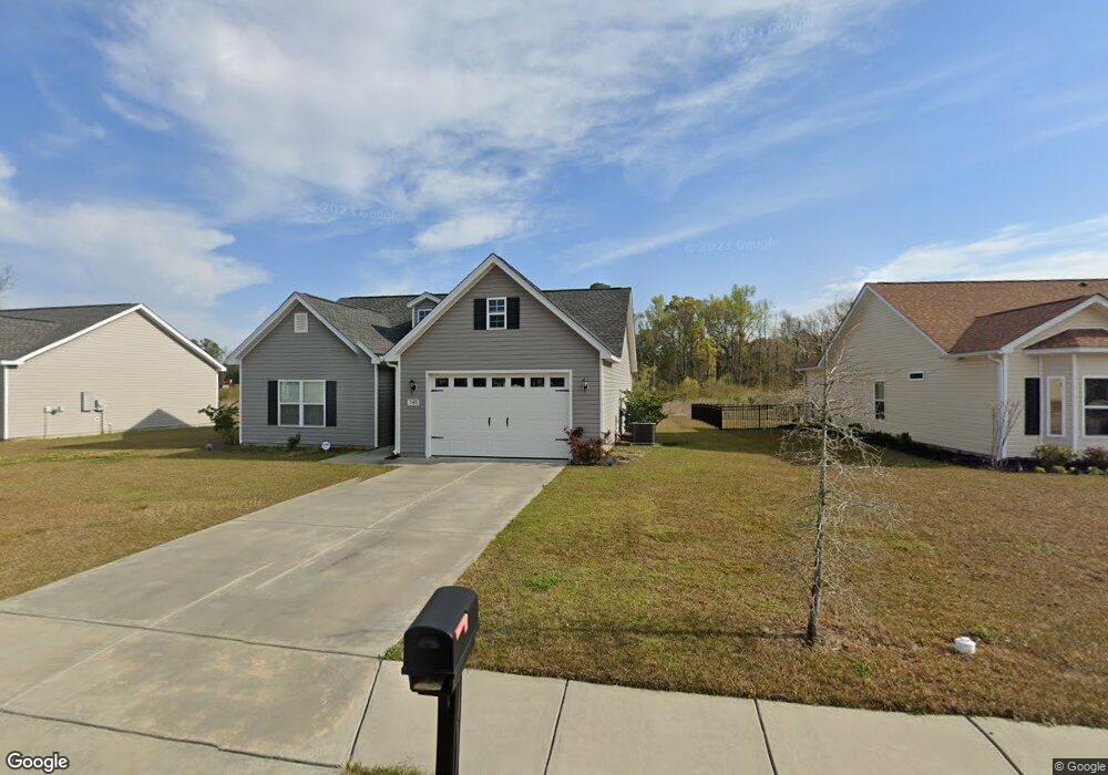
145 Springtide Dr Unit HWY 548 Conway, SC 29527
Estimated Value: $260,000 - $316,000
3
Beds
2
Baths
1,451
Sq Ft
$192/Sq Ft
Est. Value
About This Home
This home is located at 145 Springtide Dr Unit HWY 548, Conway, SC 29527 and is currently estimated at $278,013, approximately $191 per square foot. 145 Springtide Dr Unit HWY 548 is a home located in Horry County with nearby schools including Conway Elementary School, Conway Middle School, and Conway High School.
Ownership History
Date
Name
Owned For
Owner Type
Purchase Details
Closed on
Aug 29, 2024
Sold by
Chestnut Isha C
Bought by
Shepp Isha
Current Estimated Value
Purchase Details
Closed on
Jul 29, 2022
Sold by
Chestnut Jermaine
Bought by
Chestnut Isha C
Purchase Details
Closed on
May 1, 2018
Sold by
Windsor Farms Of Conway Ll
Bought by
Chestnut Jermaine and Chestnut Isha C
Home Financials for this Owner
Home Financials are based on the most recent Mortgage that was taken out on this home.
Original Mortgage
$144,433
Interest Rate
4.4%
Mortgage Type
New Conventional
Create a Home Valuation Report for This Property
The Home Valuation Report is an in-depth analysis detailing your home's value as well as a comparison with similar homes in the area
Home Values in the Area
Average Home Value in this Area
Purchase History
| Date | Buyer | Sale Price | Title Company |
|---|---|---|---|
| Shepp Isha | -- | -- | |
| Chestnut Isha C | -- | -- | |
| Chestnut Jermaine | $148,900 | -- |
Source: Public Records
Mortgage History
| Date | Status | Borrower | Loan Amount |
|---|---|---|---|
| Previous Owner | Chestnut Jermaine | $144,433 |
Source: Public Records
Tax History Compared to Growth
Tax History
| Year | Tax Paid | Tax Assessment Tax Assessment Total Assessment is a certain percentage of the fair market value that is determined by local assessors to be the total taxable value of land and additions on the property. | Land | Improvement |
|---|---|---|---|---|
| 2024 | $1,075 | $16,085 | $4,200 | $11,885 |
| 2023 | $1,075 | $5,950 | $1,140 | $4,810 |
| 2021 | $652 | $8,918 | $1,706 | $7,212 |
| 2020 | $562 | $8,918 | $1,706 | $7,212 |
| 2019 | $1,874 | $8,918 | $1,706 | $7,212 |
| 2018 | $0 | $245 | $245 | $0 |
Source: Public Records
Map
Nearby Homes
- 229 Maiden's Choice Dr
- 600 Shallow Cove Dr Unit Lot 154
- 594 Shallow Cove Dr Unit Lot 151
- 598 Shallow Cove Dr Unit Lot 153
- 596 Shallow Cove Dr Unit Lot 152
- 197 Springtide Dr
- 207 Palmetto Sand Loop
- 297 Palmetto Sand Loop Unit Lot 57 Odessa II
- 312 Palmetto Sand Loop Unit Lot 14
- 299 Palmetto Sand Loop Unit Lot 56 Wisteria II B
- 224 Palmetto Sand Loop Unit Lot 35
- Bailey II Plan at Beach Gardens
- Wisteria II Plan at Beach Gardens
- Courtney II Plan at Beach Gardens
- Julie II Plan at Beach Gardens
- Odessa II Plan at Beach Gardens
- Habersham II Plan at Beach Gardens
- 365 Palmetto Sand Loop Unit Lot 45 Wisteria II
- 284 Palmetto Sand Loop Unit Lot 21 Barnard II
- 220 Palmetto Sand Loop Unit Lot 36 Odessa II
- 145 Springtide Dr
- 145 Springtide Dr Unit Lot 62
- 151 Springtide Dr
- 151 Springtide Dr Unit Lot 61
- 139 Springtide Dr Unit Lot 63
- 139 Springtide Dr
- 146 Springtide Dr Unit Lot 36
- 193 Springtide Dr
- 155 Springtide Dr Unit Lot 60
- 155 Springtide Dr Unit Windsor Farms Lot 60
- 155 Springtide Dr
- 150 Springtide Dr Unit Lot 37
- 138 Springtide Dr
- 138 Springtide Dr Unit Lot 78
- 154 Springtide Dr
- 154 Springtide Dr Unit Lot 38
- 159 Springtide Dr
- 159 Springtide Dr Unit Lot 59
- 134 Springtide Dr
- 134 Springtide Dr Unit Lot 79