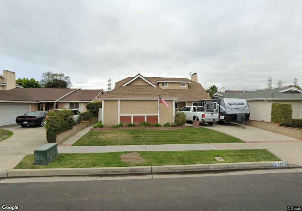
145 Stanford Ln Seal Beach, CA 90740
Estimated Value: $1,363,344 - $1,610,000
5
Beds
2
Baths
1,986
Sq Ft
$735/Sq Ft
Est. Value
About This Home
This home is located at 145 Stanford Ln, Seal Beach, CA 90740 and is currently estimated at $1,459,586, approximately $734 per square foot. 145 Stanford Ln is a home located in Orange County with nearby schools including Francis Hopkinson Elementary School, Jack L. Weaver Elementary School, and Oak Middle School.
Ownership History
Date
Name
Owned For
Owner Type
Purchase Details
Closed on
Mar 30, 2022
Sold by
Kearney Family Trust
Bought by
Kearney Joint Revocable Living Trust
Current Estimated Value
Purchase Details
Closed on
Nov 28, 2020
Sold by
Kearney Patrick and Kearney Steve
Bought by
Kearney Patrick Michael and Kearney Heidi Suzanne
Purchase Details
Closed on
Aug 3, 1999
Sold by
Kearney Cornelius R and Kearney Lois A
Bought by
Kearney Cornelius and Kearney Lois
Create a Home Valuation Report for This Property
The Home Valuation Report is an in-depth analysis detailing your home's value as well as a comparison with similar homes in the area
Home Values in the Area
Average Home Value in this Area
Purchase History
| Date | Buyer | Sale Price | Title Company |
|---|---|---|---|
| Kearney Joint Revocable Living Trust | -- | Loe Law Group | |
| Kearney Patrick Michael | -- | None Available | |
| Kearney Cornelius | -- | -- |
Source: Public Records
Tax History
| Year | Tax Paid | Tax Assessment Tax Assessment Total Assessment is a certain percentage of the fair market value that is determined by local assessors to be the total taxable value of land and additions on the property. | Land | Improvement |
|---|---|---|---|---|
| 2025 | $1,827 | $104,420 | $31,883 | $72,537 |
| 2024 | $1,827 | $102,373 | $31,258 | $71,115 |
| 2023 | $1,778 | $100,366 | $30,645 | $69,721 |
| 2022 | $1,754 | $98,399 | $30,045 | $68,354 |
| 2021 | $1,715 | $96,470 | $29,456 | $67,014 |
| 2020 | $1,706 | $95,481 | $29,154 | $66,327 |
| 2019 | $1,578 | $93,609 | $28,582 | $65,027 |
| 2018 | $1,491 | $91,774 | $28,022 | $63,752 |
| 2017 | $1,457 | $89,975 | $27,473 | $62,502 |
| 2016 | $1,426 | $88,211 | $26,934 | $61,277 |
| 2015 | $1,402 | $86,886 | $26,529 | $60,357 |
| 2014 | $1,355 | $85,185 | $26,010 | $59,175 |
Source: Public Records
Map
Nearby Homes
- 173 College Park Dr
- 105 Harvard Ln
- 6911 E 10th St
- 1075 Brookline Rd
- 1075 Brookline Rd Unit M9-220E
- 13121 Oak Hills Dr Unit 233J
- 13140 Nassau Dr
- 12746 Martha Ann Dr
- 1220 Scioto Rd
- 1220 Northwood Rd Unit M9-230D
- 2692 Salmon Dr
- 13101 Oak Hills Dr
- 13101 Oak Hills Dr Unit 234F
- 13180 Nassau Dr Unit 210D
- 13170 Southport Ln Unit 168-F
- 13170 Southport Ln Unit 168C
- 13220 Nassau Dr
- 13240 El Dorado 187a Dr
- 13241 El Dorado Dr
- 13220 Southport Ln
- 141 Stanford Ln
- 149 Stanford Ln
- 152 Harvard Ln
- 137 Stanford Ln
- 153 Stanford Ln
- 148 Harvard Ln
- 156 Harvard Ln
- 144 Harvard Ln
- 160 Harvard Ln
- 144 Stanford Ln
- 133 Stanford Ln
- 140 Stanford Ln
- 157 Stanford Ln
- 148 Stanford Ln
- 136 Stanford Ln
- 140 Harvard Ln
- 164 Harvard Ln
- 152 Stanford Ln
- 129 Stanford Ln
- 161 Stanford Ln
Your Personal Tour Guide
Ask me questions while you tour the home.