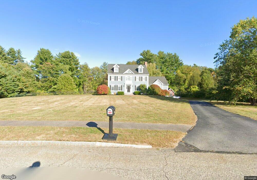
145 Wharton Row Groton, MA 01450
Estimated Value: $1,246,000 - $1,369,000
4
Beds
3
Baths
4,746
Sq Ft
$273/Sq Ft
Est. Value
About This Home
This home is located at 145 Wharton Row, Groton, MA 01450 and is currently estimated at $1,295,088, approximately $272 per square foot. 145 Wharton Row is a home located in Middlesex County with nearby schools including Groton Dunstable Regional High School, Groton Community School, and Seven Hills At Groton.
Ownership History
Date
Name
Owned For
Owner Type
Purchase Details
Closed on
Oct 18, 2001
Sold by
Groton Dev Corp
Bought by
Desroches David E and Desroches Bridget
Current Estimated Value
Home Financials for this Owner
Home Financials are based on the most recent Mortgage that was taken out on this home.
Original Mortgage
$400,000
Outstanding Balance
$156,918
Interest Rate
6.92%
Mortgage Type
Purchase Money Mortgage
Estimated Equity
$1,138,170
Create a Home Valuation Report for This Property
The Home Valuation Report is an in-depth analysis detailing your home's value as well as a comparison with similar homes in the area
Home Values in the Area
Average Home Value in this Area
Purchase History
| Date | Buyer | Sale Price | Title Company |
|---|---|---|---|
| Desroches David E | $736,585 | -- |
Source: Public Records
Mortgage History
| Date | Status | Borrower | Loan Amount |
|---|---|---|---|
| Open | Desroches David E | $400,000 |
Source: Public Records
Tax History Compared to Growth
Tax History
| Year | Tax Paid | Tax Assessment Tax Assessment Total Assessment is a certain percentage of the fair market value that is determined by local assessors to be the total taxable value of land and additions on the property. | Land | Improvement |
|---|---|---|---|---|
| 2025 | $18,829 | $1,234,700 | $316,600 | $918,100 |
| 2024 | $18,707 | $1,239,700 | $316,600 | $923,100 |
| 2023 | $17,423 | $1,114,000 | $316,600 | $797,400 |
| 2022 | $15,741 | $915,700 | $253,000 | $662,700 |
| 2021 | $15,884 | $902,500 | $229,000 | $673,500 |
| 2020 | $16,527 | $950,900 | $247,800 | $703,100 |
| 2019 | $15,394 | $850,000 | $266,600 | $583,400 |
| 2018 | $14,996 | $803,200 | $257,200 | $546,000 |
| 2017 | $14,666 | $803,200 | $257,200 | $546,000 |
| 2016 | $13,903 | $740,300 | $215,300 | $525,000 |
| 2015 | $13,525 | $740,300 | $215,300 | $525,000 |
Source: Public Records
Map
Nearby Homes
- 111 Farmers Row
- 65 W Main St
- 37 Pepperell Rd
- 320 Old Ayer Rd
- 18 Douglas Dr
- 121 Culver Rd
- 117 Main St
- 436 Main St
- 21 Blacksmith Row Unit 21
- 521 Main St Unit D
- 59 Squannacook Rd
- 43 Longley Rd
- 25 Groton School Rd Unit 23
- Lot 9A Hayes Woods Ln
- 20 Hayes Woods Ln
- 44 Nod Rd
- 147 Shirley St
- 21 Lovers Ln
- 124 Hazen Rd
- 0ABC Park St
- 141 Wharton Row
- 150 Wharton Row
- 151 Wharton Row
- 159 Wharton Row
- 139 Wharton Row
- 138 Wharton Row
- 93 Town Forest Rd
- 161 Wharton Row
- 122 Wharton Row
- 129 Wharton Row
- 168 Wharton Row
- 165 Wharton Row
- 167 Wharton Row
- 0 Wharton Row
- 121 Wharton Row
- 170 Wharton Row
- 116 Wharton Row
- 115 Wharton Row
- 180 Wharton Row
- 171 Wharton Row