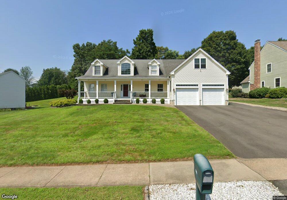
145 Whitewood Dr Rocky Hill, CT 06067
Estimated Value: $749,000 - $869,000
3
Beds
4
Baths
3,404
Sq Ft
$237/Sq Ft
Est. Value
About This Home
This home is located at 145 Whitewood Dr, Rocky Hill, CT 06067 and is currently estimated at $805,859, approximately $236 per square foot. 145 Whitewood Dr is a home located in Hartford County with nearby schools including Albert D. Griswold Middle School and Rocky Hill High School.
Ownership History
Date
Name
Owned For
Owner Type
Purchase Details
Closed on
Jul 19, 1996
Sold by
Trinity Ridge Assoc Lp
Bought by
Dimatteo Thomas and Dimatteo Mary Alice
Current Estimated Value
Home Financials for this Owner
Home Financials are based on the most recent Mortgage that was taken out on this home.
Original Mortgage
$35,000
Interest Rate
6.75%
Mortgage Type
Unknown
Create a Home Valuation Report for This Property
The Home Valuation Report is an in-depth analysis detailing your home's value as well as a comparison with similar homes in the area
Home Values in the Area
Average Home Value in this Area
Purchase History
| Date | Buyer | Sale Price | Title Company |
|---|---|---|---|
| Dimatteo Thomas | $75,000 | -- | |
| Dimatteo Thomas | $75,000 | -- |
Source: Public Records
Mortgage History
| Date | Status | Borrower | Loan Amount |
|---|---|---|---|
| Open | Dimatteo Thomas | $200,000 | |
| Closed | Dimatteo Thomas | $161,500 | |
| Closed | Dimatteo Thomas | $170,000 | |
| Closed | Dimatteo Thomas | $35,000 |
Source: Public Records
Tax History Compared to Growth
Tax History
| Year | Tax Paid | Tax Assessment Tax Assessment Total Assessment is a certain percentage of the fair market value that is determined by local assessors to be the total taxable value of land and additions on the property. | Land | Improvement |
|---|---|---|---|---|
| 2025 | $12,889 | $426,230 | $126,140 | $300,090 |
| 2024 | $12,433 | $426,230 | $126,140 | $300,090 |
| 2023 | $12,129 | $337,680 | $108,850 | $228,830 |
| 2022 | $11,729 | $339,780 | $108,850 | $230,930 |
| 2021 | $11,586 | $339,780 | $108,850 | $230,930 |
| 2020 | $11,417 | $339,780 | $108,850 | $230,930 |
| 2019 | $11,043 | $339,780 | $108,850 | $230,930 |
| 2018 | $11,333 | $349,790 | $97,860 | $251,930 |
| 2017 | $11,053 | $349,790 | $97,860 | $251,930 |
| 2016 | $10,843 | $349,790 | $97,860 | $251,930 |
| 2015 | $10,389 | $349,790 | $97,860 | $251,930 |
| 2014 | $10,389 | $349,790 | $97,860 | $251,930 |
Source: Public Records
Map
Nearby Homes
- 18 Stone Hill Dr
- 42 Rose Ct
- 40 Country Side Dr
- 221 Westmeadow Rd
- 263 Two Rod Hwy
- 370 Hayes Rd
- 634 New Britain Ave
- 155 Old Common Rd
- 39 Cottonwood Rd Unit 39
- 53 Salem Dr
- 155 Cottonwood Rd
- 15 Woodsedge Dr Unit 6C
- 15 Woodsedge Dr Unit 4B
- 122 Cottonwood Rd Unit 122
- 67 Luca (Homesite 6) Ln
- 53 Luca (Homesite 4) Ln
- 35 Woodsedge Dr Unit 4C
- 8 Stella Dr
- 9 Coachmen Ln
- 61 Luca Ln
- 146 Whitewood Dr
- 153 Whitewood Dr
- 137 Whitewood Dr
- 160 Whitewood Dr
- 161 Whitewood Dr
- 129 Whitewood Dr
- 18 Pebblebrook Dr
- 11 Bella Vista Dr
- 26 Pebblebrook Dr
- 121 Whitewood Dr
- 1 Pebblebrook Dr
- 1 Bella Vista Dr
- 170 Trinity Ridge
- 170 Whitewood Dr
- 34 Pebblebrook Dr
- 114 Whitewood Dr
- 9 Pebblebrook Dr
- 113 Whitewood Dr
- 177 Whitewood Dr
- 42 Pebblebrook Dr