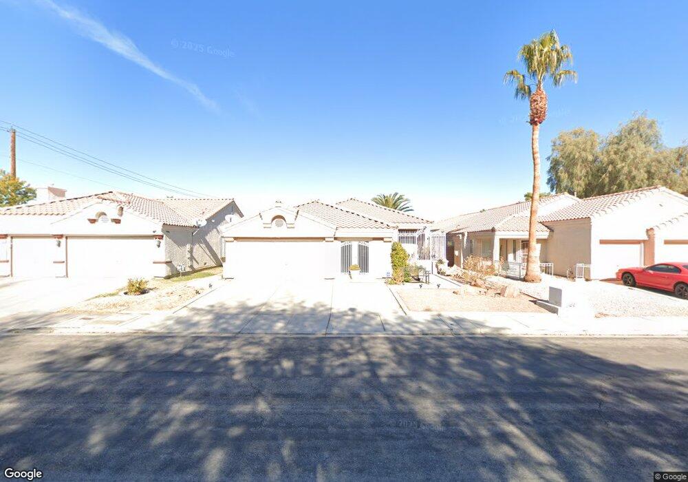
1450 Broad Arrow Dr Unit 1 North Las Vegas, NV 89032
Cheyenne NeighborhoodEstimated Value: $391,932 - $417,000
3
Beds
2
Baths
1,962
Sq Ft
$205/Sq Ft
Est. Value
About This Home
This home is located at 1450 Broad Arrow Dr Unit 1, North Las Vegas, NV 89032 and is currently estimated at $401,983, approximately $204 per square foot. 1450 Broad Arrow Dr Unit 1 is a home located in Clark County with nearby schools including Dr. Claude G Perkins Elementary School, Elizabeth Wilhelm Elementary School, and Marvin M Sedway Middle School.
Ownership History
Date
Name
Owned For
Owner Type
Purchase Details
Closed on
Jun 28, 2011
Sold by
Jannah Llc
Bought by
Burger John and Burger Janet L
Current Estimated Value
Purchase Details
Closed on
Jun 16, 2011
Sold by
Bryant Charles
Bought by
Jannah Llc
Purchase Details
Closed on
May 2, 1996
Sold by
S B A Development Inc
Bought by
Bryant Charles
Home Financials for this Owner
Home Financials are based on the most recent Mortgage that was taken out on this home.
Original Mortgage
$117,792
Interest Rate
8.07%
Mortgage Type
FHA
Create a Home Valuation Report for This Property
The Home Valuation Report is an in-depth analysis detailing your home's value as well as a comparison with similar homes in the area
Home Values in the Area
Average Home Value in this Area
Purchase History
| Date | Buyer | Sale Price | Title Company |
|---|---|---|---|
| Burger John | $105,000 | Nevada Title Las Vegas | |
| Jannah Llc | $76,500 | None Available | |
| Bryant Charles | $120,000 | Old Republic Title Company |
Source: Public Records
Mortgage History
| Date | Status | Borrower | Loan Amount |
|---|---|---|---|
| Previous Owner | Bryant Charles | $117,792 |
Source: Public Records
Tax History Compared to Growth
Tax History
| Year | Tax Paid | Tax Assessment Tax Assessment Total Assessment is a certain percentage of the fair market value that is determined by local assessors to be the total taxable value of land and additions on the property. | Land | Improvement |
|---|---|---|---|---|
| 2025 | $1,426 | $86,945 | $27,300 | $59,645 |
| 2024 | $1,385 | $86,945 | $27,300 | $59,645 |
| 2023 | $1,385 | $85,601 | $28,700 | $56,901 |
| 2022 | $1,345 | $75,366 | $23,100 | $52,266 |
| 2021 | $1,207 | $71,584 | $21,700 | $49,884 |
| 2020 | $1,168 | $70,250 | $20,650 | $49,600 |
| 2019 | $1,228 | $65,401 | $16,450 | $48,951 |
| 2018 | $1,192 | $61,045 | $14,000 | $47,045 |
| 2017 | $2,011 | $59,956 | $12,250 | $47,706 |
| 2016 | $1,130 | $48,441 | $9,100 | $39,341 |
| 2015 | $1,126 | $38,315 | $7,000 | $31,315 |
| 2014 | $1,093 | $32,009 | $5,250 | $26,759 |
Source: Public Records
Map
Nearby Homes
- 1608 Knoll Heights Ct
- 3317 Spinet Dr
- 3644 Quail Creek Dr
- 1822 Trigger Way
- 3228 Trinitero St
- 0 June Unit 2706697
- 0 June Unit 2692591
- 0 Tamerind St Unit 2685915
- 0 0 Cheyenne & Englestad Unit 1536141
- 0 0 Englestad Cheyenne Unit 1635643
- 1854 Oak Bluffs Ave
- 3743 Nairobi Ln
- 3839 Dusty Glen Ct
- 728 Twilight Blue Ave
- 0 Revere St
- 0 W Brooks Ave
- 3355 Clayton St
- 3804 Debussy Way
- 01 Brooks St
- 00 Ward
- 1440 Broad Arrow Dr
- 1460 Broad Arrow Dr
- 1430 Broad Arrow Dr
- 1417 Basin Brook Dr
- 1413 Basin Brook Dr
- 3431 Skinner Cir
- 1420 Broad Arrow Dr
- 1422 Basin Brook Dr
- 1405 Basin Brook Dr
- 3421 Skinner Cir
- 1410 Broad Arrow Dr
- 1401 Basin Brook Dr
- 3436 Beca Faith Dr
- 3432 Beca Faith Dr
- 3440 Beca Faith Dr
- 3428 Beca Faith Dr
- 1411 Broad Arrow Dr
- 3420 Skinner Cir
- 3444 Beca Faith Dr
- 1418 Basin Brook Dr
