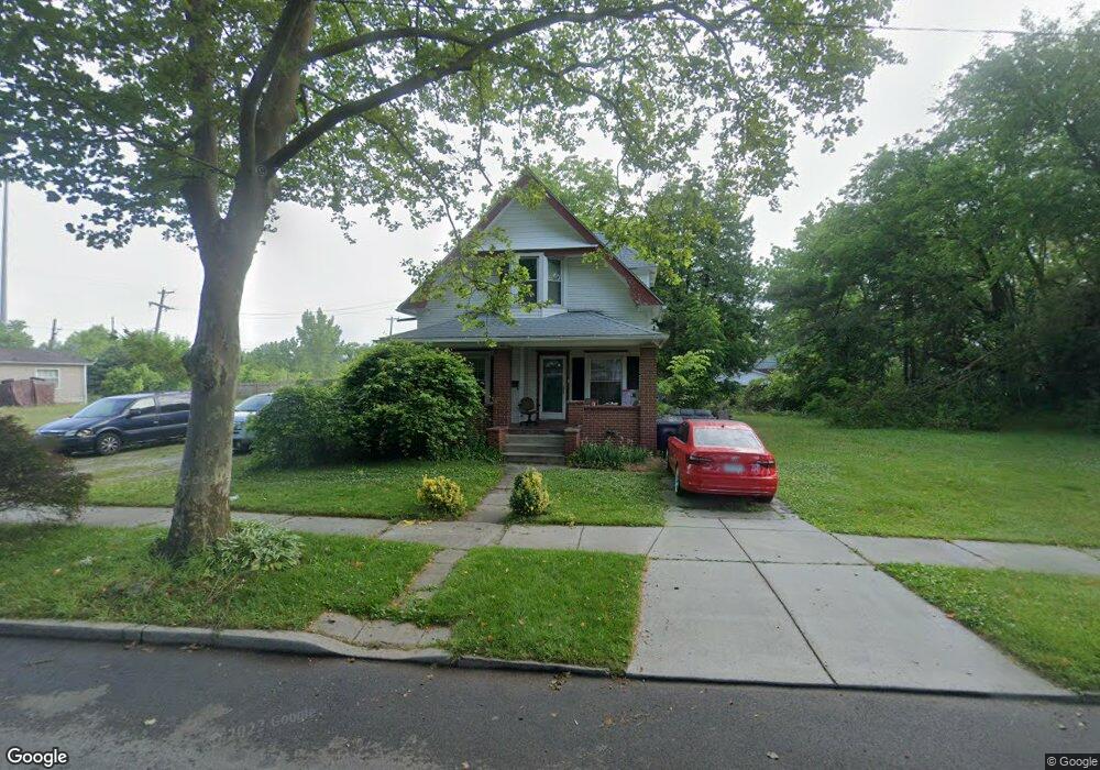
1450 Foster Ave Toledo, OH 43606
Roosevelt NeighborhoodEstimated Value: $69,000 - $84,000
3
Beds
1
Bath
1,280
Sq Ft
$58/Sq Ft
Est. Value
About This Home
This home is located at 1450 Foster Ave, Toledo, OH 43606 and is currently estimated at $74,116, approximately $57 per square foot. 1450 Foster Ave is a home located in Lucas County with nearby schools including Jesup W. Scott High School, Explorers Academy, and GESU Catholic School.
Ownership History
Date
Name
Owned For
Owner Type
Purchase Details
Closed on
Mar 8, 2022
Sold by
Jean Butts Wanda
Bought by
Auzenne Michaun A
Current Estimated Value
Purchase Details
Closed on
Jul 15, 2013
Sold by
Lucas County Land Reutilization Corp
Bought by
Butts Wanda Jena
Purchase Details
Closed on
Aug 5, 1999
Sold by
Butts John Joshua
Bought by
Butts Wanda Jean
Purchase Details
Closed on
Aug 14, 1998
Sold by
Butts John and Butts Florence T
Bought by
Butts Wanda Jean and Butts John Joshua
Purchase Details
Closed on
Jan 27, 1989
Sold by
Campbell Mary T
Create a Home Valuation Report for This Property
The Home Valuation Report is an in-depth analysis detailing your home's value as well as a comparison with similar homes in the area
Home Values in the Area
Average Home Value in this Area
Purchase History
| Date | Buyer | Sale Price | Title Company |
|---|---|---|---|
| Auzenne Michaun A | $300 | None Listed On Document | |
| Butts Wanda Jena | -- | None Available | |
| Butts Wanda Jean | -- | -- | |
| Butts Wanda Jean | -- | -- | |
| Butts Wanda Jean | -- | -- | |
| -- | $12,000 | -- |
Source: Public Records
Tax History Compared to Growth
Tax History
| Year | Tax Paid | Tax Assessment Tax Assessment Total Assessment is a certain percentage of the fair market value that is determined by local assessors to be the total taxable value of land and additions on the property. | Land | Improvement |
|---|---|---|---|---|
| 2024 | $744 | $17,745 | $3,745 | $14,000 |
| 2023 | $1,215 | $12,705 | $3,395 | $9,310 |
| 2022 | $1,220 | $12,705 | $3,395 | $9,310 |
| 2021 | $1,205 | $12,705 | $3,395 | $9,310 |
| 2020 | $1,165 | $10,500 | $2,800 | $7,700 |
| 2019 | $2,333 | $10,500 | $2,800 | $7,700 |
| 2018 | $2,277 | $10,500 | $2,800 | $7,700 |
| 2017 | $2,285 | $9,100 | $1,750 | $7,350 |
| 2016 | $2,267 | $26,000 | $5,000 | $21,000 |
| 2015 | $2,248 | $26,000 | $5,000 | $21,000 |
| 2014 | $340 | $5,400 | $1,510 | $3,890 |
| 2013 | $340 | $5,400 | $1,510 | $3,890 |
Source: Public Records
Map
Nearby Homes
- 1510 Lincoln Ave
- 1627 Fernwood Ave
- 1222 Lincoln Ave
- 1264 Fernwood Ave
- 2026 Clinton St
- 2144 Hawthorne St
- 1812 Joffre Ave
- 1157 W Woodruff Ave
- 1308 Grand Ave
- 1819 Oakwood Ave
- 2242 Auburn Ave
- 1428 Freeman St
- 2114 Parkdale Ave
- 1081 W Woodruff Ave
- 1511 Upton Ave
- 1068 Prospect Ave
- 1078 W Woodruff Ave
- 1929 Foster Ave
- 1907 Fernwood Ave
- 1557 Indiana Ave
- 1446 Foster Ave
- 1442 Foster Ave
- 1506 Foster Ave
- 1440 Foster Ave
- 1434 Foster Ave
- 1924 Smead Ave
- 1447 Prospect Ave
- 1518 Foster Ave
- 1443 Prospect Ave
- 1441 Prospect Ave
- 1432 Foster Ave
- 1439 Prospect Ave
- 1449 Foster Ave
- 1447 Foster Ave
- 1503 Foster Ave
- 1443 Foster Ave
- 1511 Foster Ave
- 1437 Prospect Ave
- 1507 Foster Ave
- 1426 Foster Ave