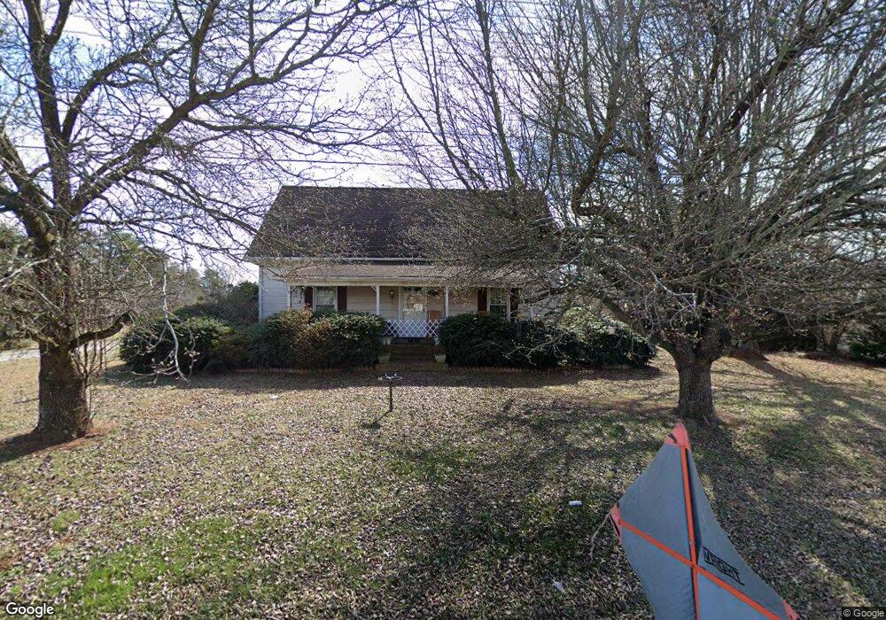
1450 N Main St Kernersville, NC 27284
Northwest Kernersville NeighborhoodEstimated Value: $240,000 - $250,000
6
Beds
2
Baths
3,092
Sq Ft
$79/Sq Ft
Est. Value
About This Home
This home is located at 1450 N Main St, Kernersville, NC 27284 and is currently estimated at $244,315, approximately $79 per square foot. 1450 N Main St is a home located in Forsyth County with nearby schools including Piney Grove Elementary, Kernersville Middle, and East Forsyth High School.
Ownership History
Date
Name
Owned For
Owner Type
Purchase Details
Closed on
Aug 31, 2000
Sold by
Flinchum John H and Flinchum Linnie C
Bought by
Lawson James R and Hoss Sherry M
Current Estimated Value
Home Financials for this Owner
Home Financials are based on the most recent Mortgage that was taken out on this home.
Original Mortgage
$103,937
Outstanding Balance
$37,739
Interest Rate
8.24%
Mortgage Type
FHA
Estimated Equity
$206,576
Create a Home Valuation Report for This Property
The Home Valuation Report is an in-depth analysis detailing your home's value as well as a comparison with similar homes in the area
Home Values in the Area
Average Home Value in this Area
Purchase History
| Date | Buyer | Sale Price | Title Company |
|---|---|---|---|
| Lawson James R | $104,000 | -- |
Source: Public Records
Mortgage History
| Date | Status | Borrower | Loan Amount |
|---|---|---|---|
| Open | Lawson James R | $103,937 |
Source: Public Records
Tax History Compared to Growth
Tax History
| Year | Tax Paid | Tax Assessment Tax Assessment Total Assessment is a certain percentage of the fair market value that is determined by local assessors to be the total taxable value of land and additions on the property. | Land | Improvement |
|---|---|---|---|---|
| 2025 | $1,039 | $241,400 | $52,500 | $188,900 |
| 2024 | $1,039 | $126,400 | $32,000 | $94,400 |
| 2023 | $1,039 | $126,400 | $32,000 | $94,400 |
| 2022 | $1,039 | $126,400 | $32,000 | $94,400 |
| 2021 | $1,039 | $126,400 | $32,000 | $94,400 |
| 2020 | $1,008 | $113,200 | $26,500 | $86,700 |
| 2019 | $1,020 | $113,200 | $26,500 | $86,700 |
| 2018 | $982 | $113,200 | $26,500 | $86,700 |
| 2016 | $976 | $113,442 | $25,500 | $87,942 |
| 2015 | $976 | $113,442 | $25,500 | $87,942 |
| 2014 | $943 | $113,442 | $25,500 | $87,942 |
Source: Public Records
Map
Nearby Homes
- 1456 N Main St
- 1375 Ouray Dr
- 1392 Ouray Dr
- 5090 Southern Pines Dr
- 1353 Ouray Dr
- 4608 Eden Bridge Dr
- 1466 Gunnison Ct
- 1465 Gunnison Ct
- Holden 2 Plan at Trail Ridge
- Redbud Plan at Trail Ridge
- Bellwood Plan at Trail Ridge
- Southport Plan at Trail Ridge
- Hamilton Plan at Trail Ridge
- Jackson Plan at Trail Ridge
- 2805 Bobby Ln
- 1618 Lazy Fox Ln Unit 5
- 9131 County Line Rd
- 9127 County Line Rd
- 1096 Hollow Creek Ln Unit 16
- 4270 Bridgehead Rd
- 1445 N Main St
- 8796 Drummond Estates Dr
- 2231 Bethel Church Rd
- 2225 Bethel Church Rd
- Track 3 N Main St
- 8790 Drummond Estates Dr
- 8783 Drummond Estates Dr
- 2237 Bethel Church Rd
- 8784 Drummond Estates Dr
- 2249 Bethel Church Rd
- 2243 Bethel Church Rd
- 1475 N Main St
- 2041 Proximity Ct
- 8778 Drummond Estates Dr
- 8777 Drummond Estates Dr
- 2047 Proximity Ct
- 8772 Drummond Estates Dr
- 2035 Proximity Ct
- 1308 Forsyth Rd
- 2269 Bethel Church Rd