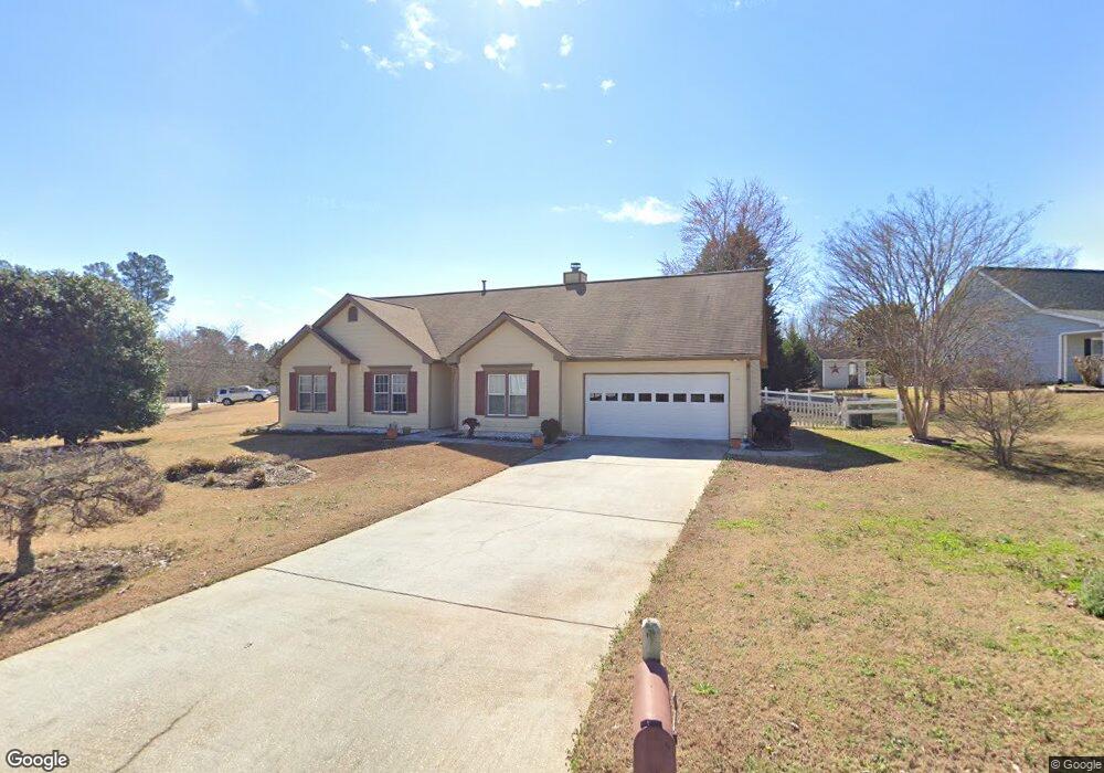
1450 Shamrock Hill Cir Unit 1 Loganville, GA 30052
Estimated Value: $329,000 - $331,000
3
Beds
2
Baths
1,793
Sq Ft
$184/Sq Ft
Est. Value
About This Home
This home is located at 1450 Shamrock Hill Cir Unit 1, Loganville, GA 30052 and is currently estimated at $329,823, approximately $183 per square foot. 1450 Shamrock Hill Cir Unit 1 is a home located in Gwinnett County with nearby schools including Magill Elementary School, Grace Snell Middle School, and South Gwinnett High School.
Ownership History
Date
Name
Owned For
Owner Type
Purchase Details
Closed on
Jun 27, 2003
Sold by
White John M
Bought by
Muxart Andrea R
Current Estimated Value
Home Financials for this Owner
Home Financials are based on the most recent Mortgage that was taken out on this home.
Original Mortgage
$30,000
Outstanding Balance
$12,448
Interest Rate
5.17%
Mortgage Type
New Conventional
Estimated Equity
$317,375
Purchase Details
Closed on
Apr 28, 1995
Sold by
Precision Craft Homes
Bought by
White John C
Create a Home Valuation Report for This Property
The Home Valuation Report is an in-depth analysis detailing your home's value as well as a comparison with similar homes in the area
Home Values in the Area
Average Home Value in this Area
Purchase History
| Date | Buyer | Sale Price | Title Company |
|---|---|---|---|
| Muxart Andrea R | $129,100 | -- | |
| White John C | $112,000 | -- |
Source: Public Records
Mortgage History
| Date | Status | Borrower | Loan Amount |
|---|---|---|---|
| Open | Muxart Andrea R | $30,000 | |
| Closed | White John C | $0 |
Source: Public Records
Tax History Compared to Growth
Tax History
| Year | Tax Paid | Tax Assessment Tax Assessment Total Assessment is a certain percentage of the fair market value that is determined by local assessors to be the total taxable value of land and additions on the property. | Land | Improvement |
|---|---|---|---|---|
| 2025 | $943 | $122,200 | $30,000 | $92,200 |
| 2024 | $940 | $115,800 | $30,000 | $85,800 |
| 2023 | $940 | $110,080 | $29,680 | $80,400 |
| 2022 | $901 | $110,000 | $19,200 | $90,800 |
| 2021 | $882 | $72,960 | $12,000 | $60,960 |
| 2020 | $880 | $72,960 | $12,000 | $60,960 |
| 2019 | $819 | $71,080 | $11,200 | $59,880 |
| 2018 | $801 | $66,640 | $8,000 | $58,640 |
| 2016 | $842 | $54,400 | $7,200 | $47,200 |
| 2015 | $832 | $44,400 | $7,200 | $37,200 |
| 2014 | -- | $51,080 | $7,200 | $43,880 |
Source: Public Records
Map
Nearby Homes
- 1245 Shamrock Hill Cir Unit 1
- The Auburn Plan at
- The Jefferson Plan at
- The Montrose Plan at
- The Edison Plan at
- The Pearson Plan at
- The Tifton Plan at
- The Weston Plan at
- The Wesley Plan at
- The Denton Plan at
- 910 Burning Bush Dr
- 900 Burning Bush Dr Unit 2
- 3315 Linstead Ct
- 3315 Linstead Ct Unit 2A
- 3792 Tielman St
- 3769 Tielman St
- 996 Lakeview Oaks Ct Unit 25-B
- 996 Lakeview Oaks Ct
- 1210 Burning Bush Dr
- 3819 Tielman St
- 1430 Shamrock Hill Cir Unit 1
- 1470 Shamrock Hill Cir
- 3560 Thrush Ct Unit 1
- 1420 Shamrock Hill Cir
- 1455 Shamrock Hill Cir
- 1200 Shamrock Hill Cir Unit 1
- 3500 Patrick Manor Dr
- 3500 Patrick Manor Dr
- 1435 Shamrock Hill Cir Unit 1
- 1445 Shamrock Hill Cir Unit 1
- 1425 Shamrock Hill Cir
- 3550 Thrush Ct
- 1410 Shamrock Hill Cir
- 1415 Shamrock Hill Cir
- 1220 Shamrock Hill Cir Unit 1
- 1205 Shamrock Hill Cir
- 3570 Thrush Ct
- 1230 Shamrock Hill Cir
- 3565 Thrush Ct
- 1405 Shamrock Hill Cir