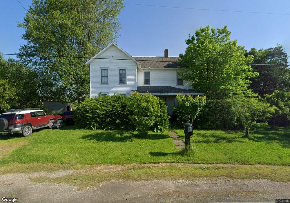
1450 State Route 523 Fremont, OH 43420
Estimated Value: $167,000 - $262,000
4
Beds
1
Bath
1,844
Sq Ft
$108/Sq Ft
Est. Value
About This Home
This home is located at 1450 State Route 523, Fremont, OH 43420 and is currently estimated at $199,425, approximately $108 per square foot. 1450 State Route 523 is a home located in Sandusky County with nearby schools including Fremont Ross High School.
Ownership History
Date
Name
Owned For
Owner Type
Purchase Details
Closed on
Oct 22, 2009
Sold by
Wilhelm Marcella Darr and Will Of Lucille G Darr
Bought by
Rimelspach John P
Current Estimated Value
Home Financials for this Owner
Home Financials are based on the most recent Mortgage that was taken out on this home.
Original Mortgage
$54,800
Outstanding Balance
$35,820
Interest Rate
5.1%
Mortgage Type
New Conventional
Estimated Equity
$163,605
Purchase Details
Closed on
Jun 27, 2003
Sold by
Lehmann Margaret M
Bought by
Lehmann Richard M
Create a Home Valuation Report for This Property
The Home Valuation Report is an in-depth analysis detailing your home's value as well as a comparison with similar homes in the area
Home Values in the Area
Average Home Value in this Area
Purchase History
| Date | Buyer | Sale Price | Title Company |
|---|---|---|---|
| Rimelspach John P | $68,500 | First Am Title | |
| Lehmann Richard M | $2,250 | -- |
Source: Public Records
Mortgage History
| Date | Status | Borrower | Loan Amount |
|---|---|---|---|
| Open | Rimelspach John P | $54,800 |
Source: Public Records
Tax History Compared to Growth
Tax History
| Year | Tax Paid | Tax Assessment Tax Assessment Total Assessment is a certain percentage of the fair market value that is determined by local assessors to be the total taxable value of land and additions on the property. | Land | Improvement |
|---|---|---|---|---|
| 2024 | $1,563 | $39,840 | $8,370 | $31,470 |
| 2023 | $1,563 | $36,200 | $7,600 | $28,600 |
| 2022 | $1,504 | $36,200 | $7,600 | $28,600 |
| 2021 | $1,550 | $36,200 | $7,600 | $28,600 |
| 2020 | $1,356 | $31,160 | $7,600 | $23,560 |
| 2019 | $1,313 | $31,160 | $7,600 | $23,560 |
| 2018 | $1,315 | $31,160 | $7,600 | $23,560 |
| 2017 | $1,228 | $29,020 | $7,600 | $21,420 |
| 2016 | $1,083 | $29,020 | $7,600 | $21,420 |
| 2015 | $1,066 | $29,020 | $7,600 | $21,420 |
| 2014 | $1,112 | $28,770 | $7,560 | $21,210 |
| 2013 | $1,088 | $28,770 | $7,560 | $21,210 |
Source: Public Records
Map
Nearby Homes
- 1301 Ohio 523 Unit 55
- 1301 Ohio 523 Unit 39
- 1301 Ohio 523 Unit 15
- 2939 County Road 206
- 3285 County Road 170
- 0 County Road 210
- 7723 W Little Portage Rd E
- 5084 W Fremont Rd
- 2087 County Road 216
- 2301 S Mud Creek Rd
- 2020 S Mud Creek Rd
- 10148 W Elmore Eastern Rd
- 2424 Stephanie Ln
- 10591 W Elmore Eastern Rd
- 1276 S Grandview Dr
- 9238 W State Route 163
- 141 N Wexford Dr E
- 295 Meachem Rd
- 265 S Meachem Rd
- 265 S Meachem Rd Unit 62
- 1495 State Route 523
- 1405 State Route 523
- 1405 State Route 523
- 1515 State Route 523
- 3621 County Road 184
- 1320 State Route 523
- 3721 County Road 184
- 4856 Ohio 53
- 1301 Ohio 523 Unit 31
- 1301 Ohio 523 Unit 50
- 1301 Ohio 523 Unit 16
- 1301 Ohio 523 Unit 29
- 1301 Ohio 523 Unit 41
- 1981 County Road 145
- 5046 Ohio 53
- 5046 N State Route 53
- 3615 County Road 182
- 3635 County Road 182
- 3555 County Road 182
- 3497 County Road 182