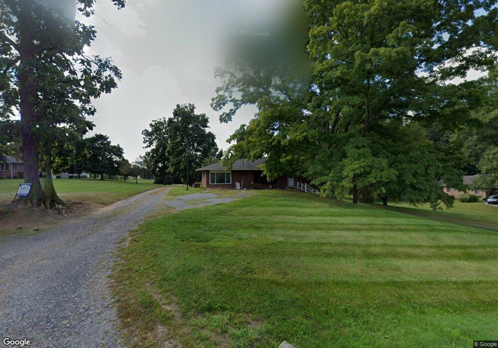
14501 Arnold Rd Dalton, OH 44618
Estimated Value: $321,000
3
Beds
2
Baths
1,428
Sq Ft
$225/Sq Ft
Est. Value
About This Home
This home is located at 14501 Arnold Rd, Dalton, OH 44618 and is currently estimated at $321,000, approximately $224 per square foot. 14501 Arnold Rd is a home located in Wayne County with nearby schools including Dalton Elementary School, Dalton Middle School, and Dalton High School.
Ownership History
Date
Name
Owned For
Owner Type
Purchase Details
Closed on
Jan 20, 2022
Sold by
Mast Ida
Bought by
Mast Branden S and Mast Amy S
Current Estimated Value
Home Financials for this Owner
Home Financials are based on the most recent Mortgage that was taken out on this home.
Original Mortgage
$325,794
Outstanding Balance
$298,257
Interest Rate
3.22%
Mortgage Type
New Conventional
Estimated Equity
$22,743
Purchase Details
Closed on
Mar 18, 2005
Sold by
Yoder Ruby and Yoder Joseph
Bought by
Mast Larry
Home Financials for this Owner
Home Financials are based on the most recent Mortgage that was taken out on this home.
Original Mortgage
$100,000
Interest Rate
5.64%
Mortgage Type
Purchase Money Mortgage
Purchase Details
Closed on
Dec 29, 2004
Sold by
Estate Of Martha M Mast
Bought by
Yoder Ruby and Mast Larry
Create a Home Valuation Report for This Property
The Home Valuation Report is an in-depth analysis detailing your home's value as well as a comparison with similar homes in the area
Purchase History
| Date | Buyer | Sale Price | Title Company |
|---|---|---|---|
| Mast Branden S | -- | New Title Company Name | |
| Mast Larry | $100,000 | -- | |
| Yoder Ruby | -- | -- |
Source: Public Records
Mortgage History
| Date | Status | Borrower | Loan Amount |
|---|---|---|---|
| Open | Mast Branden S | $325,794 | |
| Previous Owner | Mast Larry | $100,000 |
Source: Public Records
Tax History
| Year | Tax Paid | Tax Assessment Tax Assessment Total Assessment is a certain percentage of the fair market value that is determined by local assessors to be the total taxable value of land and additions on the property. | Land | Improvement |
|---|---|---|---|---|
| 2024 | $2,162 | $103,330 | $67,510 | $35,820 |
| 2023 | $2,182 | $103,330 | $67,510 | $35,820 |
| 2022 | $8,663 | $103,320 | $67,500 | $35,820 |
| 2021 | $2,216 | $53,080 | $17,260 | $35,820 |
| 2020 | $2,247 | $53,080 | $17,260 | $35,820 |
| 2019 | $1,869 | $45,540 | $15,190 | $30,350 |
| 2018 | $1,880 | $45,540 | $15,190 | $30,350 |
| 2017 | $1,743 | $45,540 | $15,190 | $30,350 |
| 2016 | $1,663 | $41,400 | $13,810 | $27,590 |
| 2015 | $1,630 | $41,400 | $13,810 | $27,590 |
| 2014 | $1,639 | $41,400 | $13,810 | $27,590 |
| 2013 | $1,664 | $41,040 | $13,180 | $27,860 |
Source: Public Records
Map
Nearby Homes
- 61 Hillside Dr
- 209 Greenbriar Ln
- 535 W Schultz Ave
- 233 Tanglewood Dr
- 223 Tanglewood Dr
- 120 N Church St
- 737 S Kohler Rd
- 71 S Kohler Rd
- 206 E Main St
- 0 Dalton Fox Lake Rd
- 110 S Kansas Rd
- 10736 Lautenschlager Rd
- 704 Homestead Pointe Dr
- 851 Cleveland Ave
- 16780 Burkhart Rd
- 122 W Paradise St
- 410 W Oak St
- 4860 SW Lebanon Rd
- 409 W Church St
- 822 W Market St
- 14447 Arnold Rd
- 14565 Arnold Rd
- 14315 Arnold Rd
- 14505 Arnold Rd
- 14100 Arnold Rd
- 14997 Arnold Rd
- 14995 Arnold Rd
- 14848 Arnold Rd
- 13922 Arnold Rd
- 13904 Arnold Rd
- 13950 Arnold Rd
- 647 Kurzen Rd S
- 14978 Arnold Rd
- 13894 Arnold Rd
- 15055 Arnold Rd
- 15014 Arnold Rd
- 2121 Zuercher Rd
- 15102 Arnold Rd
- 13750 Arnold Rd
- 15083 Arnold Rd
Your Personal Tour Guide
Ask me questions while you tour the home.