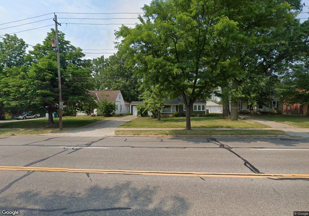
14501 Rockside Rd Maple Heights, OH 44137
Estimated Value: $114,000 - $135,000
3
Beds
1
Bath
1,032
Sq Ft
$124/Sq Ft
Est. Value
About This Home
This home is located at 14501 Rockside Rd, Maple Heights, OH 44137 and is currently estimated at $128,124, approximately $124 per square foot. 14501 Rockside Rd is a home located in Cuyahoga County with nearby schools including Abraham Lincoln Elementary School, Rockside/ J.F. Kennedy School, and Barack Obama School.
Ownership History
Date
Name
Owned For
Owner Type
Purchase Details
Closed on
Mar 30, 1983
Bought by
Lewis Bella
Current Estimated Value
Purchase Details
Closed on
Jan 1, 1975
Bought by
Bella Lewis & Margaret
Create a Home Valuation Report for This Property
The Home Valuation Report is an in-depth analysis detailing your home's value as well as a comparison with similar homes in the area
Home Values in the Area
Average Home Value in this Area
Purchase History
| Date | Buyer | Sale Price | Title Company |
|---|---|---|---|
| Lewis Bella | -- | -- | |
| Bella Lewis & Margaret | -- | -- |
Source: Public Records
Tax History
| Year | Tax Paid | Tax Assessment Tax Assessment Total Assessment is a certain percentage of the fair market value that is determined by local assessors to be the total taxable value of land and additions on the property. | Land | Improvement |
|---|---|---|---|---|
| 2025 | $3,414 | $40,460 | $10,045 | $30,415 |
| 2024 | $3,789 | $40,460 | $10,045 | $30,415 |
| 2023 | $2,106 | $17,720 | $8,370 | $9,350 |
| 2022 | $2,099 | $17,710 | $8,370 | $9,350 |
| 2021 | $2,228 | $17,710 | $8,370 | $9,350 |
| 2020 | $1,926 | $13,410 | $6,340 | $7,070 |
| 2019 | $1,794 | $38,300 | $18,100 | $20,200 |
| 2018 | $1,898 | $13,410 | $6,340 | $7,070 |
| 2017 | $2,237 | $16,170 | $5,180 | $10,990 |
| 2016 | $2,045 | $16,170 | $5,180 | $10,990 |
| 2015 | $1,046 | $16,170 | $5,180 | $10,990 |
| 2014 | $1,046 | $16,670 | $5,360 | $11,310 |
Source: Public Records
Map
Nearby Homes
- 14808 James Ave
- 14214 Tabor Ave
- 14012 Wheeler Rd
- 14203 Tabor Ave
- 14320 Janice Dr
- 5853 Monica Ln
- 13804 Rockside Rd
- 14413 Krems Ave
- 14112 Krems Ave
- 13905 Thraves Ave
- 5948 Dunham Rd
- 13800 Milo Rd
- 13810 Martin Dr
- 15313 Fernway Dr
- 15800 Northwood Ave
- 6039 E 135th St
- 13741 Grove Dr
- 15817 Northwood Ave
- 6045 Dunham Rd
- 14956 Carol Dr
- 14409 Rockside Rd
- 14513 Rockside Rd
- 14405 Rockside Rd
- 14519 Rockside Rd
- 5744 E 146th St
- 14313 Rockside Rd
- 14551 Rockside Rd
- 5740 E 146th St
- 14508 Rockside Rd
- 14450 Rockside Rd
- 14512 Rockside Rd
- 14412 Rockside Rd
- 14408 Rockside Rd
- 14601 Rockside Rd
- 14516 Rockside Rd
- 5749 E 146th St
- 5736 E 146th St
- 14404 Rockside Rd
- 14309 Rockside Rd
- 14360 Rockside Rd
Your Personal Tour Guide
Ask me questions while you tour the home.