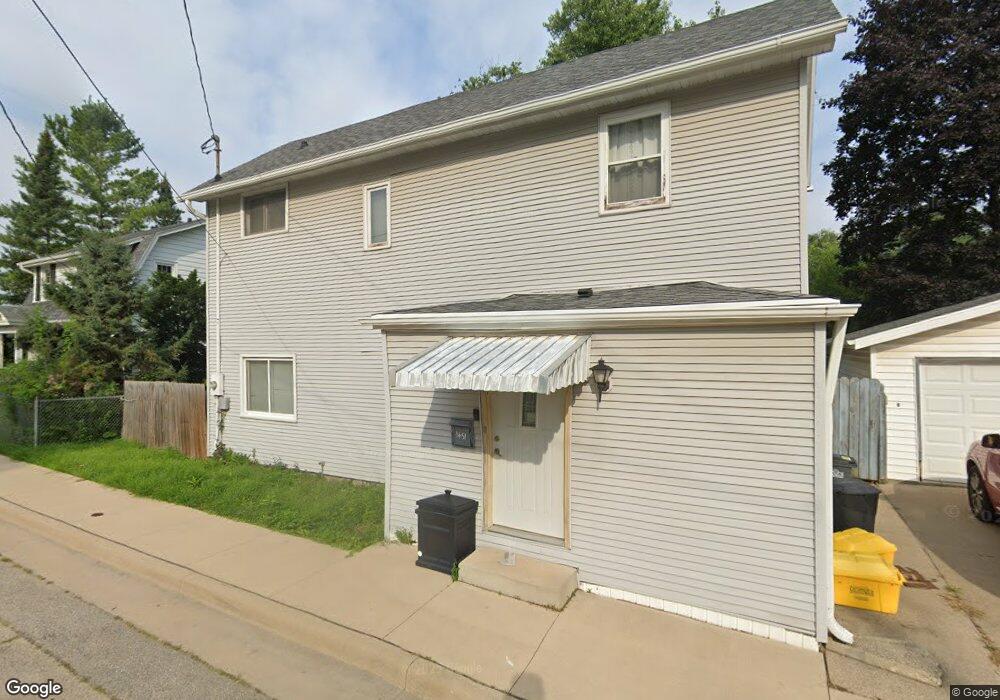
1451 McPoland Ave Dubuque, IA 52001
Estimated Value: $185,000 - $220,000
4
Beds
2
Baths
1,392
Sq Ft
$148/Sq Ft
Est. Value
About This Home
This home is located at 1451 McPoland Ave, Dubuque, IA 52001 and is currently estimated at $206,010, approximately $147 per square foot. 1451 McPoland Ave is a home located in Dubuque County with nearby schools including Irving Elementary School, George Washington Middle School, and Dubuque Senior High School.
Ownership History
Date
Name
Owned For
Owner Type
Purchase Details
Closed on
Sep 30, 2021
Sold by
Sweeney Nicholas J
Bought by
Birch Kylie M
Current Estimated Value
Home Financials for this Owner
Home Financials are based on the most recent Mortgage that was taken out on this home.
Original Mortgage
$142,200
Outstanding Balance
$130,900
Interest Rate
3.62%
Mortgage Type
New Conventional
Estimated Equity
$75,110
Create a Home Valuation Report for This Property
The Home Valuation Report is an in-depth analysis detailing your home's value as well as a comparison with similar homes in the area
Purchase History
| Date | Buyer | Sale Price | Title Company |
|---|---|---|---|
| Birch Kylie M | $158,000 | None Available |
Source: Public Records
Mortgage History
| Date | Status | Borrower | Loan Amount |
|---|---|---|---|
| Open | Birch Kylie M | $142,200 |
Source: Public Records
Tax History
| Year | Tax Paid | Tax Assessment Tax Assessment Total Assessment is a certain percentage of the fair market value that is determined by local assessors to be the total taxable value of land and additions on the property. | Land | Improvement |
|---|---|---|---|---|
| 2025 | $2,402 | $197,500 | $36,400 | $161,100 |
| 2024 | $2,402 | $177,300 | $34,500 | $142,800 |
| 2023 | $2,330 | $177,300 | $34,500 | $142,800 |
| 2022 | $2,218 | $134,160 | $32,720 | $101,440 |
| 2021 | $2,218 | $134,160 | $32,720 | $101,440 |
| 2020 | $2,184 | $122,850 | $30,910 | $91,940 |
| 2019 | $2,084 | $122,850 | $30,910 | $91,940 |
| 2018 | $2,052 | $112,130 | $29,090 | $83,040 |
| 2017 | $1,980 | $112,130 | $29,090 | $83,040 |
| 2016 | $1,940 | $102,540 | $29,090 | $73,450 |
| 2015 | $1,940 | $102,540 | $29,090 | $73,450 |
| 2014 | $1,888 | $102,540 | $29,090 | $73,450 |
Source: Public Records
Map
Nearby Homes
- 1642 Drexel Ave
- 2637 Nebraska St
- 2750 Pennsylvania Ave
- 2935 Van Buren St
- 1765 Eden Ln
- 1780 Horizon Ct
- 1930 Saint Anne Ct
- 1921 Avalon Rd
- 3063 Brunskill Rd
- 2035 Broadlawn Rd
- 2155 Decorah St
- 105 Cherokee Dr
- 2844 Oak Meadow Ct
- 2628 University Ave
- 2192 Fairway Dr
- 2160 Avalon Rd
- 2163 Lombard St
- 1698 N Algona St
- 124 Cherokee Dr
- 1556 Auburn St
- 1471 McPoland Ave
- 1550 Fairfax Ave
- 1431 McPoland Ave
- 1450 McPoland Ave
- 1501 McPoland Ave
- 1501 Fairfax Ave
- 1490 McPoland Ave
- 1525 Fairfax Ave
- 2665 Van Buren Ave
- 1553 Fairfax Ave
- 1600 Marmora Ave
- 1505 McPoland Ave
- 1565 Fairfax Ave
- 1476 Hickson Ave
- 1612 Marmora Ave
- 1510 Hickson Ave
- 2755 Van Buren Ave
- 1520 McPoland Ave
- 2755 Van Buren St
- 1458 Hickson Ave
Your Personal Tour Guide
Ask me questions while you tour the home.