Estimated Value: $309,000 - $339,000
3
Beds
3
Baths
1,092
Sq Ft
$294/Sq Ft
Est. Value
About This Home
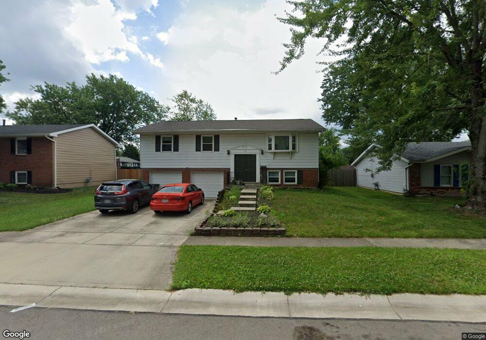
This home is located at 1451 Windsong Ct, Mason, OH 45040 and is currently estimated at $321,085, approximately $294 per square foot. 1451 Windsong Ct is a home located in Warren County with nearby schools including Mason Intermediate Elementary School, Mason Middle School, and William Mason High School.
Ownership History
Date
Name
Owned For
Owner Type
Purchase Details
Closed on
Jul 12, 2016
Sold by
Pnc Bank National Association
Bought by
Mason Home Rentals Llc
Current Estimated Value
Purchase Details
Closed on
May 10, 2016
Sold by
Miller William C
Bought by
Pnc Bank N and Pnc A
Home Financials for this Owner
Home Financials are based on the most recent Mortgage that was taken out on this home.
Interest Rate
3.61%
Purchase Details
Closed on
May 21, 1997
Sold by
Clarke Deborah A
Bought by
Miller William C and Miller Kimberly J
Home Financials for this Owner
Home Financials are based on the most recent Mortgage that was taken out on this home.
Original Mortgage
$111,180
Interest Rate
8.24%
Mortgage Type
VA
Purchase Details
Closed on
Apr 10, 1987
Sold by
Drummond Drummond and Drummond Keith A
Bought by
Johnson Johnson and Johnson Deborah Ann
Purchase Details
Closed on
May 4, 1981
Sold by
Gemberling Gemberling and Gemberling James M
Create a Home Valuation Report for This Property
The Home Valuation Report is an in-depth analysis detailing your home's value as well as a comparison with similar homes in the area
Home Values in the Area
Average Home Value in this Area
Purchase History
| Date | Buyer | Sale Price | Title Company |
|---|---|---|---|
| Mason Home Rentals Llc | $100,000 | Attorney | |
| Pnc Bank N | $111,000 | -- | |
| Miller William C | $109,000 | -- | |
| Johnson Johnson | $68,000 | -- | |
| -- | $58,500 | -- |
Source: Public Records
Mortgage History
| Date | Status | Borrower | Loan Amount |
|---|---|---|---|
| Previous Owner | Pnc Bank N | -- | |
| Previous Owner | Miller William C | $111,180 |
Source: Public Records
Tax History Compared to Growth
Tax History
| Year | Tax Paid | Tax Assessment Tax Assessment Total Assessment is a certain percentage of the fair market value that is determined by local assessors to be the total taxable value of land and additions on the property. | Land | Improvement |
|---|---|---|---|---|
| 2024 | $3,343 | $80,460 | $24,500 | $55,960 |
| 2023 | $2,968 | $60,378 | $10,762 | $49,616 |
| 2022 | $2,930 | $60,379 | $10,763 | $49,616 |
| 2021 | $2,775 | $60,379 | $10,763 | $49,616 |
| 2020 | $2,639 | $49,088 | $8,750 | $40,338 |
| 2019 | $2,432 | $49,088 | $8,750 | $40,338 |
| 2018 | $2,440 | $49,088 | $8,750 | $40,338 |
| 2017 | $2,250 | $42,252 | $8,274 | $33,978 |
| 2016 | $2,253 | $42,252 | $8,274 | $33,978 |
| 2015 | $1,129 | $42,252 | $8,274 | $33,978 |
| 2014 | $2,263 | $39,490 | $7,730 | $31,760 |
| 2013 | $2,268 | $44,700 | $8,750 | $35,950 |
Source: Public Records
Map
Nearby Homes
- 873 Tradewind Dr
- 921 Leslie Ct
- 947 Olympia Dr
- 7986 Tylers Way
- 6955 Grand Oaks Ct
- 7843 Butler Warren Rd
- 6070 Fireside Dr Unit 45
- 6356 Amber Ct Unit 91
- 8500 Crestmont Dr
- 8430 Meadowlark Ct
- 6138 Nicholas Way
- 6387 Coverage Ct
- 6369 Coverage Ct
- 6403 Coverage Ct
- 6357 Coverage Ct
- 6383 Coverage Ct
- 6407 Coverage Ct
- 6375 Coverage Ct
- 6365 Coverage Ct
- 6361 Coverage Ct
- 1443 Windsong Ct
- 1457 Windsong Ct
- 1444 Southwind Dr
- 1465 Windsong Ct
- 1404 Southwind Dr
- 1436 Southwind Dr
- 1450 Southwind Dr
- 1452 Windsong Ct
- 1458 Southwind Dr
- 1446 Windsong Ct
- 1424 Southwind Dr
- 1458 Windsong Ct
- 1438 Windsong Ct
- 1471 Windsong Ct
- 1466 Southwind Dr
- 1466 Windsong Ct
- 1432 Windsong Ct
- 1474 Southwind Dr
- 1431 Windsong Ct
- 1475 Windsong Ct