Estimated Value: $261,520 - $302,000
3
Beds
1
Bath
1,738
Sq Ft
$162/Sq Ft
Est. Value
About This Home
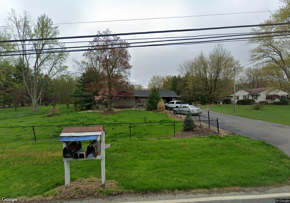
This home is located at 1452 Howe Rd, Kent, OH 44240 and is currently estimated at $281,130, approximately $161 per square foot. 1452 Howe Rd is a home located in Portage County with nearby schools including Brimfield Elementary School, Field Middle School, and Field High School.
Ownership History
Date
Name
Owned For
Owner Type
Purchase Details
Closed on
May 19, 2001
Sold by
Hagaman Brook W
Bought by
Hagaman Brook W and Sheets Catherine A
Current Estimated Value
Home Financials for this Owner
Home Financials are based on the most recent Mortgage that was taken out on this home.
Original Mortgage
$119,000
Outstanding Balance
$44,566
Interest Rate
7.07%
Estimated Equity
$236,564
Purchase Details
Closed on
May 23, 2000
Sold by
Timperman Mildred B
Bought by
Hagaman Brook W
Home Financials for this Owner
Home Financials are based on the most recent Mortgage that was taken out on this home.
Original Mortgage
$115,000
Interest Rate
8.18%
Purchase Details
Closed on
May 16, 2000
Sold by
Estate Of Robert G Timperman
Bought by
Timperman Mildred B
Home Financials for this Owner
Home Financials are based on the most recent Mortgage that was taken out on this home.
Original Mortgage
$115,000
Interest Rate
8.18%
Purchase Details
Closed on
Jan 1, 1990
Bought by
Timperman Robert G
Create a Home Valuation Report for This Property
The Home Valuation Report is an in-depth analysis detailing your home's value as well as a comparison with similar homes in the area
Home Values in the Area
Average Home Value in this Area
Purchase History
| Date | Buyer | Sale Price | Title Company |
|---|---|---|---|
| Hagaman Brook W | -- | Real Estate Title | |
| Hagaman Brook W | $145,000 | -- | |
| Timperman Mildred B | -- | -- | |
| Timperman Robert G | -- | -- |
Source: Public Records
Mortgage History
| Date | Status | Borrower | Loan Amount |
|---|---|---|---|
| Open | Hagaman Brook W | $119,000 | |
| Closed | Hagaman Brook W | $115,000 |
Source: Public Records
Tax History
| Year | Tax Paid | Tax Assessment Tax Assessment Total Assessment is a certain percentage of the fair market value that is determined by local assessors to be the total taxable value of land and additions on the property. | Land | Improvement |
|---|---|---|---|---|
| 2025 | $5,550 | $114,800 | $30,730 | $84,070 |
| 2024 | $5,459 | $114,800 | $30,730 | $84,070 |
| 2023 | $4,567 | $77,110 | $19,220 | $57,890 |
| 2022 | $4,580 | $77,110 | $19,220 | $57,890 |
| 2021 | $4,472 | $77,110 | $19,220 | $57,890 |
| 2020 | $4,019 | $62,410 | $19,220 | $43,190 |
| 2019 | $3,963 | $62,410 | $19,220 | $43,190 |
| 2018 | $3,094 | $57,060 | $19,220 | $37,840 |
| 2017 | $3,094 | $57,060 | $19,220 | $37,840 |
| 2016 | $3,069 | $57,060 | $19,220 | $37,840 |
| 2015 | $2,994 | $57,060 | $19,220 | $37,840 |
| 2014 | $2,899 | $57,060 | $19,220 | $37,840 |
| 2013 | $2,832 | $57,060 | $19,220 | $37,840 |
Source: Public Records
Map
Nearby Homes
- 4545 State Route 43
- 4360 Beal Dr
- 1676 Countryview Dr
- 1680 Countryview Dr
- 5088 Spruce Knoll Run
- 2477 Waterford Pointe Dr
- 0 Meloy Rd Unit 5162435
- 1233 Cedar Ridge Rd
- 5096 Spruce Knoll Run
- 2092 Sugar Maple Dr
- 1997 Sugar Maple Dr
- 4088 Lynwood Dr
- 410 Beryl Dr
- 1426 Loop Rd Unit 1426
- 5201 Cline Rd Unit A
- 722 Avondale St
- 4700 Gooseberry Knoll
- 3910 Willow Way
- 4620 Briar Hill Dr
- 1526 Franklin Ave
Your Personal Tour Guide
Ask me questions while you tour the home.