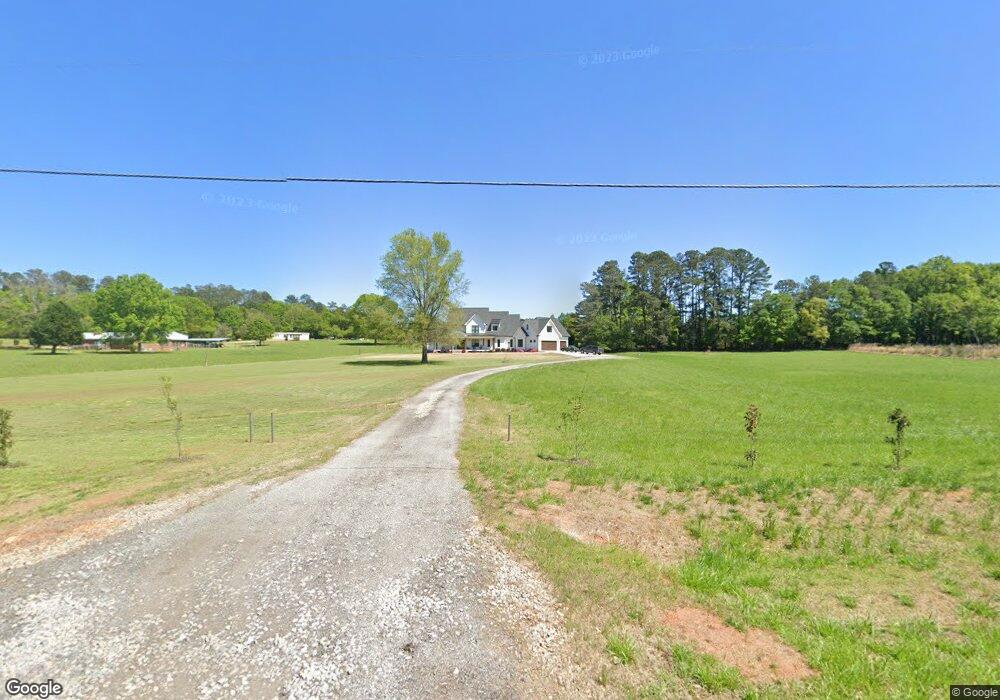
1452 Malcom Bridge Rd Bogart, GA 30622
Estimated Value: $706,000 - $976,139
--
Bed
--
Bath
3,162
Sq Ft
$266/Sq Ft
Est. Value
About This Home
This home is located at 1452 Malcom Bridge Rd, Bogart, GA 30622 and is currently estimated at $841,070, approximately $265 per square foot. 1452 Malcom Bridge Rd is a home with nearby schools including Rocky Branch Elementary School, Malcom Bridge Middle School, and North Oconee High School.
Ownership History
Date
Name
Owned For
Owner Type
Purchase Details
Closed on
Jan 19, 2023
Sold by
Rice Wesley
Bought by
Wesley And Melody Rice Living Trust
Current Estimated Value
Purchase Details
Closed on
Jul 20, 2017
Bought by
Rice Wesley and Rice Melody
Home Financials for this Owner
Home Financials are based on the most recent Mortgage that was taken out on this home.
Original Mortgage
$110,500
Interest Rate
3.9%
Mortgage Type
New Conventional
Create a Home Valuation Report for This Property
The Home Valuation Report is an in-depth analysis detailing your home's value as well as a comparison with similar homes in the area
Home Values in the Area
Average Home Value in this Area
Purchase History
| Date | Buyer | Sale Price | Title Company |
|---|---|---|---|
| Wesley And Melody Rice Living Trust | -- | -- | |
| Rice Wesley | $130,000 | -- |
Source: Public Records
Mortgage History
| Date | Status | Borrower | Loan Amount |
|---|---|---|---|
| Previous Owner | Rice Wesley | $110,500 |
Source: Public Records
Tax History Compared to Growth
Tax History
| Year | Tax Paid | Tax Assessment Tax Assessment Total Assessment is a certain percentage of the fair market value that is determined by local assessors to be the total taxable value of land and additions on the property. | Land | Improvement |
|---|---|---|---|---|
| 2024 | $6,116 | $329,305 | $88,786 | $240,519 |
| 2023 | $6,116 | $307,293 | $82,210 | $225,083 |
| 2022 | $5,546 | $260,507 | $65,769 | $194,738 |
| 2021 | $5,379 | $234,349 | $59,789 | $174,560 |
| 2020 | $4,977 | $216,674 | $54,354 | $162,320 |
| 2019 | $3,059 | $131,920 | $47,264 | $84,656 |
| 2018 | $1,018 | $42,967 | $42,967 | $0 |
| 2017 | $866 | $36,560 | $35,806 | $754 |
| 2016 | $789 | $33,306 | $32,552 | $754 |
| 2015 | $788 | $33,180 | $32,552 | $629 |
Source: Public Records
Map
Nearby Homes
- 2632 Morningside Way
- 1381 Mayfair Way
- 0 Us 53 Hwy Unit 10376334
- 1895 Vintage Place
- 1710 Whistling Creek
- 1381 Malcom Estates
- 2141 Malcom Estates
- 1190 Wareview Ct
- 2165 Harperfield Dr
- 1141 Field Ln
- 0 Clotfelter Rd Unit 1025303
- 1105 Harperfield Dr
- 1786 Cambridge Square
- 1479 Mcfall Ct
- 1336 Prince Place
- 1120 Lancaster Ct
- 1061 Bent Creek Rd
- 2082 Wade Dr
- 1031 Laurel Springs Ct
- 1071 Timarron Trail Unit Lot 5A
- 1071 Timarron Trail
- 0 Timarron Trail Unit 3167420
- 0 Timarron Trail Unit 3133750
- 0 Timarron Trail
- 1061 Timarron Trail
- 1081 Timarron Trail
- 1081 Timarron Trail
- 1470 Malcom Bridge Rd
- 1061 Timarron Trail
- 1091 Timarron Trail
- 1070 Regency Walk Unit 61
- 1193 Brookhaven Dr Unit Lot 68
- 2289 Brookhaven Dr Unit Lot 5
- 1772 Brookhaven Dr Unit Lot 50
- 1496 Brookhaven Dr Unit Lot 51
- 1711 Brookhaven Dr Unit Lot 1
- 1184 Regency Walk Unit Lot 60
- 1857 Brookhaven Dr Unit Lot 2