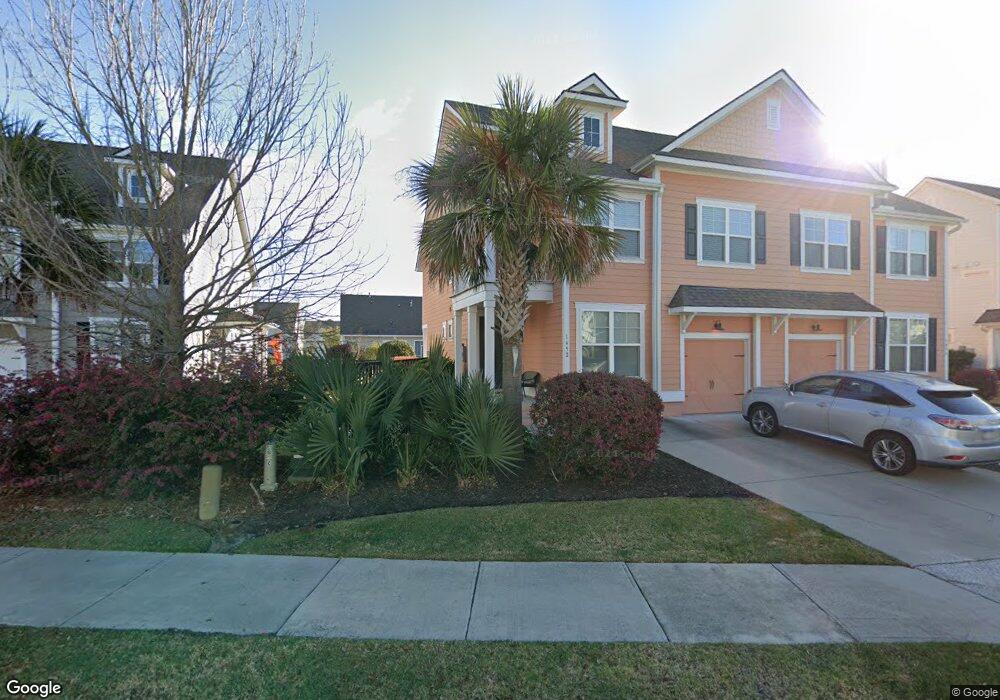
1452 Red Tide Rd Mount Pleasant, SC 29466
Estimated Value: $734,000 - $777,000
3
Beds
2
Baths
1,900
Sq Ft
$399/Sq Ft
Est. Value
About This Home
This home is located at 1452 Red Tide Rd, Mount Pleasant, SC 29466 and is currently estimated at $757,724, approximately $398 per square foot. 1452 Red Tide Rd is a home located in Charleston County with nearby schools including Mamie Whitesides Elementary School, Moultrie Middle School, and Wando High School.
Ownership History
Date
Name
Owned For
Owner Type
Purchase Details
Closed on
Sep 30, 2019
Sold by
Kahn Brett Z and Kahn Gabriel G
Bought by
Nockowitz Gabrielle M and Nockowitz Jack
Current Estimated Value
Home Financials for this Owner
Home Financials are based on the most recent Mortgage that was taken out on this home.
Original Mortgage
$425,000
Outstanding Balance
$372,321
Interest Rate
3.5%
Mortgage Type
New Conventional
Estimated Equity
$385,403
Purchase Details
Closed on
Oct 12, 2015
Sold by
D R Horton Inc
Bought by
Kahn Brett Z and Kahn Gabriel G
Home Financials for this Owner
Home Financials are based on the most recent Mortgage that was taken out on this home.
Original Mortgage
$283,628
Interest Rate
3.89%
Mortgage Type
New Conventional
Create a Home Valuation Report for This Property
The Home Valuation Report is an in-depth analysis detailing your home's value as well as a comparison with similar homes in the area
Home Values in the Area
Average Home Value in this Area
Purchase History
| Date | Buyer | Sale Price | Title Company |
|---|---|---|---|
| Nockowitz Gabrielle M | $425,000 | None Available | |
| Kahn Brett Z | $354,535 | -- |
Source: Public Records
Mortgage History
| Date | Status | Borrower | Loan Amount |
|---|---|---|---|
| Open | Nockowitz Gabrielle M | $425,000 | |
| Previous Owner | Kahn Brett Z | $283,628 |
Source: Public Records
Tax History Compared to Growth
Tax History
| Year | Tax Paid | Tax Assessment Tax Assessment Total Assessment is a certain percentage of the fair market value that is determined by local assessors to be the total taxable value of land and additions on the property. | Land | Improvement |
|---|---|---|---|---|
| 2024 | $2,228 | $22,400 | $0 | $0 |
| 2023 | $2,228 | $22,400 | $0 | $0 |
| 2022 | $1,596 | $17,000 | $0 | $0 |
| 2021 | $1,752 | $17,000 | $0 | $0 |
| 2020 | $1,811 | $17,000 | $0 | $0 |
| 2019 | $5,133 | $14,180 | $0 | $0 |
| 2017 | $1,473 | $14,180 | $0 | $0 |
Source: Public Records
Map
Nearby Homes
- 2130 Oyster Reef Ln
- 1536 Keshi Pearl Dr
- 3116 Sandy Pearl Way
- 3104 Sandy Pearl Way
- 1478 Diamond Blvd
- 1486 Diamond Blvd
- 2242 Dewees Creek Dr
- 0 Rifle Range Rd Unit (Lot 2)
- 0 Rifle Range Rd Unit (Lot 1)
- 1750 Cultivation Ln Unit 514
- 2276 Minifarm Way Unit 530
- 1750 Cultivation Ln
- 2336 Minifarm Way Unit 507
- 2284 Minifarm Way
- 2336 Minifarm Way
- 2276 Minifarm Way
- 1617 Prince Edward St
- 1509 W Palmetto Fort Dr
- 1613 Fort Palmetto Cir
- 0 Lucys Ln Unit 24029805
- 1454 Red Tide Rd
- 1450 Red Tide Rd
- 1448 Red Tide Rd
- 1456 Red Tide Rd
- 1458 Red Tide Rd
- 1444 Longspur Dr
- 1440 Longspur Dr
- 1451 Red Tide Rd
- 1448 Longspur Dr
- 1405 Longspur Dr
- 1460 Red Tide Rd
- 1459 Red Tide Rd
- 2089 Oyster Reef Ln
- 1462 Red Tide Rd
- 1461 Red Tide Rd
- 1452 Long Spur Dr
- 2091 Oyster Reef Ln
- 2092 Oyster Reef Ln
- 1436 Longspur Dr
- 1464 Red Tide Rd