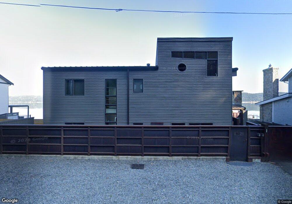
14521 E State Route 106 Belfair, WA 98528
Estimated Value: $1,204,000 - $2,718,708
3
Beds
3
Baths
840
Sq Ft
$2,107/Sq Ft
Est. Value
About This Home
This home is located at 14521 E State Route 106, Belfair, WA 98528 and is currently estimated at $1,769,569, approximately $2,106 per square foot. 14521 E State Route 106 is a home located in Mason County with nearby schools including North Mason Senior High School.
Ownership History
Date
Name
Owned For
Owner Type
Purchase Details
Closed on
Feb 28, 2023
Sold by
Hurd Generation Skipping Trust
Bought by
Hood Canal Llc
Current Estimated Value
Purchase Details
Closed on
May 23, 2011
Sold by
Bitar Gregory S
Bought by
Melchiors Gretchen and Boese Susan
Purchase Details
Closed on
Dec 11, 2010
Sold by
Bitar Gregory S
Bought by
Parks David and Parks Cynthia
Purchase Details
Closed on
Dec 30, 2009
Sold by
Bitar Douglas B
Bought by
Bitar Gregory S
Create a Home Valuation Report for This Property
The Home Valuation Report is an in-depth analysis detailing your home's value as well as a comparison with similar homes in the area
Home Values in the Area
Average Home Value in this Area
Purchase History
| Date | Buyer | Sale Price | Title Company |
|---|---|---|---|
| Hood Canal Llc | $2,800,000 | Land Title | |
| Melchiors Gretchen | $361,000 | Land Title Co | |
| Parks David | -- | Chicago Title Insurance Comp | |
| Bitar Gregory S | $177,712 | None Available |
Source: Public Records
Tax History Compared to Growth
Tax History
| Year | Tax Paid | Tax Assessment Tax Assessment Total Assessment is a certain percentage of the fair market value that is determined by local assessors to be the total taxable value of land and additions on the property. | Land | Improvement |
|---|---|---|---|---|
| 2025 | $15,140 | $1,841,240 | $211,085 | $1,630,155 |
| 2023 | $15,140 | $1,184,805 | $376,940 | $807,865 |
| 2022 | $13,954 | $1,528,430 | $263,925 | $1,264,505 |
| 2021 | $9,491 | $1,528,430 | $263,925 | $1,264,505 |
| 2020 | $11,292 | $1,060,175 | $252,070 | $808,105 |
| 2018 | $10,568 | $909,090 | $336,090 | $573,000 |
| 2017 | $9,559 | $909,105 | $336,105 | $573,000 |
| 2016 | $8,849 | $841,010 | $320,100 | $520,910 |
| 2015 | $8,934 | $784,945 | $381,385 | $403,560 |
| 2014 | -- | $781,085 | $398,525 | $382,560 |
| 2013 | -- | $638,810 | $385,670 | $253,140 |
Source: Public Records
Map
Nearby Homes
- 14341 Washington 106
- 14191 Washington 106
- 14160 Washington 106
- 14103 E State Route 106
- 48 E Twanoh Heights Rd N
- 15401 Washington 106
- 131 E Mountain View Ln
- 151 E Hillside Dr
- 60 E Christmas Tree Place
- 13540 E State Route 106
- 400 E Twanoh Falls Dr
- 110 E Canyon View Rd
- 70 E Windy Ridge Ln
- 51 E Windy Ridge Ln
- 121 E Woods Place
- 61 E Woods Place
- 15931 E State Route 106
- 0 E Greenberg Ln
- 21 E Dream Ln
- 7150 NE North Shore Rd
- 14503 E State Route 106
- 14541 E State Route 106
- 14501 E State Route 106
- 14551 E State Route 106
- 14471 E State Route 106
- 14471 E State Route 106
- 14560 E State Route 106
- 14515 E State Route 106
- 14561 E State Route 106
- 14451 E State Route 106
- 14571 E State Route 106
- 14591 E State Route 106
- 14580 E State Route 106
- 14411 E State Route 106
- 14581 E State Route 106
- 14401 E State Route 106
- 14391 E State Route 106
- 14640 E State Route 106
- 14601 E State Route 106
- 14641 E State Route 106