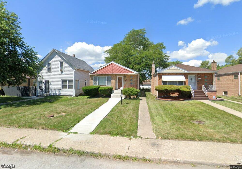
14530 Green St Harvey, IL 60426
Estimated Value: $118,472 - $159,000
3
Beds
1
Bath
1,080
Sq Ft
$131/Sq Ft
Est. Value
About This Home
This home is located at 14530 Green St, Harvey, IL 60426 and is currently estimated at $141,368, approximately $130 per square foot. 14530 Green St is a home located in Cook County with nearby schools including Bryant Elementary School, Brooks Middle School, and Thornton Township High School.
Ownership History
Date
Name
Owned For
Owner Type
Purchase Details
Closed on
Jun 15, 2004
Sold by
Morgan Richard and Morgan Lonetta
Bought by
Jones Marchan D
Current Estimated Value
Home Financials for this Owner
Home Financials are based on the most recent Mortgage that was taken out on this home.
Original Mortgage
$82,450
Outstanding Balance
$47,542
Interest Rate
8.9%
Mortgage Type
Unknown
Estimated Equity
$93,826
Purchase Details
Closed on
Apr 9, 2002
Sold by
Freeman Mae Vern
Bought by
Jp Morgan Chase Bank and The Chase Manhattan Bank
Create a Home Valuation Report for This Property
The Home Valuation Report is an in-depth analysis detailing your home's value as well as a comparison with similar homes in the area
Home Values in the Area
Average Home Value in this Area
Purchase History
| Date | Buyer | Sale Price | Title Company |
|---|---|---|---|
| Jones Marchan D | $97,000 | Chicago Title Insurance Comp | |
| Jp Morgan Chase Bank | -- | -- |
Source: Public Records
Mortgage History
| Date | Status | Borrower | Loan Amount |
|---|---|---|---|
| Open | Jones Marchan D | $82,450 | |
| Closed | Jones Marchan D | $14,550 |
Source: Public Records
Tax History Compared to Growth
Tax History
| Year | Tax Paid | Tax Assessment Tax Assessment Total Assessment is a certain percentage of the fair market value that is determined by local assessors to be the total taxable value of land and additions on the property. | Land | Improvement |
|---|---|---|---|---|
| 2024 | $3,715 | $9,000 | $1,531 | $7,469 |
| 2023 | $2,032 | $9,000 | $1,531 | $7,469 |
| 2022 | $2,032 | $5,920 | $1,313 | $4,607 |
| 2021 | $2,034 | $5,919 | $1,312 | $4,607 |
| 2020 | $2,274 | $5,919 | $1,312 | $4,607 |
| 2019 | $2,498 | $6,648 | $1,203 | $5,445 |
| 2018 | $2,433 | $6,648 | $1,203 | $5,445 |
| 2017 | $2,421 | $6,648 | $1,203 | $5,445 |
| 2016 | $2,431 | $6,252 | $1,093 | $5,159 |
| 2015 | $2,256 | $6,252 | $1,093 | $5,159 |
| 2014 | $2,284 | $6,252 | $1,093 | $5,159 |
| 2013 | $2,683 | $7,040 | $1,093 | $5,947 |
Source: Public Records
Map
Nearby Homes
- 14452 Green St
- 14542 Sangamon St
- 14631 Vincennes Rd
- 14637 Vincennes Rd
- 14622 Vincennes Rd
- 14508 Des Plaines St
- 14637 Center Ave
- 14601 Des Plaines St
- 14455 Des Plaines St
- 14502 Kentucky Ave
- 306 Calumet Blvd
- 14519 Harvey Ave
- 380 Calumet Blvd
- 271 E 148th St
- 345 Calumet Blvd
- 14725 Turlington Ave
- 14523 Lexington Ave
- 296 E 148th St
- 320 Streamside Dr
- 360 Streamside Dr
- 14532 Green St
- 14532 Green St
- 14526 Green St
- 14524 Green St
- 14536 Green St
- 14520 Green St
- 14538 Green St
- 14518 Green St
- 14531 Peoria St
- 14529 Peoria St
- 14535 Peoria St
- 14542 Green St
- 14525 Peoria St
- 231 E 146th St
- 14537 Peoria St
- 14523 Peoria St
- 14516 Green St
- 14544 Green St
- 14544 Green St
- 14541 Peoria St