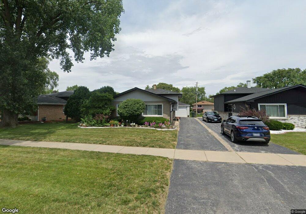
14537 Lincoln Ave Dolton, IL 60419
Estimated Value: $179,000 - $200,000
3
Beds
2
Baths
1,266
Sq Ft
$153/Sq Ft
Est. Value
About This Home
This home is located at 14537 Lincoln Ave, Dolton, IL 60419 and is currently estimated at $193,273, approximately $152 per square foot. 14537 Lincoln Ave is a home located in Cook County with nearby schools including Berger-Vandenberg Elementary School, Creative Communications Academy, and School Of Fine Arts Academy.
Ownership History
Date
Name
Owned For
Owner Type
Purchase Details
Closed on
Feb 23, 2006
Sold by
Parnell Perry L and Parnell Brenda
Bought by
Henry Nannie K
Current Estimated Value
Home Financials for this Owner
Home Financials are based on the most recent Mortgage that was taken out on this home.
Original Mortgage
$163,500
Outstanding Balance
$91,165
Interest Rate
6.33%
Mortgage Type
Fannie Mae Freddie Mac
Estimated Equity
$102,108
Create a Home Valuation Report for This Property
The Home Valuation Report is an in-depth analysis detailing your home's value as well as a comparison with similar homes in the area
Home Values in the Area
Average Home Value in this Area
Purchase History
We collect this data history from publicly available records. To have your information removed, we recommend requesting removal directly through your county’s website.
| Date | Buyer | Sale Price | Title Company |
|---|---|---|---|
| Henry Nannie K | $165,000 | Pntn |
Source: Public Records
Mortgage History
We collect this data history from publicly available records. To have your information removed, we recommend requesting removal directly through your county’s website.
| Date | Status | Borrower | Loan Amount |
|---|---|---|---|
| Open | Henry Nannie K | $163,500 |
Source: Public Records
Tax History
| Year | Tax Paid | Tax Assessment Tax Assessment Total Assessment is a certain percentage of the fair market value that is determined by local assessors to be the total taxable value of land and additions on the property. | Land | Improvement |
|---|---|---|---|---|
| 2025 | $5,095 | $15,000 | $3,127 | $11,873 |
| 2024 | $5,095 | $15,000 | $3,127 | $11,873 |
| 2023 | $5,472 | $15,000 | $3,127 | $11,873 |
| 2022 | $5,472 | $13,717 | $2,759 | $10,958 |
| 2021 | $5,318 | $13,716 | $2,758 | $10,958 |
| 2020 | $5,231 | $13,716 | $2,758 | $10,958 |
| 2019 | $2,739 | $9,929 | $2,574 | $7,355 |
| 2018 | $2,720 | $9,929 | $2,574 | $7,355 |
| 2017 | $4,142 | $12,104 | $2,574 | $9,530 |
| 2016 | $6,437 | $12,595 | $2,391 | $10,204 |
| 2015 | $6,141 | $12,595 | $2,391 | $10,204 |
| 2014 | $6,097 | $12,595 | $2,391 | $10,204 |
| 2013 | $6,307 | $13,688 | $2,391 | $11,297 |
Source: Public Records
Map
Nearby Homes
- 14549 Lincoln Ave
- 14631 Lincoln Ave
- 1031 E 146th St
- 14525 Dobson Ave
- 14418 Drexel Ave
- 14703 Ellis Ave
- 14404 Ingleside Ave
- 14658 Lincoln Ave
- 14526 Cottage Grove Ave
- 1107 E 145th St
- 14500 Van Buren St
- 14325 Ingleside Ave
- 14539 Murray Ave
- 14341 Dobson Ave
- 14424 University Ave
- 14409 Minerva Ave
- 14544 Woodlawn Ave
- 14408 Lincoln Ave
- 14708 Shepard Dr
- 14505 Woodlawn Ave
- 14533 Lincoln Ave
- 14541 Lincoln Ave
- 14529 Lincoln Ave
- 14545 Lincoln Ave
- 14538 Shepard Dr
- 14527 Lincoln Ave
- 14534 Shepard Dr
- 14540 Shepard Dr
- 14544 Shepard Dr
- 14528 Shepard Dr
- 14523 Lincoln Ave
- 14546 Shepard Dr
- 14526 Shepard Dr
- 14553 Lincoln Ave
- 14521 Lincoln Ave
- 14548 Shepard Dr
- 14522 Shepard Dr
- 14601 Lincoln Ave
- 14517 Lincoln Ave
- 14524 Lincoln Ave
Your Personal Tour Guide
Ask me questions while you tour the home.