Estimated Value: $301,352 - $353,000
3
Beds
3
Baths
1,247
Sq Ft
$264/Sq Ft
Est. Value
About This Home
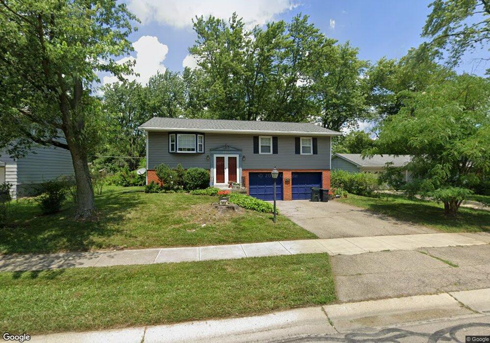
This home is located at 1454 Windward Dr, Mason, OH 45040 and is currently estimated at $329,588, approximately $264 per square foot. 1454 Windward Dr is a home located in Warren County with nearby schools including Mason Intermediate Elementary School, Mason Middle School, and William Mason High School.
Ownership History
Date
Name
Owned For
Owner Type
Purchase Details
Closed on
Jul 7, 1994
Sold by
Mcdonald Timothy J
Bought by
Aman Mark W and Hickman Lori A
Current Estimated Value
Home Financials for this Owner
Home Financials are based on the most recent Mortgage that was taken out on this home.
Original Mortgage
$84,500
Interest Rate
8.61%
Mortgage Type
New Conventional
Purchase Details
Closed on
Mar 3, 1992
Sold by
Blake Smallwood and Blake C.
Bought by
Mcdonald Mcdonald and Mcdonald Timothy J
Purchase Details
Closed on
Jun 14, 1988
Sold by
Robinson Robinson and Robinson Joann
Bought by
Blake Smallwood and Blake C.
Purchase Details
Closed on
Nov 7, 1985
Sold by
Monk Monk and Monk John
Bought by
Robinson Robinson and Robinson Joann
Purchase Details
Closed on
Feb 21, 1985
Sold by
Monk Monk and Monk John
Bought by
Monk Monk and Monk John
Purchase Details
Closed on
Oct 30, 1978
Sold by
Monk Monk and Monk Marilyn Sue
Create a Home Valuation Report for This Property
The Home Valuation Report is an in-depth analysis detailing your home's value as well as a comparison with similar homes in the area
Home Values in the Area
Average Home Value in this Area
Purchase History
| Date | Buyer | Sale Price | Title Company |
|---|---|---|---|
| Aman Mark W | $93,900 | -- | |
| Mcdonald Mcdonald | $81,000 | -- | |
| Blake Smallwood | $67,000 | -- | |
| Robinson Robinson | $51,500 | -- | |
| Monk Monk | -- | -- | |
| -- | -- | -- |
Source: Public Records
Mortgage History
| Date | Status | Borrower | Loan Amount |
|---|---|---|---|
| Closed | Aman Mark W | $84,500 |
Source: Public Records
Tax History
| Year | Tax Paid | Tax Assessment Tax Assessment Total Assessment is a certain percentage of the fair market value that is determined by local assessors to be the total taxable value of land and additions on the property. | Land | Improvement |
|---|---|---|---|---|
| 2025 | $3,376 | $83,180 | $24,500 | $58,680 |
| 2024 | $3,376 | $83,180 | $24,500 | $58,680 |
| 2023 | $3,018 | $62,818 | $10,762 | $52,055 |
| 2022 | $2,979 | $62,818 | $10,763 | $52,056 |
| 2021 | $2,822 | $62,818 | $10,763 | $52,056 |
| 2020 | $2,676 | $51,072 | $8,750 | $42,322 |
| 2019 | $2,460 | $51,072 | $8,750 | $42,322 |
| 2018 | $2,468 | $51,072 | $8,750 | $42,322 |
| 2017 | $2,274 | $43,925 | $8,274 | $35,651 |
| 2016 | $2,342 | $43,925 | $8,274 | $35,651 |
| 2015 | $2,347 | $43,925 | $8,274 | $35,651 |
| 2014 | $2,352 | $41,050 | $7,730 | $33,320 |
| 2013 | $2,357 | $46,460 | $8,750 | $37,710 |
Source: Public Records
Map
Nearby Homes
- 1475 St Lawrence Dr
- 968 Olympia Dr
- 899 Tradewind Dr
- 792 Majken Place
- 8335 Charming Manor
- 1041 Sheffield Dr
- 6300 Amber Ct
- 7966 Country Green Ct
- 6411 Coverage Ct
- 6404 Coverage Ct
- 6394 Coverage Ct
- 6382 Coverage Ct
- 6378 Coverage Ct
- 6364 Coverage Ct
- 6354 Coverage Ct
- 6379 Coverage Ct
- 6403 Nicholas Way
- 6375 Coverage Ct
- 6358 Coverage Ct
- 6393 Nicholas Way
- 1446 Windward Dr
- 1460 Windward Dr
- 1440 Windward Dr
- 1466 Windward Dr
- 912 Leslie Ct
- 713 Britt Place
- 709 Britt Place
- 1453 Windward Dr
- 1445 Windward Dr
- 1459 Windward Dr
- 1434 Windward Dr
- 1474 Windward Dr
- 1439 Windward Dr
- 1465 Windward Dr
- 908 Leslie Ct
- 708 Britt Place
- 1426 Windward Dr
- 1480 Windward Dr
- 1433 Windward Dr
- 1475 Windward Dr
Your Personal Tour Guide
Ask me questions while you tour the home.