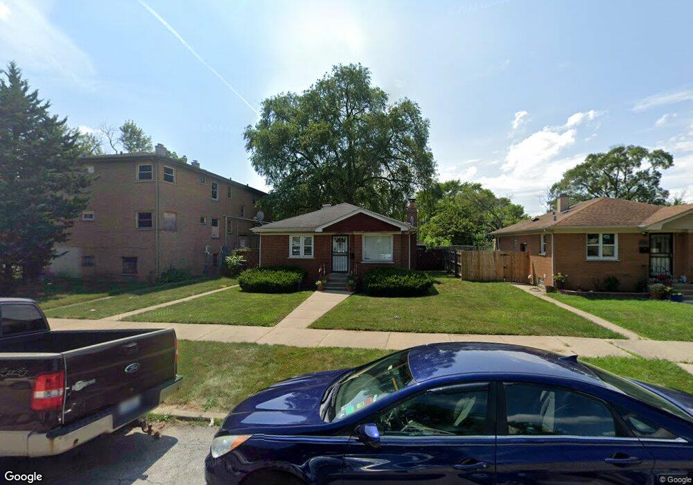
14540 Des Plaines St Harvey, IL 60426
Estimated Value: $96,509 - $127,000
2
Beds
1
Bath
1,061
Sq Ft
$101/Sq Ft
Est. Value
About This Home
This home is located at 14540 Des Plaines St, Harvey, IL 60426 and is currently estimated at $106,877, approximately $100 per square foot. 14540 Des Plaines St is a home located in Cook County with nearby schools including Bryant Elementary School, Brooks Middle School, and Thornton Township High School.
Ownership History
Date
Name
Owned For
Owner Type
Purchase Details
Closed on
Oct 4, 2024
Sold by
Rogers Rosa
Bought by
Rogers Roschone
Current Estimated Value
Purchase Details
Closed on
Aug 21, 2006
Sold by
Whitten Jesse
Bought by
Rogers Rosa
Home Financials for this Owner
Home Financials are based on the most recent Mortgage that was taken out on this home.
Original Mortgage
$96,900
Interest Rate
9.45%
Mortgage Type
New Conventional
Purchase Details
Closed on
Oct 10, 2002
Sold by
Reams David L
Bought by
Hud
Create a Home Valuation Report for This Property
The Home Valuation Report is an in-depth analysis detailing your home's value as well as a comparison with similar homes in the area
Home Values in the Area
Average Home Value in this Area
Purchase History
| Date | Buyer | Sale Price | Title Company |
|---|---|---|---|
| Rogers Roschone | -- | None Listed On Document | |
| Rogers Rosa | $102,000 | Pntn | |
| Hud | -- | -- |
Source: Public Records
Mortgage History
| Date | Status | Borrower | Loan Amount |
|---|---|---|---|
| Previous Owner | Rogers Rosa | $96,900 |
Source: Public Records
Tax History
| Year | Tax Paid | Tax Assessment Tax Assessment Total Assessment is a certain percentage of the fair market value that is determined by local assessors to be the total taxable value of land and additions on the property. | Land | Improvement |
|---|---|---|---|---|
| 2025 | $1,368 | $3,750 | $1,050 | $2,700 |
| 2024 | $1,368 | $3,750 | $1,050 | $2,700 |
| 2023 | $1,986 | $3,750 | $1,050 | $2,700 |
| 2022 | $1,986 | $2,442 | $900 | $1,542 |
| 2021 | $1,919 | $2,442 | $900 | $1,542 |
| 2020 | $1,971 | $2,442 | $900 | $1,542 |
| 2019 | $2,188 | $2,819 | $825 | $1,994 |
| 2018 | $2,135 | $2,819 | $825 | $1,994 |
| 2017 | $2,086 | $2,819 | $825 | $1,994 |
| 2016 | $1,865 | $2,881 | $750 | $2,131 |
| 2015 | $1,791 | $2,881 | $750 | $2,131 |
| 2014 | $1,787 | $2,881 | $750 | $2,131 |
| 2013 | $1,831 | $3,010 | $750 | $2,260 |
Source: Public Records
Map
Nearby Homes
- 14631 Union Ave
- 14455 Des Plaines St
- 289 E Sibley Blvd
- 14446 Des Plaines St
- 14506 Clinton St
- 14443 Des Plaines St
- 380 Calumet Blvd
- 14529 Clinton St
- 14438 Des Plaines St
- 14427 Halsted St
- 14452 Green St
- 345 Calumet Blvd
- 306 Calumet Blvd
- 14501 Peoria St
- 360 Streamside Dr
- 14631 Vincennes Rd
- 272 E 148th St
- 14801 Madison Ave
- 309 Streamside Dr
- 14311 Parnell Ave
- 14540 Des Plaines St
- 14536 Des Plaines St
- 14534 Des Plaines St
- 14530 Des Plaines St
- 14530 Des Plaines St
- 14600 Des Plaines St
- 14535 Union Ave
- 14604 Des Plaines St
- 14533 Union Ave
- 14541 Des Plaines St
- 14541 Des Plaines St
- 14539 Des Plaines St
- 14528 Des Plaines St
- 14537 Des Plaines St
- 14606 Des Plaines St
- 14535 Des Plaines St
- 14527 Union Ave
- 14605 Union Ave
- 14531 Des Plaines St
- 14522 Des Plaines St
Your Personal Tour Guide
Ask me questions while you tour the home.