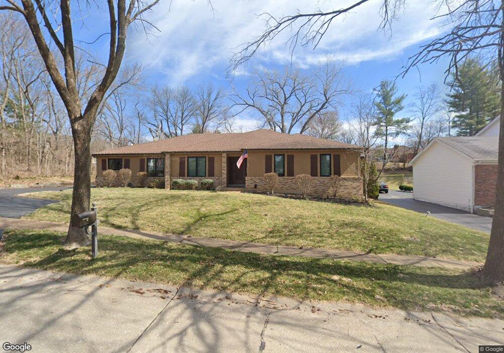
14548 Fairfield Farm Dr Chesterfield, MO 63017
Estimated Value: $549,618 - $706,000
3
Beds
2
Baths
2,331
Sq Ft
$262/Sq Ft
Est. Value
About This Home
This home is located at 14548 Fairfield Farm Dr, Chesterfield, MO 63017 and is currently estimated at $610,405, approximately $261 per square foot. 14548 Fairfield Farm Dr is a home located in St. Louis County with nearby schools including Henry Elementary School, Parkway West Middle School, and Parkway West High School.
Ownership History
Date
Name
Owned For
Owner Type
Purchase Details
Closed on
Jan 4, 2008
Sold by
Postal Properties Family Properties Llc
Bought by
Postal Flora C
Current Estimated Value
Purchase Details
Closed on
Jun 23, 2006
Sold by
Postal William J and Postal Flora C
Bought by
Postal Flora C
Purchase Details
Closed on
Aug 1, 2003
Sold by
Lewis Nancy and Postal Michael D
Bought by
Postal William J
Purchase Details
Closed on
Nov 22, 2002
Sold by
Postal William J
Bought by
Postal Richard
Purchase Details
Closed on
Nov 25, 1997
Sold by
Postal Flora C
Bought by
Postal William J and Postal Flora C
Home Financials for this Owner
Home Financials are based on the most recent Mortgage that was taken out on this home.
Original Mortgage
$145,000
Interest Rate
6.88%
Create a Home Valuation Report for This Property
The Home Valuation Report is an in-depth analysis detailing your home's value as well as a comparison with similar homes in the area
Home Values in the Area
Average Home Value in this Area
Purchase History
| Date | Buyer | Sale Price | Title Company |
|---|---|---|---|
| Postal Flora C | -- | None Available | |
| Postal Flora C | -- | None Available | |
| Postal Properties Family Properties Llc | -- | None Available | |
| Postal William J | -- | -- | |
| Postal Richard | -- | -- | |
| Sheetz Mary | -- | -- | |
| Postal Michael D | -- | -- | |
| Lewis Nancy | -- | -- | |
| Postal William J | -- | -- |
Source: Public Records
Mortgage History
| Date | Status | Borrower | Loan Amount |
|---|---|---|---|
| Previous Owner | Postal William J | $145,000 |
Source: Public Records
Tax History Compared to Growth
Tax History
| Year | Tax Paid | Tax Assessment Tax Assessment Total Assessment is a certain percentage of the fair market value that is determined by local assessors to be the total taxable value of land and additions on the property. | Land | Improvement |
|---|---|---|---|---|
| 2025 | $5,642 | $93,820 | $39,500 | $54,320 |
| 2024 | $5,642 | $85,330 | $23,690 | $61,640 |
| 2023 | $5,412 | $85,330 | $23,690 | $61,640 |
| 2022 | $5,357 | $76,870 | $23,690 | $53,180 |
| 2021 | $5,335 | $76,870 | $23,690 | $53,180 |
| 2020 | $5,295 | $73,270 | $23,240 | $50,030 |
| 2019 | $5,180 | $73,270 | $23,240 | $50,030 |
| 2018 | $5,377 | $70,550 | $23,240 | $47,310 |
| 2017 | $5,230 | $70,550 | $23,240 | $47,310 |
| 2016 | $5,029 | $64,460 | $17,420 | $47,040 |
| 2015 | $5,272 | $64,460 | $17,420 | $47,040 |
| 2014 | $4,523 | $59,090 | $15,450 | $43,640 |
Source: Public Records
Map
Nearby Homes
- 2317 Hank's Close Unit 186 STB
- 1620 Chalmers Dr
- 2021 Brook Hill Ct
- 1870 Buckington Dr
- 1685 Ansonborough Dr
- 14628 Big Timber Ln
- 2168 Bantry Ct
- 1505 Timberbluff Ct
- 14443 Bantry Ln Unit 1
- 14422 Rue de Gascony Ct
- 605 Aspen Ridge Ct
- 2237 Ole Castle Ct
- 731 Kraffel Ln
- 1519 Mallard Landing Ct
- 770 Straub Rd
- 14260 Cedar Springs Dr
- 719 Clayton Corners Dr
- 2034 Emerald Crest Ct
- 2 Willow at Woods Mill Crossing
- 15047 Green Circle Dr
- 14554 Fairfield Farm Dr
- 1805 Brittania Ct
- 1801 Brittania Ct
- 14560 Fairfield Farm Dr
- 1807 Autumn Glen Ct
- 14672 Summer Blossom Ln
- 1804 Summer Blossom Place
- 14676 Summer Blossom Ln
- 1803 Autumn Glen Ct
- 1811 Brittania Ct
- 14602 Fairfield Farm Dr
- 1811 Autumn Glen Ct
- 1800 Brittania Ct
- 1817 Brittania Ct
- 1808 Summer Blossom Place
- 14608 Fairfield Farm Dr
- 14669 Summer Blossom Ln
- 1806 Brittania Ct
- 1801 Summer Blossom Place
- 1812 Brittania Ct