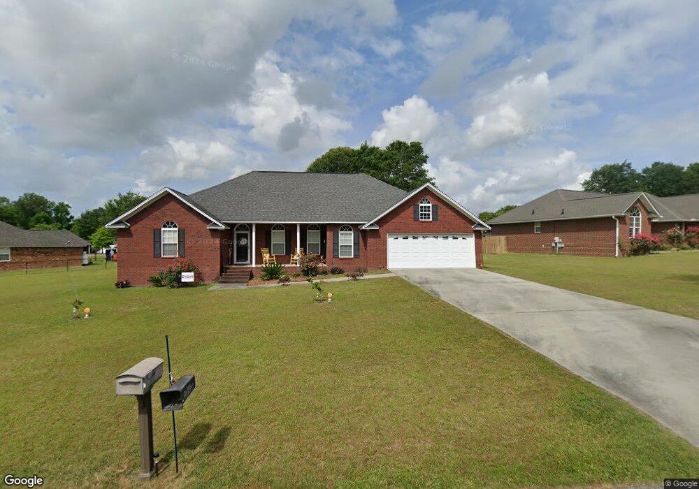
1455 Loblolly Dr Manning, SC 29102
Estimated Value: $288,191 - $342,000
4
Beds
4
Baths
2,350
Sq Ft
$135/Sq Ft
Est. Value
About This Home
This home is located at 1455 Loblolly Dr, Manning, SC 29102 and is currently estimated at $318,298, approximately $135 per square foot. 1455 Loblolly Dr is a home located in Clarendon County with nearby schools including Manning Early Childhood Center, Manning Primary School, and Manning Elementary School.
Ownership History
Date
Name
Owned For
Owner Type
Purchase Details
Closed on
Apr 1, 2020
Sold by
B A R Properties Of Manning Llc
Bought by
Mcduffie Richard and Mcduffie Sandra
Current Estimated Value
Home Financials for this Owner
Home Financials are based on the most recent Mortgage that was taken out on this home.
Original Mortgage
$190,500
Interest Rate
3.4%
Mortgage Type
Land Contract Argmt. Of Sale
Purchase Details
Closed on
Jan 25, 2011
Sold by
Donald Morris Construction Co Inc
Bought by
Baker Duane and Baker Shona
Create a Home Valuation Report for This Property
The Home Valuation Report is an in-depth analysis detailing your home's value as well as a comparison with similar homes in the area
Home Values in the Area
Average Home Value in this Area
Purchase History
| Date | Buyer | Sale Price | Title Company |
|---|---|---|---|
| Mcduffie Richard | $192,500 | None Available | |
| Baker Duane | -- | None Available |
Source: Public Records
Mortgage History
| Date | Status | Borrower | Loan Amount |
|---|---|---|---|
| Closed | Mcduffie Richard | $190,500 |
Source: Public Records
Tax History Compared to Growth
Tax History
| Year | Tax Paid | Tax Assessment Tax Assessment Total Assessment is a certain percentage of the fair market value that is determined by local assessors to be the total taxable value of land and additions on the property. | Land | Improvement |
|---|---|---|---|---|
| 2024 | $1,799 | $8,860 | $1,000 | $7,860 |
| 2023 | $1,764 | $8,860 | $1,000 | $7,860 |
| 2022 | $1,743 | $8,860 | $1,000 | $7,860 |
| 2021 | $4,455 | $7,764 | $800 | $6,964 |
| 2020 | $4,050 | $11,646 | $0 | $0 |
| 2019 | $3,878 | $11,646 | $0 | $0 |
| 2018 | $3,733 | $11,646 | $0 | $0 |
| 2017 | $3,722 | $11,646 | $0 | $0 |
| 2016 | $3,659 | $11,646 | $0 | $0 |
| 2015 | $3,726 | $12,030 | $1,200 | $10,830 |
| 2014 | $3,670 | $12,030 | $1,200 | $10,830 |
| 2013 | -- | $12,030 | $1,200 | $10,830 |
Source: Public Records
Map
Nearby Homes
- 1023 Shortleaf Dr
- 1513 Loblolly Dr
- 1868 Haseldon Dr
- 605 Gib Dr
- 617 Pickwood Dr
- 0000 Sylvan Dr
- 1026 Jamie Ct
- 412 Briarcliff St
- 1054 Hickory Ridge Cir
- TBD S Carolina 260
- 1682 Heritage Dr
- 1665 Heritage Dr
- 1085 Birdie Ct
- 1158 Doral Dr
- 1356 Mckenzie Rd
- 633 Sykes St
- 408 Toccoa Dr
- 1111 Nicole Dr
- TBD White Oak Dr
- 1200 Mulligan Dr
- 1483 Loblolly Dr
- 1026 Shortleaf Dr
- 1439 Loblolly Dr
- 1026 Short Leaf Dr
- 1036 Short Leaf Dr
- 1011 Sand Pine Ct
- 1452 Loblolly Dr
- 1491 Loblolly Dr
- 1046 Short Leaf Dr
- 1496 Loblolly Dr
- 1490 Loblolly Dr
- 1024 Sand Pine Ct
- 1503 Loblolly Dr
- 1023 Short Leaf Dr
- 1023 Sand Pine Ct
- 1436 Loblolly Dr
- 1415 Loblolly Dr
- 1031 Short Leaf Dr
- 1058 Short Leaf Dr
- 1058 Shortleaf Dr