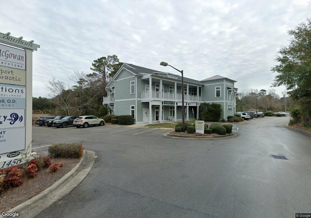
1456 N Howe St Southport, NC 28461
Estimated Value: $4,525,423
--
Bed
--
Bath
43,560
Sq Ft
$104/Sq Ft
Est. Value
About This Home
This home is located at 1456 N Howe St, Southport, NC 28461 and is currently estimated at $4,525,423, approximately $103 per square foot. 1456 N Howe St is a home located in Brunswick County with nearby schools including Southport Elementary School, South Brunswick Middle School, and South Brunswick High School.
Ownership History
Date
Name
Owned For
Owner Type
Purchase Details
Closed on
Jun 22, 2006
Sold by
Tri-Coast Properties Llc
Bought by
Southport Land Llc
Current Estimated Value
Home Financials for this Owner
Home Financials are based on the most recent Mortgage that was taken out on this home.
Original Mortgage
$2,000,000
Outstanding Balance
$1,170,564
Interest Rate
6.49%
Mortgage Type
Commercial
Estimated Equity
$3,354,859
Create a Home Valuation Report for This Property
The Home Valuation Report is an in-depth analysis detailing your home's value as well as a comparison with similar homes in the area
Home Values in the Area
Average Home Value in this Area
Purchase History
| Date | Buyer | Sale Price | Title Company |
|---|---|---|---|
| Southport Land Llc | $2,200,000 | None Available |
Source: Public Records
Mortgage History
| Date | Status | Borrower | Loan Amount |
|---|---|---|---|
| Open | Southport Land Llc | $2,000,000 |
Source: Public Records
Tax History Compared to Growth
Tax History
| Year | Tax Paid | Tax Assessment Tax Assessment Total Assessment is a certain percentage of the fair market value that is determined by local assessors to be the total taxable value of land and additions on the property. | Land | Improvement |
|---|---|---|---|---|
| 2025 | $20,460 | $2,725,450 | $945,000 | $1,780,450 |
| 2024 | $20,460 | $2,725,450 | $945,000 | $1,780,450 |
| 2023 | $19,674 | $2,725,450 | $945,000 | $1,780,450 |
| 2022 | $17,211 | $1,963,330 | $900,000 | $1,063,330 |
| 2021 | $17,211 | $1,963,330 | $900,000 | $1,063,330 |
| 2020 | $17,211 | $1,963,330 | $900,000 | $1,063,330 |
| 2019 | $17,211 | $939,560 | $900,000 | $39,560 |
| 2018 | $16,194 | $726,580 | $696,000 | $30,580 |
| 2017 | $16,094 | $726,580 | $696,000 | $30,580 |
| 2016 | $14,974 | $726,580 | $696,000 | $30,580 |
| 2015 | $14,974 | $1,839,350 | $696,000 | $1,143,350 |
| 2014 | $15,719 | $2,049,036 | $870,000 | $1,179,036 |
Source: Public Records
Map
Nearby Homes
- 114 W 14th St Unit B
- 1218 N Caswell Ave
- 1110 Caney Ct
- 430 Raven Glen Dr
- 1200 N Caswell Ave
- 457 Raven Glen Dr
- 422 Raven Glen Dr
- 538 Jabbertown Rd
- L-7 Jabbertown Rd
- 2119 Maple Leaf Dr
- 110 Highland Park
- 818 Cades Trail
- 420 Cades Trail
- 813 Cades Trail
- 1676 N Howe St
- 2443 Lake Ridge Dr
- 2451 Lake Ridge Dr
- 304 W 11th St
- 408 Fire Fly Ln
- 2478 Lake Ridge Dr
- 8874 River Rd SE
- 1418 N Howe St
- 1418 B N Howe
- 751 Jabbertown Rd
- 1427 N Howe St
- 1419 N Howe St
- 1 N Carolina 87
- 4138 N Carolina 87
- 0 N Carolina 87
- 74 N Carolina 87
- 733 Jabbertown Rd
- 722 Jabbertown Rd
- 727 Jabbertown Rd
- 725 Jabbertown Rd
- 1403 N Howe St
- 723 Jabbertown Rd
- 1330 N Howe St Unit 2
- 1330 N Howe St Unit 4
- 1330 N Howe St Unit 1
- 1330 N Howe St