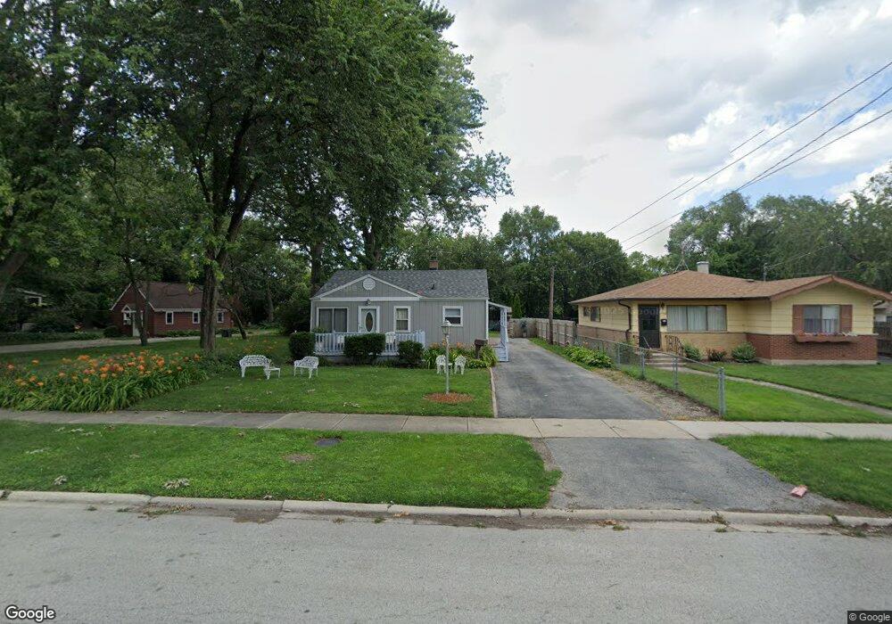
14566 Abbottsford Rd Midlothian, IL 60445
Estimated Value: $161,000 - $213,000
2
Beds
1
Bath
728
Sq Ft
$246/Sq Ft
Est. Value
About This Home
This home is located at 14566 Abbottsford Rd, Midlothian, IL 60445 and is currently estimated at $179,346, approximately $246 per square foot. 14566 Abbottsford Rd is a home located in Cook County with nearby schools including Springfield Elementary School, Bremen High School, and St Christopher School.
Ownership History
Date
Name
Owned For
Owner Type
Purchase Details
Closed on
Jul 31, 2001
Sold by
Scott Donald S and Scott Karen E
Bought by
Lennon John and Lennon Dorothy
Current Estimated Value
Home Financials for this Owner
Home Financials are based on the most recent Mortgage that was taken out on this home.
Original Mortgage
$86,860
Outstanding Balance
$32,306
Interest Rate
7.14%
Estimated Equity
$147,040
Purchase Details
Closed on
Nov 30, 1994
Sold by
Shull Joel G and Shull Karen A
Bought by
Scott Donald S and Scott Karen E
Home Financials for this Owner
Home Financials are based on the most recent Mortgage that was taken out on this home.
Original Mortgage
$81,595
Interest Rate
8.91%
Mortgage Type
FHA
Create a Home Valuation Report for This Property
The Home Valuation Report is an in-depth analysis detailing your home's value as well as a comparison with similar homes in the area
Home Values in the Area
Average Home Value in this Area
Purchase History
| Date | Buyer | Sale Price | Title Company |
|---|---|---|---|
| Lennon John | $96,500 | Ticor Title | |
| Scott Donald S | $82,000 | Attorneys Natl Title Network |
Source: Public Records
Mortgage History
| Date | Status | Borrower | Loan Amount |
|---|---|---|---|
| Open | Lennon John | $86,860 | |
| Previous Owner | Scott Donald S | $81,595 |
Source: Public Records
Tax History
| Year | Tax Paid | Tax Assessment Tax Assessment Total Assessment is a certain percentage of the fair market value that is determined by local assessors to be the total taxable value of land and additions on the property. | Land | Improvement |
|---|---|---|---|---|
| 2025 | $2,908 | $11,001 | $3,063 | $7,938 |
| 2024 | $2,908 | $11,001 | $3,063 | $7,938 |
| 2023 | $3,657 | $11,001 | $3,063 | $7,938 |
| 2022 | $3,657 | $11,204 | $2,625 | $8,579 |
| 2021 | $3,556 | $11,204 | $2,625 | $8,579 |
| 2020 | $3,485 | $11,204 | $2,625 | $8,579 |
| 2019 | $2,398 | $8,951 | $2,406 | $6,545 |
| 2018 | $2,358 | $8,951 | $2,406 | $6,545 |
| 2017 | $2,297 | $8,951 | $2,406 | $6,545 |
| 2016 | $2,358 | $7,994 | $2,187 | $5,807 |
| 2015 | $2,253 | $7,994 | $2,187 | $5,807 |
| 2014 | $2,209 | $7,994 | $2,187 | $5,807 |
| 2013 | $2,221 | $8,700 | $2,187 | $6,513 |
Source: Public Records
Map
Nearby Homes
- 14503 Waverly Ave
- 14517 Saint Louis Ave
- 14430 Ridgeway Ave
- 3625 147th St
- 14301 Hamlin Ave
- 14328 Lawndale Ave
- 14542 Turner Ave
- 14839 Lawndale Ave
- 14732 Turner Ave Unit D
- 14539 Crawford Ave
- 3902 Claire Blvd
- 14401 Pulaski Rd
- 14850 Homan Ave
- 14820 Turner Ave
- 14601 Keystone Ave Unit A3
- 14613 Keystone Ave
- 14501 Keystone Ave Unit 8
- 14044 S Grace Ave
- 14618 Keystone Ave
- 14039 S Claire Blvd
- 14562 Abbottsford Rd
- 14556 Abbottsford Rd
- 14574 Abbottsford Rd
- 14554 Abbottsford Rd
- 14575 Abbottsford Rd
- 14550 Abbottsford Rd
- 14538 Central Park Ave
- 14552 Central Park Ave
- 14600 Abbottsford Rd
- 14546 Abbottsford Rd
- 14556 Central Park Ave
- 14519 Waverly Ave
- 14513 Waverly Ave
- 14608 Abbottsford Rd
- 14603 Millard Ave
- 14529 Waverly Ave
- 14495 Waverly Ave
- 14600 Central Park Ave
- 14607 Millard Ave
- 14610 Abbottsford Rd