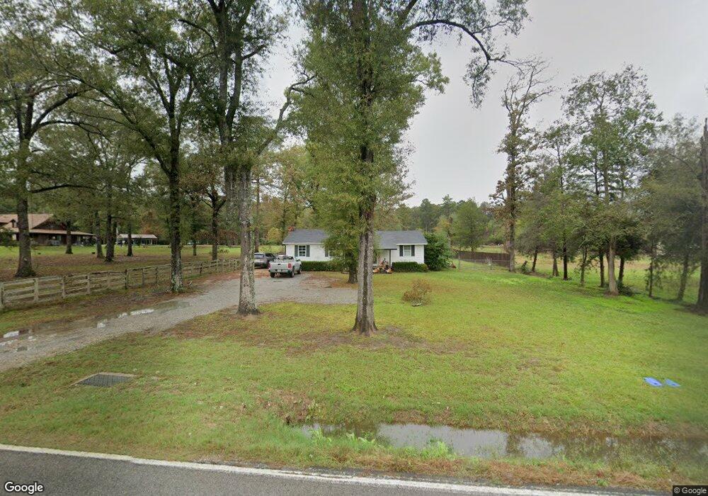
1457 Highway 134 Monroe, LA 71203
Estimated Value: $140,000 - $229,000
3
Beds
2
Baths
1,553
Sq Ft
$118/Sq Ft
Est. Value
About This Home
This home is located at 1457 Highway 134, Monroe, LA 71203 and is currently estimated at $183,106, approximately $117 per square foot. 1457 Highway 134 is a home located in Ouachita Parish with nearby schools including Sterlington Elementary School and Sterlington High School.
Ownership History
Date
Name
Owned For
Owner Type
Purchase Details
Closed on
Jun 16, 2020
Sold by
Spence Haywood
Bought by
Spence Ronald L
Current Estimated Value
Home Financials for this Owner
Home Financials are based on the most recent Mortgage that was taken out on this home.
Original Mortgage
$109,890
Outstanding Balance
$97,409
Interest Rate
3.2%
Mortgage Type
New Conventional
Estimated Equity
$85,697
Purchase Details
Closed on
Mar 31, 2010
Sold by
Kellick Nicky W and Kellick Laneli
Bought by
Spence Matthew H
Home Financials for this Owner
Home Financials are based on the most recent Mortgage that was taken out on this home.
Original Mortgage
$76,011
Interest Rate
5%
Mortgage Type
Purchase Money Mortgage
Purchase Details
Closed on
Mar 25, 2008
Sold by
Wells Fargo Bank Na
Bought by
Kellick Lanell Rushing and Kellick Nicky W
Purchase Details
Closed on
Nov 7, 2007
Sold by
Posey Stephen B
Bought by
Wells Fargo Bank Na
Create a Home Valuation Report for This Property
The Home Valuation Report is an in-depth analysis detailing your home's value as well as a comparison with similar homes in the area
Home Values in the Area
Average Home Value in this Area
Purchase History
| Date | Buyer | Sale Price | Title Company |
|---|---|---|---|
| Spence Ronald L | $135,000 | None Available | |
| Spence Matthew H | $75,000 | None Available | |
| Kellick Lanell Rushing | -- | First Financial Title Agency | |
| Wells Fargo Bank Na | $654 | None Available |
Source: Public Records
Mortgage History
| Date | Status | Borrower | Loan Amount |
|---|---|---|---|
| Open | Spence Ronald L | $109,890 | |
| Previous Owner | Spence Matthew H | $76,011 |
Source: Public Records
Tax History Compared to Growth
Tax History
| Year | Tax Paid | Tax Assessment Tax Assessment Total Assessment is a certain percentage of the fair market value that is determined by local assessors to be the total taxable value of land and additions on the property. | Land | Improvement |
|---|---|---|---|---|
| 2024 | $1,395 | $9,951 | $1,269 | $8,682 |
| 2023 | $1,395 | $9,951 | $1,269 | $8,682 |
| 2022 | $1,362 | $9,775 | $1,269 | $8,506 |
| 2021 | $1,323 | $9,589 | $1,269 | $8,320 |
| 2020 | $1,334 | $9,673 | $1,269 | $8,404 |
| 2019 | $1,245 | $9,149 | $1,269 | $7,880 |
| 2018 | $214 | $9,149 | $1,269 | $7,880 |
| 2017 | $974 | $7,310 | $588 | $6,722 |
| 2016 | $950 | $7,310 | $588 | $6,722 |
| 2015 | -- | $7,310 | $588 | $6,722 |
| 2014 | -- | $7,310 | $588 | $6,722 |
| 2013 | -- | $7,310 | $588 | $6,722 |
Source: Public Records
Map
Nearby Homes
- 1469 Highway 134
- 1431 Highway 134
- 1511 Highway 134
- 1426 Highway 134
- 1421 Highway 134
- 1510 Highway 134
- 1525 Highway 134
- 1407 Highway 134
- 1406 Highway 134
- 127 Curtis Rd
- 35 Brook Orchard Cir
- 33 Brook Orchard Cir
- 31 Brook Orchard Cir
- 29 Brook Orchard Cir
- 23 Brook Orchard Cir
- 25 Brook Orchard Cir
- 7 Brook Orchard Cir
- 0000 Brook Orchard Cir
- Lots 20, 21, 22 Brook Orchard Cir
- 120 Brook Orchard Cir