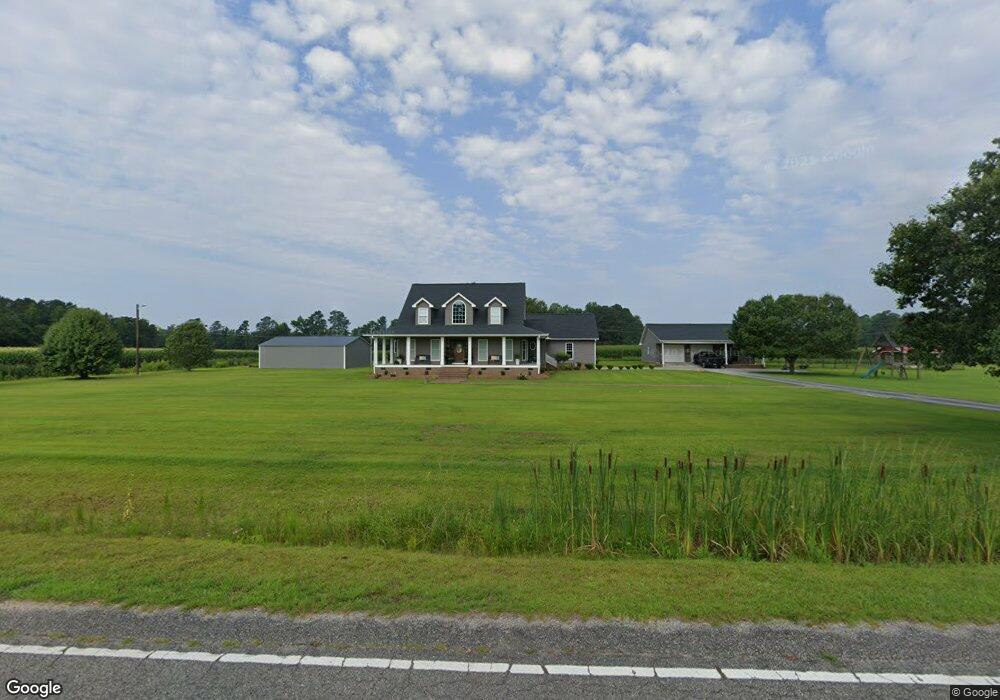
14573 Highway 19 Nichols, SC 29581
Estimated Value: $359,000 - $540,378
3
Beds
3
Baths
3,499
Sq Ft
$133/Sq Ft
Est. Value
About This Home
This home is located at 14573 Highway 19, Nichols, SC 29581 and is currently estimated at $464,345, approximately $132 per square foot. 14573 Highway 19 is a home located in Horry County with nearby schools including Green Sea Floyds Elementary School and Green Sea Floyds High School.
Ownership History
Date
Name
Owned For
Owner Type
Purchase Details
Closed on
Jun 6, 2017
Sold by
Williams Travis D
Bought by
Williamson Brandon R
Current Estimated Value
Home Financials for this Owner
Home Financials are based on the most recent Mortgage that was taken out on this home.
Original Mortgage
$250,000
Outstanding Balance
$208,118
Interest Rate
4.05%
Mortgage Type
New Conventional
Estimated Equity
$256,227
Purchase Details
Closed on
Feb 16, 2005
Sold by
Williams Travis Duncan and Long Karen R
Bought by
Williams Travis D
Create a Home Valuation Report for This Property
The Home Valuation Report is an in-depth analysis detailing your home's value as well as a comparison with similar homes in the area
Home Values in the Area
Average Home Value in this Area
Purchase History
| Date | Buyer | Sale Price | Title Company |
|---|---|---|---|
| Williamson Brandon R | $223,000 | -- | |
| Williams Travis D | -- | -- |
Source: Public Records
Mortgage History
| Date | Status | Borrower | Loan Amount |
|---|---|---|---|
| Open | Williamson Brandon R | $250,000 |
Source: Public Records
Tax History Compared to Growth
Tax History
| Year | Tax Paid | Tax Assessment Tax Assessment Total Assessment is a certain percentage of the fair market value that is determined by local assessors to be the total taxable value of land and additions on the property. | Land | Improvement |
|---|---|---|---|---|
| 2024 | $1,193 | $19,091 | $2,892 | $16,199 |
| 2023 | $1,193 | $10,443 | $482 | $9,961 |
| 2021 | $1,077 | $11,054 | $482 | $10,572 |
| 2020 | $953 | $11,054 | $482 | $10,572 |
| 2019 | $953 | $11,054 | $482 | $10,572 |
| 2018 | $844 | $9,081 | $429 | $8,652 |
| 2017 | $844 | $9,081 | $429 | $8,652 |
| 2016 | -- | $9,081 | $429 | $8,652 |
| 2015 | $844 | $9,081 | $429 | $8,652 |
| 2014 | $779 | $9,081 | $429 | $8,652 |
Source: Public Records
Map
Nearby Homes
- Tbd Hwy 19 Unit LotWP001
- TBD Long Branch Swamp Rd
- TBD Pleasant View Church Rd
- 6800 Black Creek Rd
- 5671 Highway 917 Unit 19
- TBD Black Creek Rd
- 7320 Maple Wild Rd
- TBD Lot B4 Mount Olive Church Rd
- TBD Lot B5 Mount Olive Church Rd
- TBD Lot B6 Mount Olive Church Rd
- 2308 Mount Olive Church Rd
- TBD Lot B2 Mount Olive Church Rd
- TBD Lot B3 Mount Olive Church Rd
- TBD Lot B7 Mount Olive Church Rd
- TBD Lot B1 Mount Olive Church Rd
- 46.89 Ac Tbd Beth Ln
- Tract 2 Beth Dr
- Tbd Bellaire Dr Unit 4
- Tbd Shelley Rd
- TBD Fifteen Mile Bay Rd
- 14326 Highway 19 Unit 14304, 14350
- 14326 Highway 19
- 6200 Livingston Ln
- 14296 Highway 19
- 6280 S Carolina 19
- 14262 Highway 19
- 5950 Long Branch Swamp Rd
- 5930 Long Branch Swamp Rd
- 5880 Long Branch Swamp Rd
- 14792 Highway 19
- 875 Mount Olive Church Rd
- 565 Mount Olive Church Rd
- 1125 Liner Rd
- 964 Mount Olive Church Rd
- 910 Mount Olive Church Rd
- 14011 Highway 19
- 1107 Mount Olive Church Rd
- 1165 Mount Olive Church Rd
- 14007 Highway 19