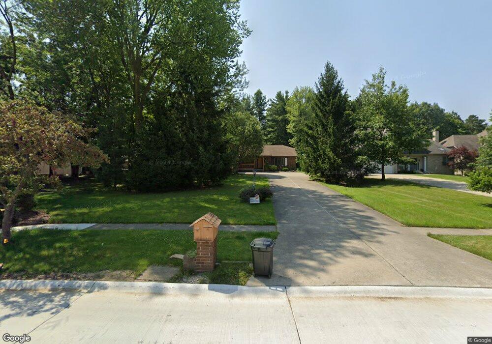
14577 Walking Stick Way Strongsville, OH 44136
Estimated Value: $499,000 - $549,000
4
Beds
3
Baths
3,218
Sq Ft
$162/Sq Ft
Est. Value
About This Home
This home is located at 14577 Walking Stick Way, Strongsville, OH 44136 and is currently estimated at $522,196, approximately $162 per square foot. 14577 Walking Stick Way is a home located in Cuyahoga County with nearby schools including Strongsville High School and Royal Redeemer Lutheran School.
Ownership History
Date
Name
Owned For
Owner Type
Purchase Details
Closed on
Oct 7, 2009
Sold by
Watts Arthur L and Watts Kathleen B
Bought by
Sopka Mihajlo D and Sopka Nataliya
Current Estimated Value
Home Financials for this Owner
Home Financials are based on the most recent Mortgage that was taken out on this home.
Original Mortgage
$221,355
Interest Rate
5.15%
Mortgage Type
New Conventional
Purchase Details
Closed on
Jan 1, 1987
Bought by
Watts Arthur L and K B
Create a Home Valuation Report for This Property
The Home Valuation Report is an in-depth analysis detailing your home's value as well as a comparison with similar homes in the area
Home Values in the Area
Average Home Value in this Area
Purchase History
| Date | Buyer | Sale Price | Title Company |
|---|---|---|---|
| Sopka Mihajlo D | $245,950 | Barristers Title Agency | |
| Watts Arthur L | -- | -- |
Source: Public Records
Mortgage History
| Date | Status | Borrower | Loan Amount |
|---|---|---|---|
| Closed | Sopka Mihajlo D | $221,355 |
Source: Public Records
Tax History Compared to Growth
Tax History
| Year | Tax Paid | Tax Assessment Tax Assessment Total Assessment is a certain percentage of the fair market value that is determined by local assessors to be the total taxable value of land and additions on the property. | Land | Improvement |
|---|---|---|---|---|
| 2024 | $6,761 | $143,570 | $27,020 | $116,550 |
| 2023 | $7,342 | $116,830 | $26,600 | $90,230 |
| 2022 | $7,289 | $116,830 | $26,600 | $90,230 |
| 2021 | $7,233 | $116,830 | $26,600 | $90,230 |
| 2020 | $6,702 | $95,760 | $21,810 | $73,960 |
| 2019 | $6,506 | $273,600 | $62,300 | $211,300 |
| 2018 | $5,715 | $95,760 | $21,810 | $73,960 |
| 2017 | $5,624 | $84,490 | $15,260 | $69,230 |
| 2016 | $5,579 | $84,490 | $15,260 | $69,230 |
| 2015 | $5,658 | $84,490 | $15,260 | $69,230 |
| 2014 | $5,658 | $84,490 | $15,260 | $69,230 |
Source: Public Records
Map
Nearby Homes
- 14558 Drake Rd
- 14132 Walking Stick Way
- 18987 Laurell Cir
- 13448 Compass Point Dr
- 18229 Howe Rd
- 14985 Camden Cir
- 14292 Trenton Ave
- 13335 Tradewinds Dr
- 19252 Hidden Woods Ln
- 17130 Golden Star Dr
- 19297 Hunt Rd
- 19813 Cross Trail S
- 15188 Trails Landing
- 19694 Benbow Rd
- 19740 Benbow Rd
- 15604-REAR Boston Rd
- 16650 Lanier Ave
- 15772 Boston Rd
- 3137 Blackburn Ln
- 106 Briarleigh Dr
- 14619 Walking Stick Way
- 18080 W Bend Dr
- 18118 W Bend Dr
- 18042 W Bend Dr
- 14641 Walking Stick Way
- 18156 W Bend Dr
- 18194 W Bend Dr
- 14572 Walking Stick Way
- 14663 Walking Stick Way
- 14614 Walking Stick Way
- 14550 Walking Stick Way
- 14437 Walking Stick Way
- 18079 W Bend Dr
- 14512 Walking Stick Way
- 18117 W Bend Dr
- 18232 W Bend Dr
- 14658 Walking Stick Way
- 14474 Walking Stick Way
- 18155 W Bend Dr
- 18270 W Bend Dr