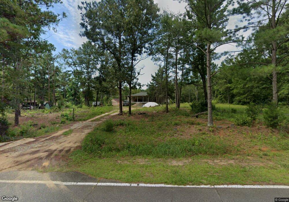
1458 Griffin Rd Macon, GA 31216
Estimated Value: $168,000 - $208,000
3
Beds
2
Baths
1,690
Sq Ft
$114/Sq Ft
Est. Value
About This Home
This home is located at 1458 Griffin Rd, Macon, GA 31216 and is currently estimated at $192,787, approximately $114 per square foot. 1458 Griffin Rd is a home located in Bibb County with nearby schools including Heard Elementary School, Rutland Middle School, and Rutland High School.
Ownership History
Date
Name
Owned For
Owner Type
Purchase Details
Closed on
Mar 15, 2021
Sold by
Rodriquez Kimberly
Bought by
Rogers Larry
Current Estimated Value
Purchase Details
Closed on
Feb 19, 2021
Sold by
Rogers Larry
Bought by
Mulla Yeamattie
Purchase Details
Closed on
Jan 14, 2021
Sold by
Rodriquez Kimberly
Bought by
Rogers Larry
Purchase Details
Closed on
Jan 6, 2021
Sold by
Ryals Tonya
Bought by
Rogers Larry
Purchase Details
Closed on
May 4, 1979
Sold by
Curtis L Rogers By Extrx 1213/559
Bought by
Rogers Gertrude W
Create a Home Valuation Report for This Property
The Home Valuation Report is an in-depth analysis detailing your home's value as well as a comparison with similar homes in the area
Home Values in the Area
Average Home Value in this Area
Purchase History
| Date | Buyer | Sale Price | Title Company |
|---|---|---|---|
| Rogers Larry | -- | None Listed On Document | |
| Mulla Yeamattie | $23,000 | None Available | |
| Mulla Yeamattie | -- | None Listed On Document | |
| Rogers Larry | -- | None Available | |
| Rogers Larry | -- | None Available | |
| Rogers Gertrude W | -- | -- |
Source: Public Records
Tax History Compared to Growth
Tax History
| Year | Tax Paid | Tax Assessment Tax Assessment Total Assessment is a certain percentage of the fair market value that is determined by local assessors to be the total taxable value of land and additions on the property. | Land | Improvement |
|---|---|---|---|---|
| 2024 | $1,187 | $53,751 | $6,278 | $47,473 |
| 2023 | $730 | $53,751 | $6,278 | $47,473 |
| 2022 | $76 | $20,190 | $7,635 | $12,555 |
| 2021 | $650 | $17,114 | $6,737 | $10,377 |
| 2020 | $664 | $17,114 | $6,737 | $10,377 |
| 2019 | $670 | $17,114 | $6,737 | $10,377 |
| 2018 | $1,206 | $17,114 | $6,737 | $10,377 |
| 2017 | $641 | $17,114 | $6,737 | $10,377 |
| 2016 | $1,151 | $33,258 | $6,737 | $26,521 |
| 2015 | $1,629 | $33,258 | $6,737 | $26,521 |
| 2014 | $1,649 | $33,621 | $7,100 | $26,521 |
Source: Public Records
Map
Nearby Homes
- 312 Buckskin Dr
- 7386 Hawkinsville Rd
- 1850 Barnes Ferry Rd
- 7070 Sofkee Place
- 120 Abberley Ln
- 2165 Griffin Rd
- 117 Abberley Ln
- 326 Stockton Cir
- 301 Stockton Cir
- Plan 2700 at The Abberley
- Plan 2604 at The Abberley
- 317 Stockton Cir
- 8410 Hawkinsville Rd Unit LOT 42
- 2154 Allen Rd
- 4037 Liberty Estates Dr
- 4025 Liberty Estates Dr
- 2741 Liberty Church Rd
- 261 Amanda Dr
- 149 Lew Dr
- 344 Browning Pointe Rd
- 1472 Griffin Rd
- 2011 Griffin Rd
- 2005 Griffin Rd
- 1939 Griffin Rd
- 1449 Griffin Rd
- 1486 Griffin Rd
- 1439 Griffin Rd
- 1430 Griffin Rd
- 955 Killarney Cir
- 0 Killarney Cir Unit 7537684
- 1487 Griffin Rd
- 981 Killarney Cir
- 985 Killarney Cir
- 945 Killarney Cir
- 1419 Griffin Rd
- 971 Killarney Cir
- 1497 Griffin Rd
- 957 Killarney Cir
- 925 Killarney Cir
- 102 Deer Forest Trail