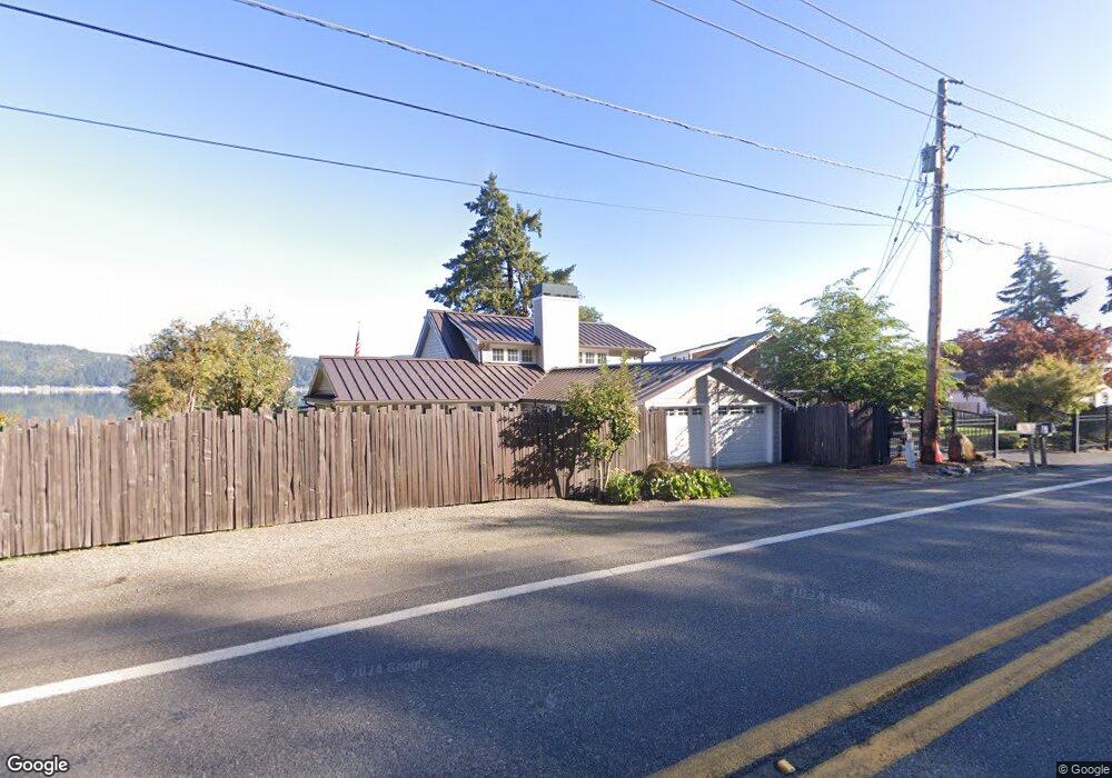
14581 E State Route 106 Belfair, WA 98528
Estimated Value: $1,003,000 - $1,625,253
2
Beds
2
Baths
2,584
Sq Ft
$495/Sq Ft
Est. Value
About This Home
This home is located at 14581 E State Route 106, Belfair, WA 98528 and is currently estimated at $1,280,313, approximately $495 per square foot. 14581 E State Route 106 is a home located in Mason County with nearby schools including North Mason Senior High School.
Ownership History
Date
Name
Owned For
Owner Type
Purchase Details
Closed on
May 18, 2010
Sold by
Powell Ronald M
Bought by
Risinger Tomas and Risinger Julie A
Current Estimated Value
Home Financials for this Owner
Home Financials are based on the most recent Mortgage that was taken out on this home.
Original Mortgage
$307,000
Interest Rate
5.21%
Mortgage Type
Purchase Money Mortgage
Purchase Details
Closed on
Jan 12, 2006
Sold by
Roland M Powell Trust and Powell Roland M
Bought by
Powell Roland M
Create a Home Valuation Report for This Property
The Home Valuation Report is an in-depth analysis detailing your home's value as well as a comparison with similar homes in the area
Home Values in the Area
Average Home Value in this Area
Purchase History
| Date | Buyer | Sale Price | Title Company |
|---|---|---|---|
| Risinger Tomas | $420,000 | Mason County Title Ins Co | |
| Powell Roland M | -- | None Available |
Source: Public Records
Mortgage History
| Date | Status | Borrower | Loan Amount |
|---|---|---|---|
| Closed | Risinger Tomas | $307,000 |
Source: Public Records
Tax History Compared to Growth
Tax History
| Year | Tax Paid | Tax Assessment Tax Assessment Total Assessment is a certain percentage of the fair market value that is determined by local assessors to be the total taxable value of land and additions on the property. | Land | Improvement |
|---|---|---|---|---|
| 2025 | $12,745 | $1,569,770 | $243,990 | $1,325,780 |
| 2023 | $12,745 | $1,088,395 | $435,690 | $652,705 |
| 2022 | $9,751 | $1,065,295 | $234,895 | $830,400 |
| 2021 | $6,816 | $1,065,295 | $234,895 | $830,400 |
| 2020 | $8,110 | $759,350 | $223,680 | $535,670 |
| 2018 | $7,714 | $662,050 | $298,240 | $363,810 |
| 2017 | $5,046 | $662,110 | $298,300 | $363,810 |
| 2016 | $5,321 | $442,315 | $284,095 | $158,220 |
| 2015 | $6,221 | $470,425 | $445,000 | $25,425 |
| 2014 | -- | $542,340 | $465,000 | $77,340 |
| 2013 | -- | $524,845 | $450,000 | $74,845 |
Source: Public Records
Map
Nearby Homes
- 14341 Washington 106
- 14191 Washington 106
- 14160 Washington 106
- 14103 E State Route 106
- 15401 Washington 106
- 48 E Twanoh Heights Rd N
- 131 E Mountain View Ln
- 151 E Hillside Dr
- 60 E Christmas Tree Place
- 13540 E State Route 106
- 70 E Windy Ridge Ln
- 51 E Windy Ridge Ln
- 400 E Twanoh Falls Dr
- 110 E Canyon View Rd
- 15931 E State Route 106
- 0 E Greenberg Ln
- 21 E Dream Ln
- 7150 NE North Shore Rd
- 121 E Woods Place
- 61 E Woods Place
- 14571 E State Route 106
- 14561 E State Route 106
- 14580 E State Route 106
- 14515 E State Route 106
- 14591 E State Route 106
- 14601 E State Route 106
- 14560 E State Route 106
- 14551 E State Route 106
- 14641 E State Route 106
- 14640 E State Route 106
- 14541 E State Route 106
- 14680 E State Route 106
- 14671 E State Route 106
- 14521 E State Route 106
- 14681 E State Route 106
- 14503 E State Route 106
- 14691 E State Route 106
- 14501 E State Route 106
- 14711 E State Route 106
- 14711 Washington 106