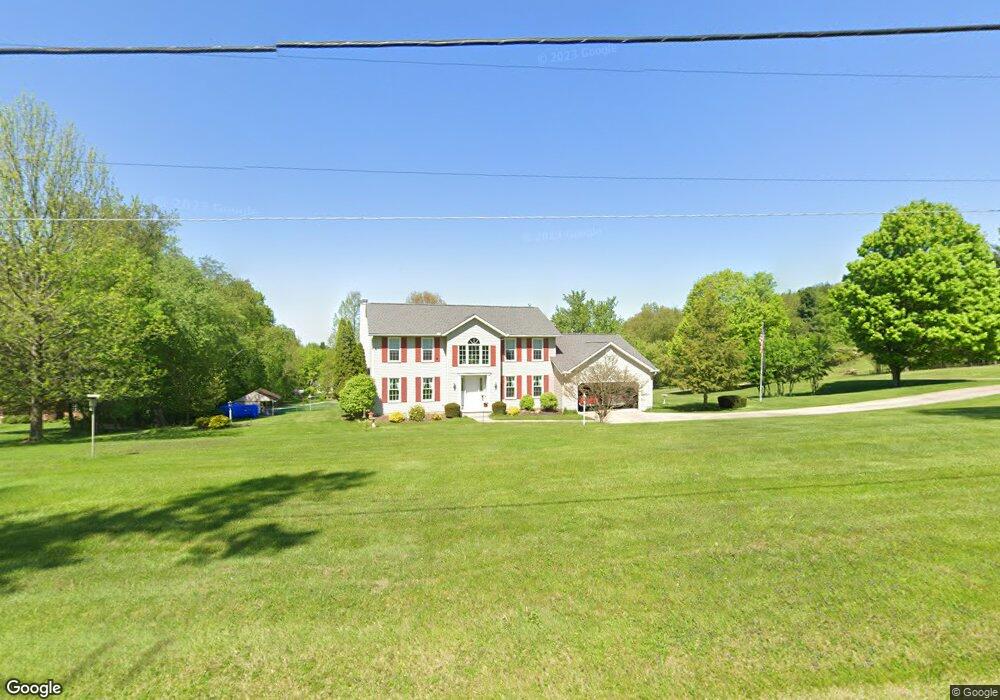
14581 Eldon Dr Mount Vernon, OH 43050
Estimated Value: $394,548 - $539,000
3
Beds
3
Baths
2,348
Sq Ft
$202/Sq Ft
Est. Value
About This Home
This home is located at 14581 Eldon Dr, Mount Vernon, OH 43050 and is currently estimated at $473,887, approximately $201 per square foot. 14581 Eldon Dr is a home located in Knox County with nearby schools including Mount Vernon High School, St. Vincent de Paul School, and Ruscel Montessori Childrens House.
Ownership History
Date
Name
Owned For
Owner Type
Purchase Details
Closed on
Apr 23, 1993
Sold by
Brenneman Douglas O and Brenneman Kin
Bought by
Bowden Earl B and Bowden Lilian M
Current Estimated Value
Purchase Details
Closed on
Apr 9, 1993
Sold by
Brenneman Norita M
Bought by
Brenneman Douglas O and Brenneman Kin
Purchase Details
Closed on
Feb 17, 1993
Sold by
Brenneman Scott C and Brenneman Norit
Bought by
Brenneman Norita M
Create a Home Valuation Report for This Property
The Home Valuation Report is an in-depth analysis detailing your home's value as well as a comparison with similar homes in the area
Purchase History
| Date | Buyer | Sale Price | Title Company |
|---|---|---|---|
| Bowden Earl B | $12,500 | -- | |
| Brenneman Douglas O | $30,000 | -- | |
| Brenneman Norita M | -- | -- |
Source: Public Records
Tax History
| Year | Tax Paid | Tax Assessment Tax Assessment Total Assessment is a certain percentage of the fair market value that is determined by local assessors to be the total taxable value of land and additions on the property. | Land | Improvement |
|---|---|---|---|---|
| 2024 | $3,490 | $107,370 | $11,160 | $96,210 |
| 2023 | $3,993 | $107,370 | $11,160 | $96,210 |
| 2022 | $3,425 | $84,540 | $8,790 | $75,750 |
| 2021 | $3,425 | $84,540 | $8,790 | $75,750 |
| 2020 | $3,341 | $84,540 | $8,790 | $75,750 |
| 2019 | $3,206 | $76,230 | $9,890 | $66,340 |
| 2018 | $3,207 | $76,230 | $9,890 | $66,340 |
| 2017 | $3,153 | $76,230 | $9,890 | $66,340 |
| 2016 | $2,826 | $70,580 | $9,160 | $61,420 |
| 2015 | $2,838 | $70,580 | $9,160 | $61,420 |
| 2014 | $2,852 | $70,580 | $9,160 | $61,420 |
| 2013 | $2,999 | $70,580 | $8,610 | $61,970 |
Source: Public Records
Map
Nearby Homes
- 13399 Old Mansfield Rd
- 13270 Rolling Hills Ct
- 14835 Indian Hills Rd
- 0 Indian Hills Rd
- 0 Crooked St
- 13683 Upper Fredericktown Rd
- 0 Crooked Street Land Split 2
- 13919 Upper Fredericktown Rd
- 14281 N Liberty Rd
- 1309 N Mulberry St
- 800 N Sandusky St
- 10 Buena Vista Ave
- 19 Avalon Rd
- 717 N Sandusky St
- 717 N Sandusky St Unit 14
- 1737 Vernonview Dr
- 332 Wooster Rd
- 0 N Sandusky St
- 13999 Wooster Rd
- 305 Cooper St
- 14541 Eldon Dr
- 13605 Old Mansfield Rd
- 13521 Old Mansfield Rd
- 14501 Eldon Dr
- 13639 Old Mansfield Rd
- 0 Eldon Dr Unit 2487243
- 0 Eldon Dr Unit 2421163
- 0 Eldon Dr Unit A
- 0 Eldon Dr Unit Lot B 2751941
- 0 Eldon Dr Unit Lot A
- 13600 Old Mansfield Rd
- 14460 Eldon Dr
- 14451 Eldon Dr
- 13445 Old Mansfield Rd
- 13699 Old Mansfield Rd
- 14421 Eldon Dr
- 13739 Old Mansfield Rd
- 13376 Old Mansfield Rd
- 7575 N Liberty Rd
- 14389 Eldon Dr
Your Personal Tour Guide
Ask me questions while you tour the home.